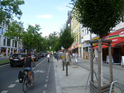
a better urban life
  • Home
  • City Livability Blog
  • Project Samples
  • About
  • Links

Nature of the Fourth Kind: Berlin

8/22/2013

4 Comments

 
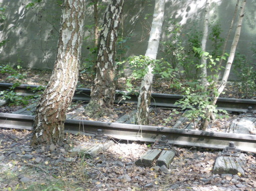
PictureFourth Nature on Display
As I've written earlier, Berlin is a uniquely green city - without a doubt one of the greenest large cities in the world.  This green reality has arisen through a long history of enlightened city planning, high level urban ecological understanding and, rather perversely, the incredible destruction of the Second World War and the city's subsequent political division.  In this posting I will write about a particularly German notion of urban green space, one that is occupying a more and more central role in the green identity of Berlin and that has arisen from Berlin's unique attributes and history.  I will start with a bit of a history. 

At the end of World War II Berlin found itself in an odd situation.  It was a divided city, ultimately between an East German controlled East and a West German controlled West.  This division separated the city not only politically, but also in terms of ecological study and practice.  The universities and practitioners in the western part of the city gradually became more and more detached from those in the eastern part, especially after the wall went up.  What's more, with the erection of the wall and strict travel restrictions, ecologists in the West were deprived of access to Berlin's green hinterland, the countryside surrounding Berlin, their traditional area of research.  This left ecologists and natural scientists with a greatly restricted area for research and ultimately redirected a group of them to the variety of open spaces within the city itself that supported nature.  Berlin had a large number of new habitats for these researchers to examine:  large tracts of empty land left over from destroyed buildings (rubble fields, really) and abandoned industrial infrastructure which were gradually being recolonized by vegetation and wildlife.
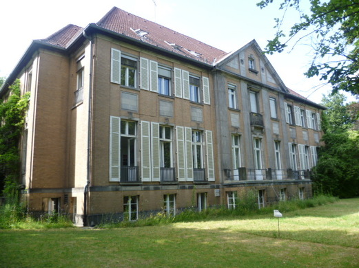
PictureThe old Baumgarten villa
To learn about this 'new' object of ecological study, I paid a visit to Dr. Ingo Kowarik, a warm and welcoming ecology professor at Berlin's venerable Technical University, TU. I visited him at his office in the Ecological Institute of the university in the upper-class Berlin district of Steglitz.  The physical appearance of the Institute, I must say, embodies much of the charm that characterizes Berlin itself today.  It is not a shiny, meticulously maintained facility, but instead a lovely old, somewhat timeworn former villa.  The gardens around the villa also reflect the condition of much of Berlin's green space.  There are no manicured gardens, but simply an un-fussily managed yard with lawns, bushes, trees and a few flowers.  It seems to benefit from a kind of benign neglect that gives it a cozy and welcoming feeling,  Berliners today seem to have a view of urban nature not as something pristine and manicured but instead a bit more messy and accessible, I think.

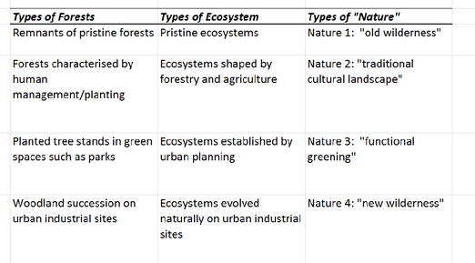
PictureSimplified chart from a paper by Dr. Kowarik.
Dr. Kowarik acquainted me with the details of the early history of the novel urban ecosystems that have arisen on rubble fields and old industrial sites, calling them collectively 'Nature of the Fourth Kind.'  This term positions these ecosystems in a conceptual framework devised by Dr. Kowarik.  The framework contains four types of urban ecosystems and ranges from "Nature of the First Type' to 'Nature of the Fourth Type' as outlined in the chart above.  The lower the classification number, the more 'wild' and similar an ecosystem is to the region's original, pre-human ecosystem.

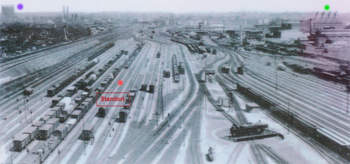
PictureSüdgelände railyard in 1935
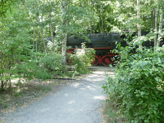
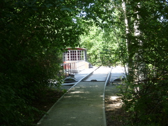
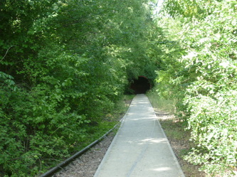
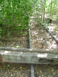
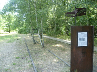
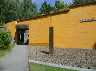
An excellent example of 'Nature of the Fourth Type' and its integration into Berlin's green infrastructure is the Natur-Park Südegelände.  This park has been developed on the site of a huge abandoned railyard, previously the largest in the city.  After the war and the division of the Berlin, the yard fell into disuse.  Over time vegetation grew on what had once been a very inhospitable surface of gravel, cement, and rail ties.  A whole ecosystem, including grasslands and groves of trees, evolved and was discovered by local environmentalist who lobbied for the site to be protected.  They won their battle, and today this popular park, full of biodiversity, is one of a handful of 4th Nature protected areas in the city.  More parks of this type are now planned, including one on the area of what used to be the Nordbahnhof, the North Train Station. Some may see a similarity between 4th Nature parks and the High Line Park in Manhattan.  The difference is that the vegetation in 4th Nature parks sprung up naturally, without direct human involvement.  It evolved on its own, creating an ecosystem over decades.   

Below are some pictures from the Natur-Park Südegelände.
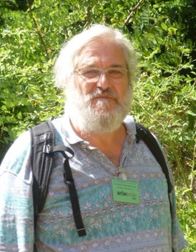
PictureProfessor Wiedenmann: Part of Berlin 'Ecosystem'
A key lesson from my ongoing research project in many cities around the world is the incredible difference helpful local contacts make in understanding complex phenomenon, such as the urban environment.  A fine example is the ecologist Dr. Gottfried Wiedenmann who works at the Natur-Park Südegelände (see picture at left).  Dr. Wiedenmann generously gave me time and shared his deep knowledge of the history of Berlin's ecology and its 4th Nature sites.  It transformed my thinking about this topic.  It also reinforced my belief in the underlying strength and depth of Berlin's network of urban greening specialists.  

The lessons of 4th Nature parks for rust-belt cities in the US, and other declining industrial cities, are great.  Berlin makes me think a lot about Detroit (which in some ways resembles Berlin after the war), and I imagine there must be a huge potential for 4th Nature parks in that city. 

More sharing of best practices like this are required throughout the world, but especially in the developing world where cities have limited space and resources.  4th Nature parks use abandoned land that is often unsuited for other types of development and are relatively inexpensive to develop and maintain.  This is just one great innovation that I've learned about in Germany. 
4 Comments

The Berlin Green Divide

7/27/2013

4 Comments

 
PictureThe carefully tended Schloßstraße in upscale Steglitz.
Berlin is a city with an embarrassment of green riches.  44 percent of its territory is made up of green, open spaces including parks, forests, lakes, community gardens and even some farmland.  However, Berliners are not satisfied.  A coordinated combination of government agencies, experts, NGOs and private citizens are working to expand and improve upon the city's green spaces, with a common belief that access to urban nature is the foundation for a high quality, sustainable city life.   

Berlin's green identity is no accident.  There has been a long history of green urban planning, going back to the the late 19th century when Berlin became the new and rapidly growing capital of the German Empire.  There was early recognition in Germany that trees and natural spaces could act as a sort of remedy for the ills of 'modern' city life and so they were included in city planning.  These natural spaces took the form not only of parks and street trees, but also large segments of the natural landscape on the city's edge and in the suburbs.  Berlin is still surrounded by natural woodlands, lakes and fields, all readily accessible by public transport or bicycle.

PictureThe relatively desolate Hermanstraße in poor Neukölln.
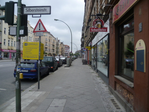
The green spaces and the benefits they provide (such as fresh air, beauty and a place for recreation), were not, however, uniformly distributed throughout the city when it was built.  Upper-class districts of the city, for example wealthy Steglitz in the picture above, has far more green space than densely populated working-class areas, such as Neukölln, in the picture to the right.  Central areas of the city tended to contain tightly packed worker tenements and, due to regulatory weakness, only the layout of the streets was determined by the city. Property developers could maximize the areas used for housing, providing workers with small apartments in tall, densely packed buildings with very little public space.  The legacy of this early division continues to weigh heavily on the city as efforts are made to provide more equitable access to green spaces. According to the State of Berlin (Berlin is a state as well as a city), there should be six square meters of green space per inhabitant, and it should be within 500 meters of where they live.  Several inner-city areas are far from reaching this standard.

PictureMuddy path into the mucky edge of Tegel Lake.
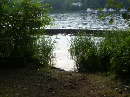
An aspect of the green divide in Berlin which has come to my attention lately, during a period of unusually hot weather, is limited cost-free access to Berlin's lakes (there are 24).  Most of the lakes I've come to know in Berlin are either surrounded by private - or at least fenced off - property, or the waterfront is simply not designed for bathers.  Beach-like areas are not widespread, not well marked or publicized, and often getting into the lake to swim requires some improvisation.  It's not always a completely pleasant experience. 

An example is the Plötzensee, one of Berlin's most central lakes, in the lower income district of Wedding.  This lake is entirely fenced in on all sides, with private beaches and clubs surrounding it.  The only 'free' public access is unauthorized access from a very short promenade along one side of the lake.  People climb over the railings and enter the lake here.  This is not only potentially dangerous, as people are jumping and diving from the railings into the lake (splashing all those around), but the space is so limited that it is almost always extremely crowded, detracting from the positive experience of having a relaxing time at the lake.  There is little space to stretch out and sunbathe along the side of the lake, only a small, very worn grassy area in front of the promenade. I found a similar situation at other Berlin lakes I've visited.  The picture above shows my entry point into Tegel Lake yesterday, also in the north of Berlin.  I was with my friend Yasuko, and we watched two wincing Spanish women wading through the muddy bottom to get to deeper water to swim.  We winced a bit, too, but enjoyed our swim in the seemingly very clean water filled with many fish. Let me add here that I've been told about ongoing efforts to expand public access to the Berlin waterfront, and slow progress is being made. 

PictureA gravel road in a dense forest in the north of Berlin
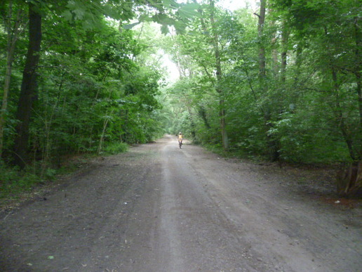
It is important to note that the green divide in Berlin is nothing like that found in most cities.  Even in the working class districts of Berlin, residential streets are almost uniformly lined with a canopy of trees (The condition of these trees may not always be optimal, but they are there, as are the open spaces for planting them).  And there really is a huge amount of green space, even if it might be further than the ideal 500 meters and might sometimes require getting on a bicycle or the metro to enjoy.  From virtually anywhere in the city, you can be in deep forest in under 30 minutes by train.  While other cities, such as Bogota, Colombia have huge forested areas within the city limits, these areas are not open to the public or are not safe.  Even if they were open and safe, using public transport to get to these spots for most city dwellers is hardly as effortless as it is in Berlin.  Excellent public transport is a critical element to Berliners quality of life and access to nature. 

PicturePlaza upgrade underway on the rather depressing Karl Marx Straße in Neukölln.
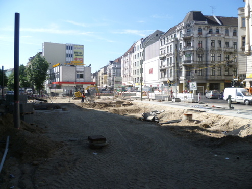
What specifically has Berlin done to bridge its green divide?  Efforts at improving green access for the relatively poor were started as early as the late 19th century in the form of increased park construction and gardening allotments for the working class. These expanded steadily, especially during the 1920s.  Park and green space development continued through the 1930s, but after the war, so much had changed.  Due to the incredible destruction (nearly 30 square kilometers of Berlin had been destroyed) new trajectories were set. 

Initially, a green movement emerged that saw this destruction as a blessing in disguise.  The worst of the damage to the city had occurred in the central districts, the very districts where high density housing for the working class often existed.  It became fashionable for planners to envision a 'loosened' city, where open green spaces would be reintroduced to the dense center resulting in a more 'organic' structure of the central city. 

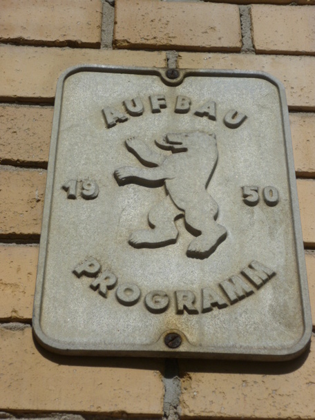
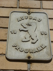
PictureRebuilt apartment building from 'building program' of 1950.
Barriers to reaching this goal quickly arose.  Despite the severe destruction of huge areas of buildings in the central parts of Berlin, the underlying infrastructure of sewer, water, electrical and gas lines was intact.  In the resource-short period after the war, it made much more sense to simply rebuild upon this existing infrastructure than to start from scratch somewhere else. Hence, the rubble strewn areas that could have supported new green spaces were often rebuilt with housing along the dense lines of what had existed previously. 

The political and later physical division of the city also limited the amount of land available for development in the West, leading to a pragmatic shift in planning away from nature towards economic and social development on the spaces left open after the war.  In the East there were far fewer resources available for development of any kind, and it lagged far behind the West in both green and social investment. 

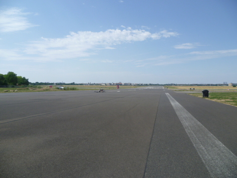
PictureA former runway at Tempelhof on a sultry July day.
Instead of a fundamental reworking of the central city (a sizable portion of which was in the East), work in the West focused on linking existing parks with other open spaces, such as sports fields and playgrounds.  Green paths along rivers and other bodies of water were built that often served as connectors between larger green spaces.  This work continues today and has resulted in the 20 Green Main Routes, a system of green 'linkways' which crisscross the city and tie together key elements of Berlin's open and green spaces. 

One route runs very near my apartment and continues on through Tempelhof Feld (photo above), the former airport made famous in the Berlin Airlift.  I ride on it nearly every day.  Tempelhof Feld, a huge open space of grassy meadows and wide car-less surfaces of cement and asphalt, resulted from the decommissioning of the airport.  It's just another example of the growing collection of vasts open and green areas of which Berlin can be proud.  It directly abuts areas of lower socioeconomic level, and is filled every summer day with young people relaxing and drinking beer, picnickers, Turkish families enjoying a barbecue, and even wind surfers.

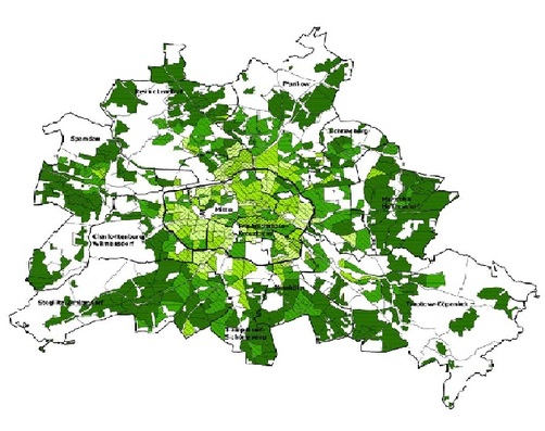
PictureData map of Berliners access to green space. Lighter green = lower access.
Critical to an understanding of the well functioning system of green space management in Berlin is the organizational complexity and competence of urban planning in Germany.  At work are a multidisciplinary network of academics, planning professionals, government offices, private groups and so many more that today bring a holistic, collective approach to creating a high quality of urban life.  This 'ecosystem" of urban planning entities has been growing and evolving for well over a century.  It has culminated in a very sophisticated understanding of the physical, ecological and social environment of Berlin, and is evidenced in the vast store of well-organized data the city has.  Without deep data, a typical problem faced in many developing world cities, effective policy formulation and planning is not effective.  An example of Berlin's excellent database tools is the Environmental Atlas, which provides data on a block-by-block basis on the socio-environmental conditions of the city and is available to the public. 
Urban environmental justice, and the green divide, is best addressed when approached as a multidimensional issue with the support of multiple disciplines.  Very few large cities in the world are as well-equipped as Berlin to meet the challenges environmental inequities raise.  The steady progress of environmental improvements in this city can serve as a model to other cities around the world.  

4 Comments

Small details from my Berlin neighborhood, Neukölln

7/15/2013

1 Comment

 
1 Comment

Kaleidoscopic Berlin

6/25/2013

2 Comments

 
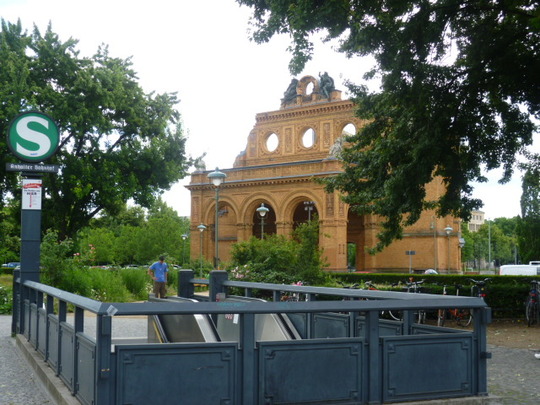
PictureS-Bahn entrance in front of the facade of the former Anhalter Bahnhof.
Berlin, the always surprising capital of Germany, has been my home now for a little over a month, As the title of this posting states, I'm discovering it to be a city of many personalities with a diversity of urban scenery unrivaled by any city I know.

Berlin encompasses quaint villages, rebuilt central zones with cutting-edge modern architecture, 19th century bourgeois districts, vast areas of  worker and middle-class apartments from the same period, hundreds of kilometers of waterfront along rivers, canals and lakes, deep forests, countless mysteriously abandoned buildings, forlorn (but inspiring) pre-war industrial zones, and of course in the old east, the socialist architecture of the GDR.  This is a city impossible to characterize with a few simple phrases. 

Most people are familiar with famous Berlin landmarks such as the Brandenburg Gate, the Reichstag and the Berlin Wall.  I want to highlight some discoveries I've made that show the unique character of this city, and will start in this first posting with two elements that I find particularly fascinating:  the water that binds this city together and the abandoned buildings that are interspersed throughout the cityscape. 

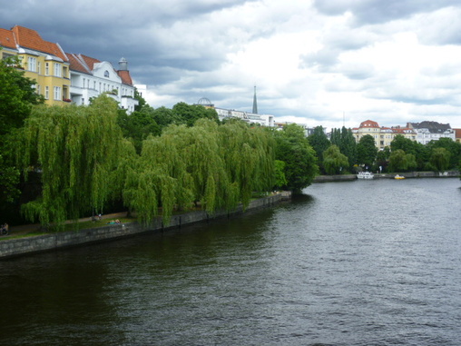
PictureA scene along the park-lined Spree River in the heart of Berlin.
Berlin is a city where it's hard to get away from the water.  In any direction you go (and often without moving in this rainy city) before long you will see water.  The hundreds of bridges crossing its many canals or rivers are never far away.  I think this may be one of the lesser known facts about this city of water.  In total, there are 3 rivers, 11 canals and 24 lakes in Berlin.  The Spree River runs through the center of the city and along most of its length lie green parks that are somehow designed to provide small zones of intimacy and seclusion.  The string of parkland along the river is connected with well-maintained bicycle paths and I've ridden along most of its length. 

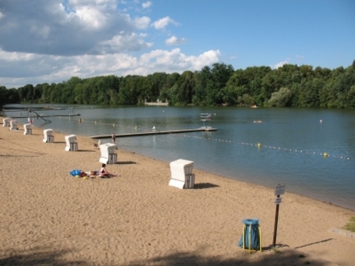
PictureThe Plötzensee, where I spent part of last Sunday swimming.
Last Sunday I discovered the wonder of Berlin's lakes.  My friend Yasuko (an artist I know from my time in New York) was having a birthday picnic in Goethe Park in the Wedding neighborhood north of the center. My friend Suh and I rode our bicycles to the park all the way from Neukölln (where I live), which took us an hour and a half. As we neared Goethe Park, we spotted a beautiful lake with a beach and later decided with a few others to go back and have a swim.  The water was a perfect temperature and seemed very clear and clean.  The beach charges an entrance fee of 4 euros, but we discovered that many people got into the generally fenced-in lake from a terrace along the edge on the other side of the lake.  When we went there, we encountered a boisterous, but friendly, group of middle-aged Russian men with a lot of beer on hand.  They had all been swimming, too.  

Only upon returning home and reading about the lake (Plötzensee) did I learn that it was adjacent to a rather notorious Nazi prison.  The next time I go I will look for the Memorial Center, which somehow we missed.  It's just one of the constant reminders of how heavily history weighs on this city.

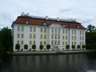
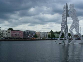
The waterfront in Berlin offers views which seem to be from totally different worlds.  On the bottom left is a canal in a quiet spot in Köpenick (in the southeastern corner of Berlin), in the middle the Köpenick Castle along the Dahme River, and on the right a sculpture in the Spree called the Molecule Man by the American artist Jonathan Borofsky, If you look closely across the river behind the sculpture, you can see a remaining segment of the Berlin Wall (click on the pictures to enlarge).  

PictureEierhäuschen
Almost as hard to avoid as water in Berlin are the thousands of abandoned buildings (or ruins of buildings) that pop up in rather surprising places.  All have a history and all seem to be fairly well documented on German websites that specialize in this sort of thing.  While riding my bicycle south along the Spree yesterday, I came across this rather attractive structure, which turns out to be the old riverside restaurant Eierhäuschen (Eggs Cottage) which was a favorite getaway for Berliners before the war and for east Berliners until the fall of the Wall. Apparently the building was also used as a backdrop by East German television for some programs.  Due to legal issues, the site cannot yet be rehabilitated and used.

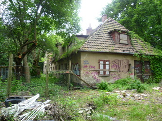
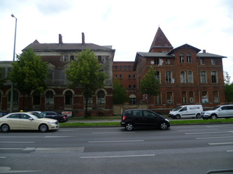
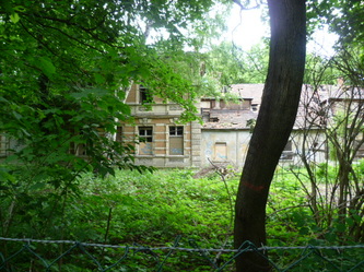
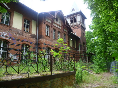
Below is a sampling of abandoned buildings I saw on the same bike ride yesterday - all on what was previously the east side of Berlin. The first is what seems to be an abandoned home.  My friend Simon and I saw a fox there.  When it spotted us it just froze and stared at us for a few minutes, at quite close range, before running back into the house, where it must live.  The second is a complex of buildings that I think were part of a factory.  Finally, on the right is an old building hidden in trees behind barbed wire.  There is more than one website devoted to buildings like this in Berlin.  You can check them out here:  http://www.modernruins.de/ or http://vergessene-orte.blogspot.de/

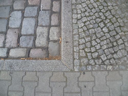
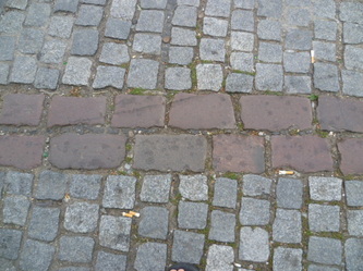
PictureA very typical border between a street and sidewalk here.
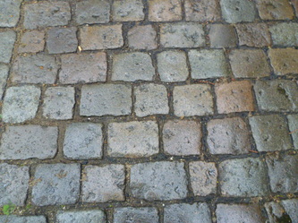
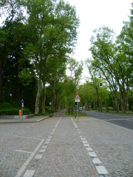
In closing my first blog entry on Berlin, I want to highlight a striking aspect of the urban infrastructure here.  This is the carefully planned and built surface of the city - infrastructure designed and generally maintained with a level of care unusual in most of the world. 

I should mention, before I get started, that although I'm very impressed with what's on display in Berlin, Germans seem to typically view Berlin as a bit of a mess with relatively poorly maintained infrastructure.  The city is living, to some degree, on the good design and construction from the past.  However, for an American used to cities covered with artlessly poured cement or hastily spread asphalt, there is a lot to impress. 

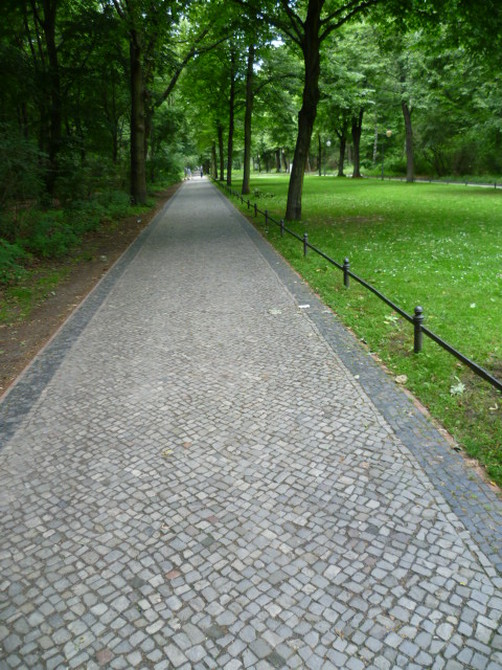
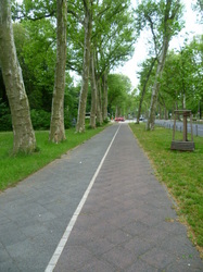
PictureA walkway in Tiergarten, the major park in the center of the city.
The pavements that make up the streets, sidewalks and bicycle paths in Berlin are almost never constructed of seamless concrete or asphalt,  The use of those materials is spared for high-speed roads.  Due to the use of a variety of paving stones, Berlin not only has beautiful sidewalks, but sidewalks that integrate very well with the green world around them.  And Berlin is an incredibly green city. 

The spaces between the paving stones or bricks allow for water to pass through to the soil below, not only helping to provide water for the trees and plants in the surroundings, but also decreasing the amount of storm runoff that occurs with rain.  The city more naturally absorbs water with built surfaces like these.

In longer established sidewalks, it's quite normal to see a variety of plants living in the cracks between stones and bricks.  Again, the streets and sidewalks do not exclude and dismiss nature...they are somehow a part of it.  It's interesting to note that most of these environmentally 'advanced' designs date from centuries ago,  The granite paving stones used in Berlin's streets almost certainly all date from before the war (they would be simply too expensive to produce today, I imagine).  . 

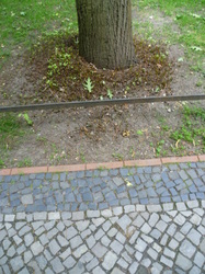
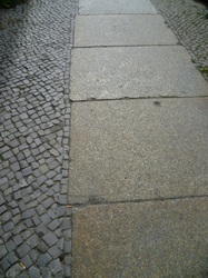
Below is a sampling of sidewalk and street surfaces.

2 Comments
    Picture

    about the author

    RSS Feed

    Picture
    Mark Brown

    Categories

    All
    Africa
    Ajijic
    Amsterdam
    Argentina
    Asia
    Balconies
    Belgrade
    Berlin
    Bicycles
    Biodiversity Walks
    Bogota
    Buenos Aires
    Chemicals In The Home
    Chicago
    Chile
    China
    Colombia
    Columbus
    Details
    Environmental Justice
    Europe
    Finland
    Gardens
    Germany
    Green Divide
    Guadalajara
    Hangzhou
    Helsinki
    India
    Indoor Pollution
    Israel
    Istanbul
    Japan
    Kenya
    Kiev
    Lagos
    Latin America
    Mexico
    Mexico City
    Middle East
    Mobility
    Mumbai
    Nairobi
    Netherlands
    New York
    Nigeria
    North America
    Norway
    Parks
    Portland
    San Francisco
    Santiago
    Serbia
    Shanghai
    Short Takes
    South America
    Spain
    Sustainability
    Tel-aviv
    Tenerife
    Tokyo
    Trees
    Turkey
    Ukraine
    United States
    Urban Design
    Urban Greening
    Water

    Archives

    October 2017
    January 2017
    September 2016
    July 2015
    January 2015
    December 2014
    October 2014
    July 2014
    June 2014
    May 2014
    April 2014
    March 2014
    February 2014
    January 2014
    November 2013
    October 2013
    August 2013
    July 2013
    June 2013
    May 2013
    February 2013
    October 2012
    May 2012
    January 2012
    April 2011
    March 2011
    January 2011
    August 2010
    July 2010
    January 2010
    May 2009
    December 2008
    January 2008

    After nearly two decades of corporate duty, I decided to follow my heart and do what I love: make cities greener and healthier places.  Over the coming years I will be traveling to cities all over the world, reporting on what I see and learning about how even resource-poor places can improve urban lives through urban greening and greener lifestyles.  I've started the CitiNature project to channel my energies and drive initiatives supporting equal access to green amenities for everyone.
Powered by Create your own unique website with customizable templates.