a better urban life
  • Home
  • City Livability Blog
  • Project Samples
  • About
  • Links

Nature of the Fourth Kind: Berlin

8/22/2013

4 Comments

 
PictureFourth Nature on Display
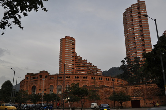
As I've written earlier, Berlin is a uniquely green city - without a doubt one of the greenest large cities in the world.  This green reality has arisen through a long history of enlightened city planning, high level urban ecological understanding and, rather perversely, the incredible destruction of the Second World War and the city's subsequent political division.  In this posting I will write about a particularly German notion of urban green space, one that is occupying a more and more central role in the green identity of Berlin and that has arisen from Berlin's unique attributes and history.  I will start with a bit of a history. 

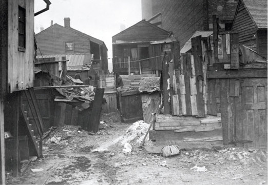
At the end of World War II Berlin found itself in an odd situation.  It was a divided city, ultimately between an East German controlled East and a West German controlled West.  This division separated the city not only politically, but also in terms of ecological study and practice.  The universities and practitioners in the western part of the city gradually became more and more detached from those in the eastern part, especially after the wall went up.  What's more, with the erection of the wall and strict travel restrictions, ecologists in the West were deprived of access to Berlin's green hinterland, the countryside surrounding Berlin, their traditional area of research.  This left ecologists and natural scientists with a greatly restricted area for research and ultimately redirected a group of them to the variety of open spaces within the city itself that supported nature.  Berlin had a large number of new habitats for these researchers to examine:  large tracts of empty land left over from destroyed buildings (rubble fields, really) and abandoned industrial infrastructure which were gradually being recolonized by vegetation and wildlife.

Picture
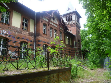
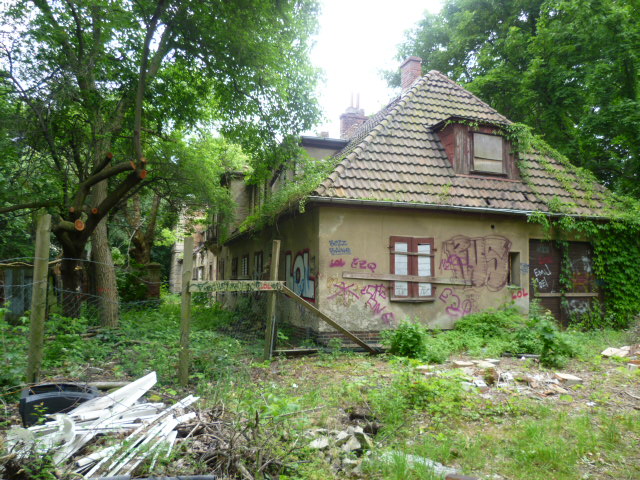
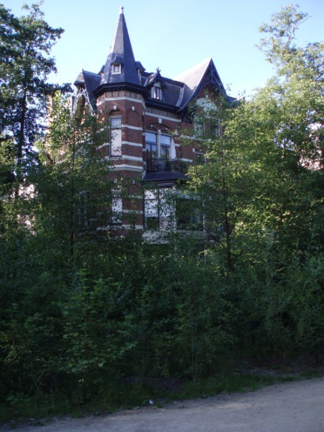
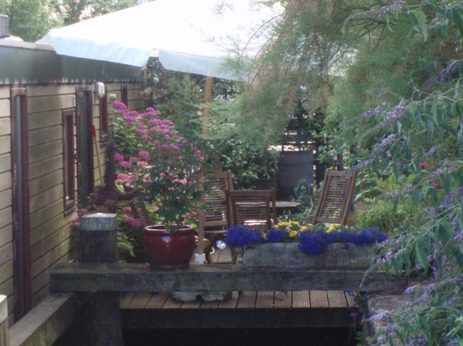
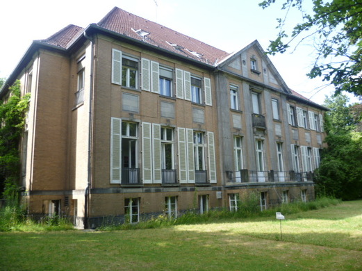
The old Baumgarten villa
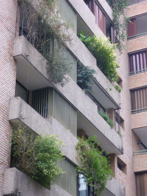
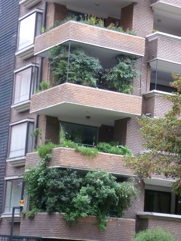
To learn about this 'new' object of ecological study, I paid a visit to Dr. Ingo Kowarik, a warm and welcoming ecology professor at Berlin's venerable Technical University, TU. I visited him at his office in the Ecological Institute of the university in the upper-class Berlin district of Steglitz.  The physical appearance of the Institute, I must say, embodies much of the charm that characterizes Berlin itself today.  It is not a shiny, meticulously maintained facility, but instead a lovely old, somewhat timeworn former villa.  The gardens around the villa also reflect the condition of much of Berlin's green space.  There are no manicured gardens, but simply an un-fussily managed yard with lawns, bushes, trees and a few flowers.  It seems to benefit from a kind of benign neglect that gives it a cozy and welcoming feeling,  Berliners today seem to have a view of urban nature not as something pristine and manicured but instead a bit more messy and accessible, I think.

Picture
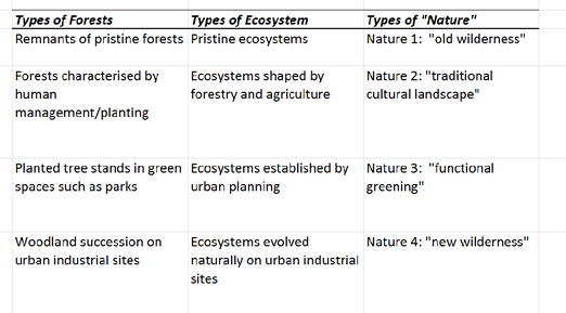
Simplified chart from a paper by Dr. Kowarik.
Dr. Kowarik acquainted me with the details of the early history of the novel urban ecosystems that have arisen on rubble fields and old industrial sites, calling them collectively 'Nature of the Fourth Kind.'  This term positions these ecosystems in a conceptual framework devised by Dr. Kowarik.  The framework contains four types of urban ecosystems and ranges from "Nature of the First Type' to 'Nature of the Fourth Type' as outlined in the chart above.  The lower the classification number, the more 'wild' and similar an ecosystem is to the region's original, pre-human ecosystem.

Picture
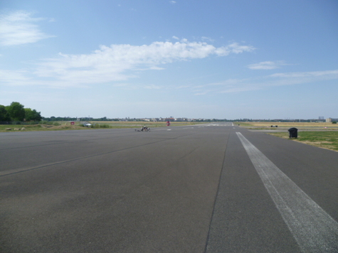
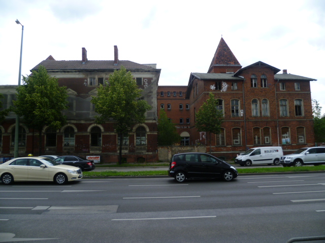
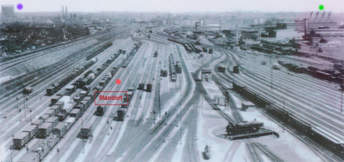
Südgelände railyard in 1935
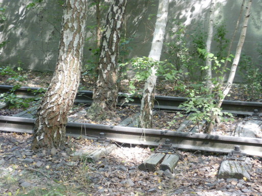
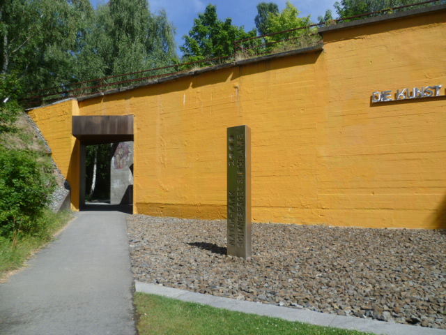
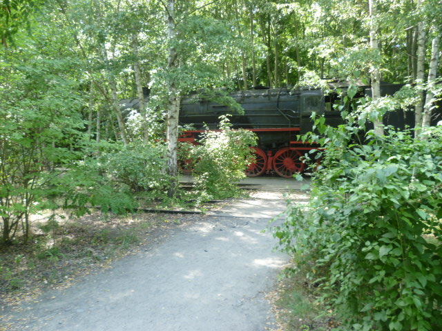
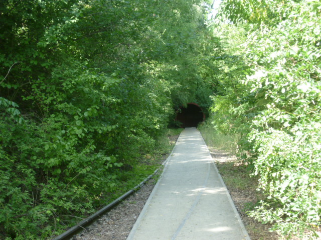
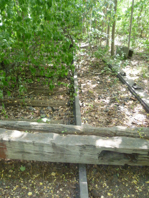
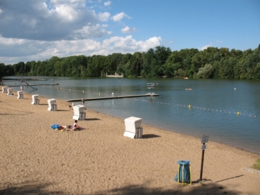
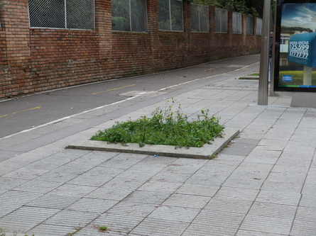
An excellent example of 'Nature of the Fourth Type' and its integration into Berlin's green infrastructure is the Natur-Park Südegelände.  This park has been developed on the site of a huge abandoned railyard, previously the largest in the city.  After the war and the division of the Berlin, the yard fell into disuse.  Over time vegetation grew on what had once been a very inhospitable surface of gravel, cement, and rail ties.  A whole ecosystem, including grasslands and groves of trees, evolved and was discovered by local environmentalist who lobbied for the site to be protected.  They won their battle, and today this popular park, full of biodiversity, is one of a handful of 4th Nature protected areas in the city.  More parks of this type are now planned, including one on the area of what used to be the Nordbahnhof, the North Train Station. Some may see a similarity between 4th Nature parks and the High Line Park in Manhattan.  The difference is that the vegetation in 4th Nature parks sprung up naturally, without direct human involvement.  It evolved on its own, creating an ecosystem over decades.   

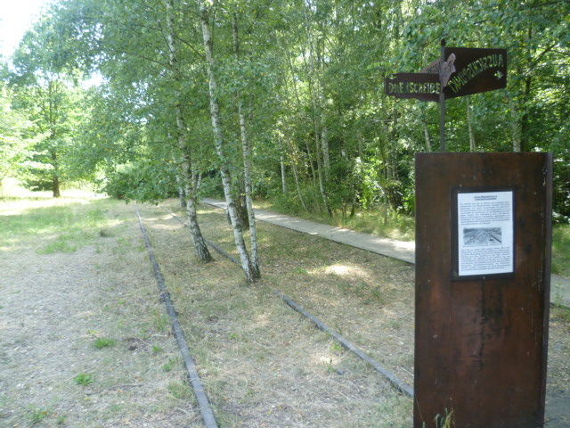
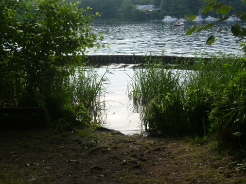
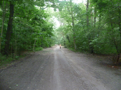
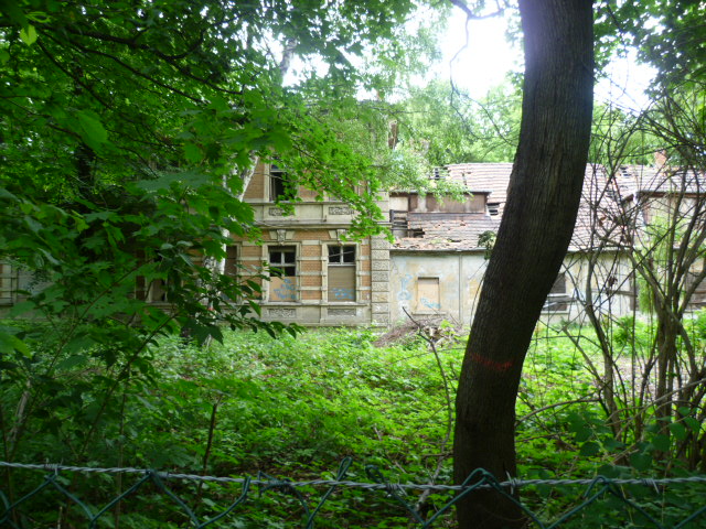
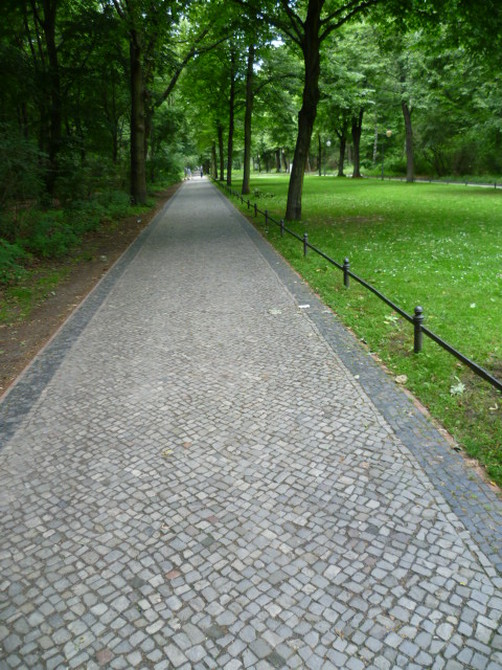
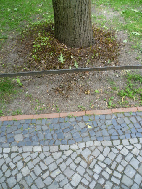
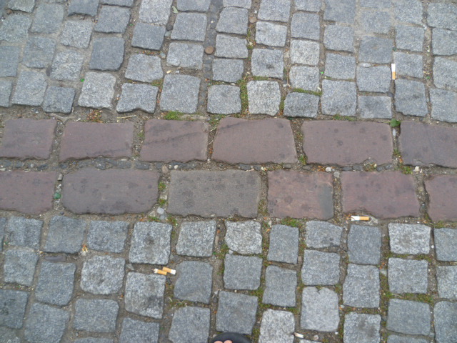
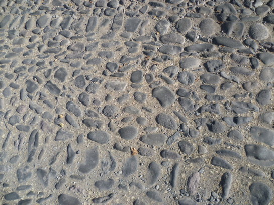
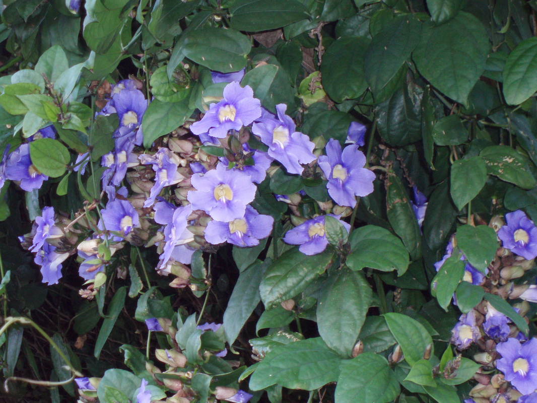
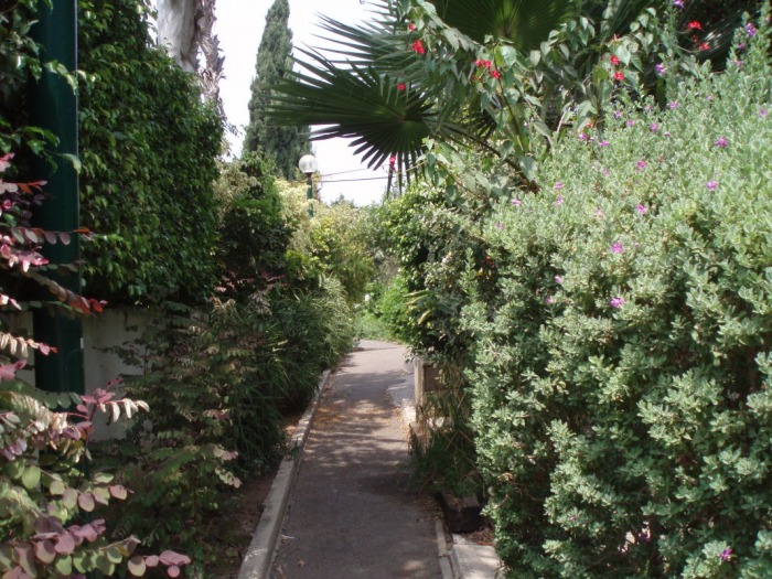
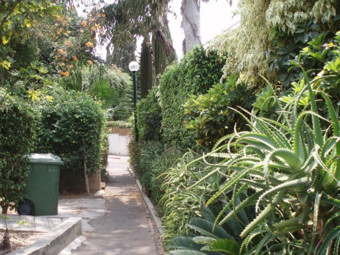
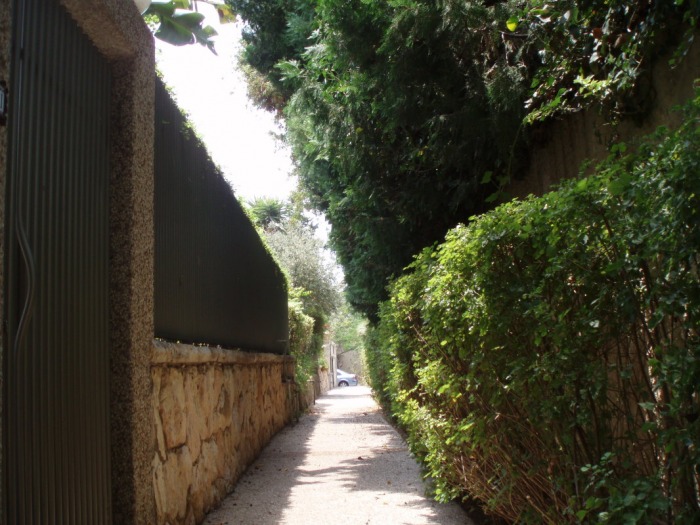
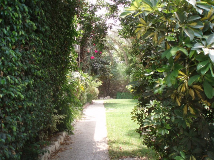
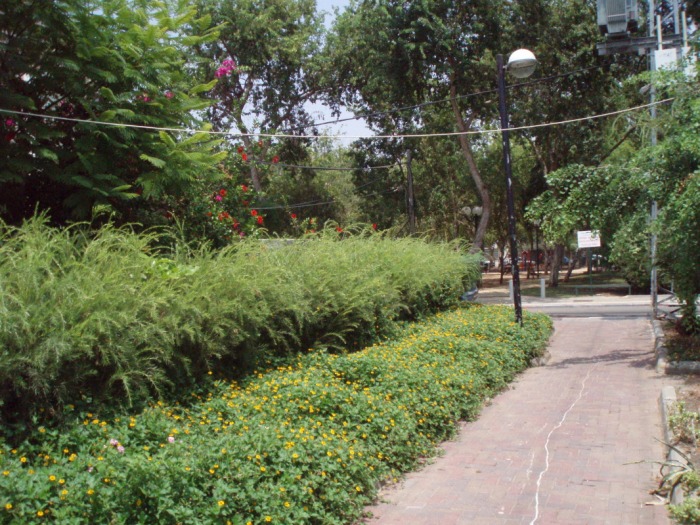
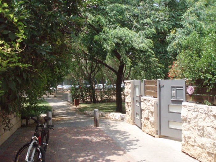
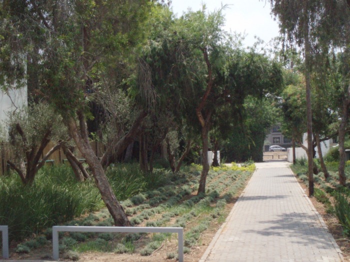
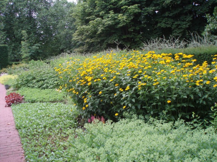
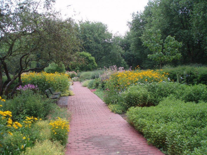
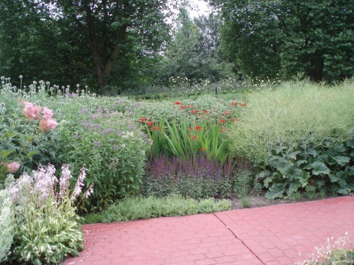
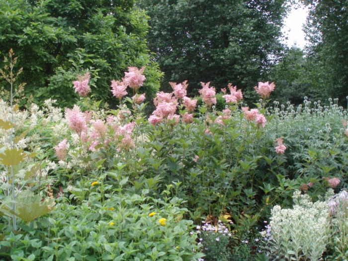
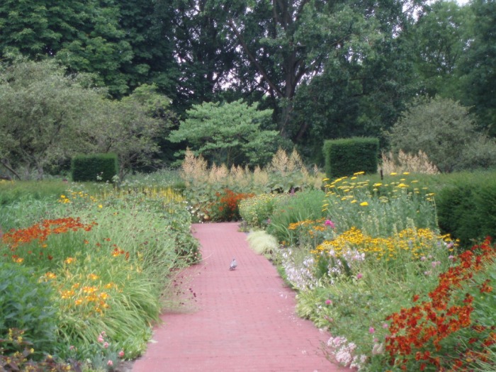
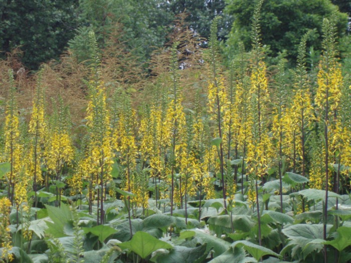
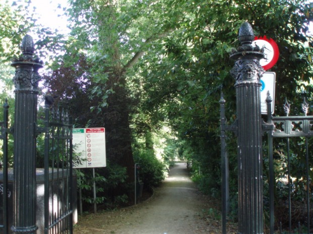
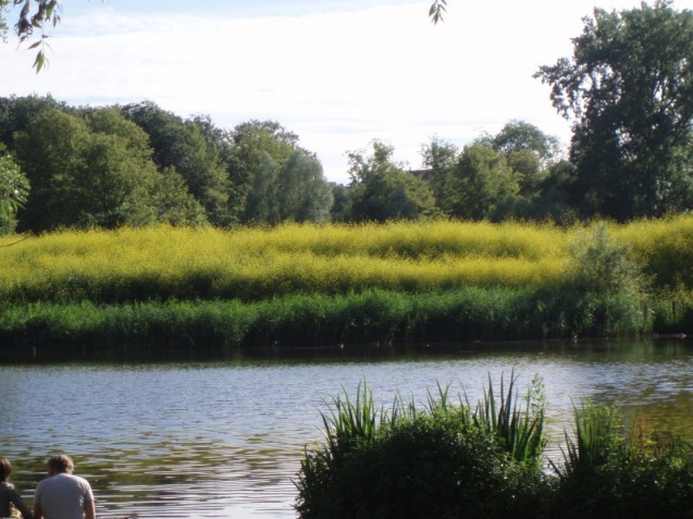
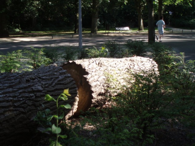
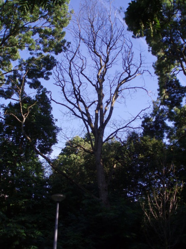
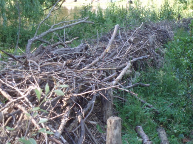
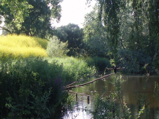
Below are some pictures from the Natur-Park Südegelände.
Picture
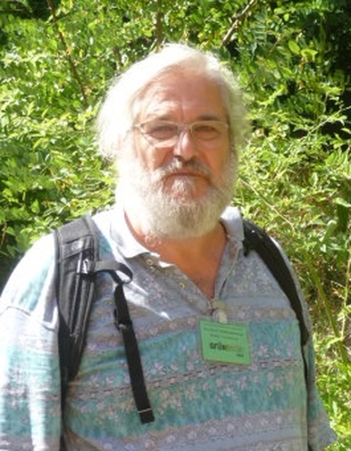
Professor Wiedenmann: Part of Berlin 'Ecosystem'
A key lesson from my ongoing research project in many cities around the world is the incredible difference helpful local contacts make in understanding complex phenomenon, such as the urban environment.  A fine example is the ecologist Dr. Gottfried Wiedenmann who works at the Natur-Park Südegelände (see picture at left).  Dr. Wiedenmann generously gave me time and shared his deep knowledge of the history of Berlin's ecology and its 4th Nature sites.  It transformed my thinking about this topic.  It also reinforced my belief in the underlying strength and depth of Berlin's network of urban greening specialists.  

The lessons of 4th Nature parks for rust-belt cities in the US, and other declining industrial cities, are great.  Berlin makes me think a lot about Detroit (which in some ways resembles Berlin after the war), and I imagine there must be a huge potential for 4th Nature parks in that city. 

More sharing of best practices like this are required throughout the world, but especially in the developing world where cities have limited space and resources.  4th Nature parks use abandoned land that is often unsuited for other types of development and are relatively inexpensive to develop and maintain.  This is just one great innovation that I've learned about in Germany. 

4 Comments

The Berlin Green Divide

7/27/2013

3 Comments

 
PictureThe carefully tended Schloßstraße in upscale Steglitz.
Berlin is a city with an embarrassment of green riches.  44 percent of its territory is made up of green, open spaces including parks, forests, lakes, community gardens and even some farmland.  However, Berliners are not satisfied.  A coordinated combination of government agencies, experts, NGOs and private citizens are working to expand and improve upon the city's green spaces, with a common belief that access to urban nature is the foundation for a high quality, sustainable city life.   

Berlin's green identity is no accident.  There has been a long history of green urban planning, going back to the the late 19th century when Berlin became the new and rapidly growing capital of the German Empire.  There was early recognition in Germany that trees and natural spaces could act as a sort of remedy for the ills of 'modern' city life and so they were included in city planning.  These natural spaces took the form not only of parks and street trees, but also large segments of the natural landscape on the city's edge and in the suburbs.  Berlin is still surrounded by natural woodlands, lakes and fields, all readily accessible by public transport or bicycle.

PictureThe relatively desolate Hermanstraße in poor Neukölln.
The green spaces and the benefits they provide (such as fresh air, beauty and a place for recreation), were not, however, uniformly distributed throughout the city when it was built.  Upper-class districts of the city, for example wealthy Steglitz in the picture above, has far more green space than densely populated working-class areas, such as Neukölln, in the picture to the right.  Central areas of the city tended to contain tightly packed worker tenements and, due to regulatory weakness, only the layout of the streets was determined by the city. Property developers could maximize the areas used for housing, providing workers with small apartments in tall, densely packed buildings with very little public space.  The legacy of this early division continues to weigh heavily on the city as efforts are made to provide more equitable access to green spaces. According to the State of Berlin (Berlin is a state as well as a city), there should be six square meters of green space per inhabitant, and it should be within 500 meters of where they live.  Several inner-city areas are far from reaching this standard.

PictureMuddy path into the mucky edge of Tegel Lake.
An aspect of the green divide in Berlin which has come to my attention lately, during a period of unusually hot weather, is limited cost-free access to Berlin's lakes (there are 24).  Most of the lakes I've come to know in Berlin are either surrounded by private - or at least fenced off - property, or the waterfront is simply not designed for bathers.  Beach-like areas are not widespread, not well marked or publicized, and often getting into the lake to swim requires some improvisation.  It's not always a completely pleasant experience. 

An example is the Plötzensee, one of Berlin's most central lakes, in the lower income district of Wedding.  This lake is entirely fenced in on all sides, with private beaches and clubs surrounding it.  The only 'free' public access is unauthorized access from a very short promenade along one side of the lake.  People climb over the railings and enter the lake here.  This is not only potentially dangerous, as people are jumping and diving from the railings into the lake (splashing all those around), but the space is so limited that it is almost always extremely crowded, detracting from the positive experience of having a relaxing time at the lake.  There is little space to stretch out and sunbathe along the side of the lake, only a small, very worn grassy area in front of the promenade. I found a similar situation at other Berlin lakes I've visited.  The picture above shows my entry point into Tegel Lake yesterday, also in the north of Berlin.  I was with my friend Yasuko, and we watched two wincing Spanish women wading through the muddy bottom to get to deeper water to swim.  We winced a bit, too, but enjoyed our swim in the seemingly very clean water filled with many fish. Let me add here that I've been told about ongoing efforts to expand public access to the Berlin waterfront, and slow progress is being made. 

PictureA gravel road in a dense forest in the north of Berlin
It is important to note that the green divide in Berlin is nothing like that found in most cities.  Even in the working class districts of Berlin, residential streets are almost uniformly lined with a canopy of trees (The condition of these trees may not always be optimal, but they are there, as are the open spaces for planting them).  And there really is a huge amount of green space, even if it might be further than the ideal 500 meters and might sometimes require getting on a bicycle or the metro to enjoy.  From virtually anywhere in the city, you can be in deep forest in under 30 minutes by train.  While other cities, such as Bogota, Colombia have huge forested areas within the city limits, these areas are not open to the public or are not safe.  Even if they were open and safe, using public transport to get to these spots for most city dwellers is hardly as effortless as it is in Berlin.  Excellent public transport is a critical element to Berliners quality of life and access to nature. 

PicturePlaza upgrade underway on the rather depressing Karl Marx Straße in Neukölln.
What specifically has Berlin done to bridge its green divide?  Efforts at improving green access for the relatively poor were started as early as the late 19th century in the form of increased park construction and gardening allotments for the working class. These expanded steadily, especially during the 1920s.  Park and green space development continued through the 1930s, but after the war, so much had changed.  Due to the incredible destruction (nearly 30 square kilometers of Berlin had been destroyed) new trajectories were set. 

Initially, a green movement emerged that saw this destruction as a blessing in disguise.  The worst of the damage to the city had occurred in the central districts, the very districts where high density housing for the working class often existed.  It became fashionable for planners to envision a 'loosened' city, where open green spaces would be reintroduced to the dense center resulting in a more 'organic' structure of the central city. 

PictureRebuilt apartment building from 'building program' of 1950.
Barriers to reaching this goal quickly arose.  Despite the severe destruction of huge areas of buildings in the central parts of Berlin, the underlying infrastructure of sewer, water, electrical and gas lines was intact.  In the resource-short period after the war, it made much more sense to simply rebuild upon this existing infrastructure than to start from scratch somewhere else. Hence, the rubble strewn areas that could have supported new green spaces were often rebuilt with housing along the dense lines of what had existed previously. 

The political and later physical division of the city also limited the amount of land available for development in the West, leading to a pragmatic shift in planning away from nature towards economic and social development on the spaces left open after the war.  In the East there were far fewer resources available for development of any kind, and it lagged far behind the West in both green and social investment. 

PictureA former runway at Tempelhof on a sultry July day.
Instead of a fundamental reworking of the central city (a sizable portion of which was in the East), work in the West focused on linking existing parks with other open spaces, such as sports fields and playgrounds.  Green paths along rivers and other bodies of water were built that often served as connectors between larger green spaces.  This work continues today and has resulted in the 20 Green Main Routes, a system of green 'linkways' which crisscross the city and tie together key elements of Berlin's open and green spaces. 

One route runs very near my apartment and continues on through Tempelhof Feld (photo above), the former airport made famous in the Berlin Airlift.  I ride on it nearly every day.  Tempelhof Feld, a huge open space of grassy meadows and wide car-less surfaces of cement and asphalt, resulted from the decommissioning of the airport.  It's just another example of the growing collection of vasts open and green areas of which Berlin can be proud.  It directly abuts areas of lower socioeconomic level, and is filled every summer day with young people relaxing and drinking beer, picnickers, Turkish families enjoying a barbecue, and even wind surfers.

PictureData map of Berliners access to green space. Lighter green = lower access.
Critical to an understanding of the well functioning system of green space management in Berlin is the organizational complexity and competence of urban planning in Germany.  At work are a multidisciplinary network of academics, planning professionals, government offices, private groups and so many more that today bring a holistic, collective approach to creating a high quality of urban life.  This 'ecosystem" of urban planning entities has been growing and evolving for well over a century.  It has culminated in a very sophisticated understanding of the physical, ecological and social environment of Berlin, and is evidenced in the vast store of well-organized data the city has.  Without deep data, a typical problem faced in many developing world cities, effective policy formulation and planning is not effective.  An example of Berlin's excellent database tools is the Environmental Atlas, which provides data on a block-by-block basis on the socio-environmental conditions of the city and is available to the public. 

Urban environmental justice, and the green divide, is best addressed when approached as a multidimensional issue with the support of multiple disciplines.  Very few large cities in the world are as well-equipped as Berlin to meet the challenges environmental inequities raise.  The steady progress of environmental improvements in this city can serve as a model to other cities around the world.  

3 Comments

Kaleidoscopic Berlin

6/25/2013

2 Comments

 
PictureS-Bahn entrance in front of the facade of the former Anhalter Bahnhof.
Berlin, the always surprising capital of Germany, has been my home now for a little over a month, As the title of this posting states, I'm discovering it to be a city of many personalities with a diversity of urban scenery unrivaled by any city I know.

Berlin encompasses quaint villages, rebuilt central zones with cutting-edge modern architecture, 19th century bourgeois districts, vast areas of  worker and middle-class apartments from the same period, hundreds of kilometers of waterfront along rivers, canals and lakes, deep forests, countless mysteriously abandoned buildings, forlorn (but inspiring) pre-war industrial zones, and of course in the old east, the socialist architecture of the GDR.  This is a city impossible to characterize with a few simple phrases. 

Most people are familiar with famous Berlin landmarks such as the Brandenburg Gate, the Reichstag and the Berlin Wall.  I want to highlight some discoveries I've made that show the unique character of this city, and will start in this first posting with two elements that I find particularly fascinating:  the water that binds this city together and the abandoned buildings that are interspersed throughout the cityscape. 

PictureA scene along the park-lined Spree River in the heart of Berlin.
Berlin is a city where it's hard to get away from the water.  In any direction you go (and often without moving in this rainy city) before long you will see water.  The hundreds of bridges crossing its many canals or rivers are never far away.  I think this may be one of the lesser known facts about this city of water.  In total, there are 3 rivers, 11 canals and 24 lakes in Berlin.  The Spree River runs through the center of the city and along most of its length lie green parks that are somehow designed to provide small zones of intimacy and seclusion.  The string of parkland along the river is connected with well-maintained bicycle paths and I've ridden along most of its length. 

PictureThe Plötzensee, where I spent part of last Sunday swimming.
Last Sunday I discovered the wonder of Berlin's lakes.  My friend Yasuko (an artist I know from my time in New York) was having a birthday picnic in Goethe Park in the Wedding neighborhood north of the center. My friend Suh and I rode our bicycles to the park all the way from Neukölln (where I live), which took us an hour and a half. As we neared Goethe Park, we spotted a beautiful lake with a beach and later decided with a few others to go back and have a swim.  The water was a perfect temperature and seemed very clear and clean.  The beach charges an entrance fee of 4 euros, but we discovered that many people got into the generally fenced-in lake from a terrace along the edge on the other side of the lake.  When we went there, we encountered a boisterous, but friendly, group of middle-aged Russian men with a lot of beer on hand.  They had all been swimming, too.  

Only upon returning home and reading about the lake (Plötzensee) did I learn that it was adjacent to a rather notorious Nazi prison.  The next time I go I will look for the Memorial Center, which somehow we missed.  It's just one of the constant reminders of how heavily history weighs on this city.

The waterfront in Berlin offers views which seem to be from totally different worlds.  On the bottom left is a canal in a quiet spot in Köpenick (in the southeastern corner of Berlin), in the middle the Köpenick Castle along the Dahme River, and on the right a sculpture in the Spree called the Molecule Man by the American artist Jonathan Borofsky, If you look closely across the river behind the sculpture, you can see a remaining segment of the Berlin Wall (click on the pictures to enlarge).  

PictureEierhäuschen
Almost as hard to avoid as water in Berlin are the thousands of abandoned buildings (or ruins of buildings) that pop up in rather surprising places.  All have a history and all seem to be fairly well documented on German websites that specialize in this sort of thing.  While riding my bicycle south along the Spree yesterday, I came across this rather attractive structure, which turns out to be the old riverside restaurant Eierhäuschen (Eggs Cottage) which was a favorite getaway for Berliners before the war and for east Berliners until the fall of the Wall. Apparently the building was also used as a backdrop by East German television for some programs.  Due to legal issues, the site cannot yet be rehabilitated and used.

Below is a sampling of abandoned buildings I saw on the same bike ride yesterday - all on what was previously the east side of Berlin. The first is what seems to be an abandoned home.  My friend Simon and I saw a fox there.  When it spotted us it just froze and stared at us for a few minutes, at quite close range, before running back into the house, where it must live.  The second is a complex of buildings that I think were part of a factory.  Finally, on the right is an old building hidden in trees behind barbed wire.  There is more than one website devoted to buildings like this in Berlin.  You can check them out here:  http://www.modernruins.de/ or http://vergessene-orte.blogspot.de/

PictureA very typical border between a street and sidewalk here.
In closing my first blog entry on Berlin, I want to highlight a striking aspect of the urban infrastructure here.  This is the carefully planned and built surface of the city - infrastructure designed and generally maintained with a level of care unusual in most of the world. 

I should mention, before I get started, that although I'm very impressed with what's on display in Berlin, Germans seem to typically view Berlin as a bit of a mess with relatively poorly maintained infrastructure.  The city is living, to some degree, on the good design and construction from the past.  However, for an American used to cities covered with artlessly poured cement or hastily spread asphalt, there is a lot to impress. 

PictureA walkway in Tiergarten, the major park in the center of the city.
The pavements that make up the streets, sidewalks and bicycle paths in Berlin are almost never constructed of seamless concrete or asphalt,  The use of those materials is spared for high-speed roads.  Due to the use of a variety of paving stones, Berlin not only has beautiful sidewalks, but sidewalks that integrate very well with the green world around them.  And Berlin is an incredibly green city. 

The spaces between the paving stones or bricks allow for water to pass through to the soil below, not only helping to provide water for the trees and plants in the surroundings, but also decreasing the amount of storm runoff that occurs with rain.  The city more naturally absorbs water with built surfaces like these.

In longer established sidewalks, it's quite normal to see a variety of plants living in the cracks between stones and bricks.  Again, the streets and sidewalks do not exclude and dismiss nature...they are somehow a part of it.  It's interesting to note that most of these environmentally 'advanced' designs date from centuries ago,  The granite paving stones used in Berlin's streets almost certainly all date from before the war (they would be simply too expensive to produce today, I imagine).  . 

Below is a sampling of sidewalk and street surfaces.

2 Comments

Ajijic, Jalisco:  Green Oasis

5/4/2013

1 Comment

 
PictureThe view from the terrace on my parents' home in Ajijic.
I've spent most of the last 8 months in a Mexican village on the shores of Mexico's largest lake - Lake Chapala.  My parents retired here here over a decade ago, and I've been helping take care of my mother who sadly had a terminal illness.  Living in a small village was a dramatic change for a big city kind of guy, but the experience was rich on many levels.  And as I'm always on the lookout for ideas on how to improve urban sustainability and biodiversity I managed to learn some urban design lessons while here that should be applied in large cities.

PictureNatural stone street paving.
The sustainable design visible in Ajijic results, in fact, from being behind the times. Modern, efficient construction techniques are only beginning to filter into the structure of the town.  Roads are generally not paved with smothering asphalt or cement, but instead with stones hand placed on a natural foundation of dirt.  These stones are quarried locally, are put into place without any mortar, and provide a very durable and long-lasting surface that is permeable to rain.  The roots of trees and other vegetation can grow nicely under the streets.  When changes are required the stones are simply dug up and rearranged.  An added advantage to these natural streets is that they do not encourage high speed auto traffic.  The roads are a bit rough for cars, so drivers generally drive slowly.  Traditional construction techniques extend into housing.  Most everything in this village is built from bricks and clay tiles.   Cement is used for the underlying structures of the houses (and for mortar, as well), but generally speaking there are few non-biodegradable materials used.  When local houses are abandoned, they sort of dissolve back into nature. 

Close-ups of beautiful vines, which seem to cover most walls here..
PictureA street with hundreds of species of plants and a hand-laid stone pavement.

Another striking thing about Ajijic is the proliferation of green on all sides.  There are gardens and trees wherever you look, and the ubiquitous stone walls are generally covered with flowering vines.  Biodiversity, already very high in this part of Mexico, is astounding.  Although many non-native species of plants are grown around houses, birds of many colors, small animals and insects are in abundance.  The surrounding mountains, largely undeveloped and disturbed only by some traditional agriculture, are also sources of beauty and biodiversity. 

Most large cities don't have the nature-rich, mountainous backdrop of Ajijic (nor the near-ideal climate), but there is no reason they can't adopt the sustainable and biodiversity-enriching practices I see around me here. Many streets and alleyways in U.S. cities could be, at least in part, made from permeable, natural pavements.  I mention the U.S. because in Europe permeable streets are much more common.   Both European and American cities can strengthen efforts to increase the variety of trees and shrubs they plant, choosing those varieties that encourage and nurture wildlife.  Spaces that generally are not green, such as the walls of buildings, can be retrofitted to support vines and other plants and provide nesting sites for birds.  These may seem like radical ideas, but here in Ajijic they surround you on all sides.  I will miss this corner of Mexico. 

1 Comment

Guadalajara, Mexico:  Strikingly Horizontal

2/11/2013

6 Comments

 
PictureA view to the main cathedral in the historic center.
Guadalajara, the center of Mexico's second largest metropolitan area, is a city I've come to know over several decades.  My grandparents used to spend their winters here (in the 1980s), and my parents have made the nearby village of Ajijic their retirement home for the last 10 years.  There are thousands of expatriates from all over the world in this area and the attraction is easy to see.  It has one of the best climates anywhere on the planet and is wrapped in the beauty of the mountainous mesa central, Mexico's altiplano region.

PictureMany unsightly parking garages spoil the atmosphere of the city center.
The physical charms of the city of Guadalajara, however, are harder to appreciate.  Despite a historic center studded with hundreds of impressive buildings, the quality of the urban experience is greatly compromised by jarring architectural blight, streetscapes overwhelmed by traffic in cars and smoke-belching, ramshackle buses, and a serious shortage of trees.  Considering Mexico's relatively high economic standing, lack of resources cannot be a fair excuse for this state of affairs.  Mexico has an income per head well above the Latin American average and one significantly higher than that in Belgrade or Bogota, cities I've written about favorably here.  It's obvious that something has seriously gone wrong with city governance and planning.  Tapatios, as the people of Guadalajara call themselves, are proud of their city and may be surprised to read what I write here.  But compared to so many other cities at this economic level, Guadalajara has a lot of work to do to catch up. 

PictureThe beautiful Biblioteca Iberoamericana on a square.
Let me put my disappointment into context.  Whenever I go into the center of Guadalajara I feel a sense of promise.  The ingredients required for a stunningly beautiful urban scene are all here.  I'm not exaggerating.  As I mentioned earlier, there is a wealth of impressive architecture, from colonial to neoclassical, with many beautiful plazas and parks.  There is also a lively pulse due to a youthful population  Yet, the beautiful assets are disconnected and mixed in with unsightly buildings, low-end retail and gaudy fast food establishments.  The areas of beauty are strung together by charmless and unwelcoming streets.  This is a city that seems to willfully ignore its own potential (and problems), leaving its incredible assets wasted.  It's why Guadalajara itself never features as a top tourist destination in Mexico.  In discussions with people here I sense complacency.  There is limited recognition that the city lags so severely in quality of life.  And without this recognition there is, I imagine, limited public demand for the changes necessary to tie all the wonderful things this city has to offer into a compelling whole.

PictureStreet in city center with rare example of electric bus (sadly in a decrepit state).
The quality of life deficit derives from   many things, including a society plagued by high levels of inequality and undeniably poor planning and city governance.  The inequalities have produced social problems that have driven the middle and upper classes out of the center of the city into quiet and safe suburban enclaves.  City and regional leaders did seemingly little to stem this flow and encouraged unending sprawl by building wide roads, almost like highways, radiating out from the center.  Instead of bolstering the historic center by maintaining high quality infrastructure and creating incentives for the middle and upper classes to stay, the center was allowed to deteriorate and become, in many areas, a haven for beggars and criminals.  It was no longer a meeting place for all segments of society, but primarily a commercial center for the lower classes. 

PictureJuarez station on the two-line and sadly rather short Guadalajara metro.
So instead of investing in the center and establishing policies that would encourage density and vertical growth, the Guadalajara region has opted, if by plan or negligence, to expand horizontally.  In structure, it has more in common with large cities in the United States than with those in Europe or South America.  Yet, unlike the United States, Mexico is not a wealthy country where automobile ownership is the norm.  Despite having nearly 5 million people in the metro area, most of whom are dependent on public transport, the region does not have a well developed, integrated public transport system. For those in poverty, this disorganization means grueling, multi-segment and expensive commutes.

PictureNew brick sidewalks with tree plantings in the city center.
It wouldn't be fair not to point out the recent efforts that are being made to improve the center of Guadalajara, although in my opinion they are piecemeal.  In many areas of the center new, wider stone sidewalks have been laid, often with tree plantings.  There are now pole-mounted garbage cans on many streets, and plans are afoot to extend the metro and add more rapid-transit bus lines.  Some serious urban renewal is taking place, especially in the Chapultepec area, where new high-rise apartment buildings are under construction and the young and trendy congregate.  However, it is still in the outlying suburbs where the major development takes place. Puerta Hierro, an exclusive commercial and residential high-rise development, is a case in point.  It is far from the city center and difficult to access without a car.

PicturePedestrianized shopping street in the city center.
What I have't been able to find is a clear vision and master plan for the urban renewal of central Guadalajara - a renewal that includes the return of the middle and upper classes (and tourists) to the city center.  It would require getting cars off more of the streets and a great expansion of pedestrian areas, replacing polluting, derelict buses with modern, quiet and clean alternatives, the widespread construction of quality multi-story housing, and incentives to get desirable businesses back into the center.  There are many excellent models available.  Santiago, Chile provides one example of how a thriving Latin American city center, inclusive of all socioeconomic groups, can look.  See my posting on Santiago here.  With the right policies and investment, Guadalajara has what it takes to become an elegant, walkable city with a thriving, inclusive city culture.  It can also become a top destination for tourists to Mexico.

PLEASE SEE MY NEW BLOG POSTING IN 2017 ON POSITIVE CHANGES IN GUADALAJARA: http://www.citinature.org/city-livability-blog/category/guadalajara

6 Comments

Belgrade, Serbia:  On the Fringe

10/11/2012

1 Comment

 
“Travel is fatal to prejudice, bigotry, and narrow-mindedness, and many of our people need it sorely on these accounts. Broad, wholesome, charitable views of men and things cannot be acquired by vegetating in one little corner of the earth all one's lifetime.”
― Mark Twain, The Innocents Abroad/Roughing It
PictureA view from the hills over the Danube in the Belgrade neighborhood of Zemun.
I came to Belgrade, Serbia (and spent nearly 3 weeks in this country) rather by accident, but found the experience reinforced my conviction that explorations off the beaten path are often the most rewarding.
I discovered in this Balkan country a people curious and eager to engage with outsiders. 

What's more, Serbia's isolation has preserved unusual ways of living and thinking.  In Belgrade I developed a unique sense of place that went beyond its green environment.  I also observed at close hand how political and economic dislocation can impact the quality of the urban environment. 

PictureThe Balkans
My route to Belgrade, as the visit was unplanned, was not direct.  I'd taken a flight from Amsterdam to Budapest on a whim, really, just wanting to get away for a bit.  Upon learning that there was a train connection to Belgrade from Keleti station, near my hotel, I bought the 20 euro ticket and the next morning was on an old Serbian train crossing south through the great plain named after the Roman province of Pannonia, which covered this same territory 2000 years ago.


Picture
The passenger compartment was dated, adding to a growing sense of going back in time as we passed through dozens of tidy, small Hungarian towns and villages with red-tile roofed houses and well-tended gardens.  The number of passengers gradually decreased to just a handful as we approached the last Hungarian town on the line, Kelebia.  I met only one other tourist, a young Finnish film director, during the long stop at the Serbian border town of Subotica. 
 
I felt both the centrality and remoteness of Serbia.  Although only slightly over 3 hours from Budapest, the border brought me into a world that was markedly different.  The look of country towns in Serbia, run down but still quaint, with old Zastavas and East-German Trabants and Wartburgs still on the roads, reminded me of the eastern Europe I knew 20 years ago.  But there was something pleasant about this countryside, too.  The fields were well tended and efforts were made to keep even train stations tidy.  From Subotica, we continued for another 3 hours, through unending fields of sunflowers and maize, until we arrived at the limit of what had once been the Austro-Hungarian empire:  the Danube crossing to Belgrade.

PictureBelgrade's main train station, seemingly unchanged in decades.
Soon I was disembarking from the train in Belgrade's weathered old station (with weeds growing between the tracks), and headed off on foot to my hotel - with my senses sharpened in search of the first signs of Belgrade's green identity.  Belgrade is probably a rather odd place to look for green design or innovation.  The capital of a country only recently emerging from its status as a pariah state, this is not a place that normally provides positive models of any sort to the outside world. 

But this city fascinated me.  Once the proud capital of the much larger Yugoslavia, Belgrade is now a diminished city abuzz with conspiracy theories in the grip of what I must call a siege mentality.  The economic and political catastrophe that fuels this sort of thinking is easy to see across the country, but in Belgrade particularly it struck me daily how tenuous a country's fortunes can be - especially when under the influence of unbridled nationalism. 

PictureThe bombed out and abandoned former Ministry of Defense building
The implications of Serbia's fall are evident in the urban environment.  Infrastructure and housing are often in poor shape.  There is a feeling, outside of the rather elegant urban center, of neglect and decay.  This city has certainly seen some hard times in the last 20 years as the capital of a country at war, the subject of Nato bombing, and the epicenter of a severe economic depression.  

However, Belgrade, like so often in its troubled history, is emerging from disaster and remaking itself.  And this period of pain is not exceptional.  A long history of shifting control and influence, from Roman times to the present, has left Belgrade overrun, burned to the ground and repopulated dozens of times in its history.  In fact, there are no buildings that predate the 18th century here despite a history that extends thousands of years into the past.  

PictureA typically covered cafe near the university at night.
For fear of leaving a forlorn impression I must point out that there are many very delightful sides to Belgrade.  The city has its special charms.  There are countless sidewalk cafes, dozens of floating restaurants on the graceful Danube, eye-catching architecture throughout the city, the quaint charm of a small village in the neighborhood of Zemun, and commanding views of the whole region from Belgrade Fortress.
A thought that struck me repeatedly was that if this city existed outside of Europe, maybe somewhere in Latin America, it would be celebrated as a gem of European architecture and culture.  Instead, it vies for attention with Budapest, Vienna and other cities of central and southeastern Europe.  It's tough competition. 

But what about the green face of Belgrade?  It's not the first thing that would come to mind upon a visit here, but Belgrade is in fact a very green city for a number of reasons.  First of all, it is a city of pedestrians and people using public transportation.  Serbian per capita consumption of petroleum is only one fifth that of the average US citizen.  Most people walk to do their shopping, and there is an excellent system of buses and trams, far superior to what you would find in cities at this economic level in other parts of the world.  In fact, although Serbia has a GDP per head on par with countries such as Colombia and Peru, in terms of public transport, Belgrade is more like cities in other parts of Europe.

PictureOne of the relatively new electric buses imported from Byelorussia.
This edge in urban transport  is a legacy of the communist era, when public transport was a government priority.  One of its nicest features is the electric tram and trolley bus network. Throughout the communist world expensive oil was often shunned in public transportation and replaced with cheap electricity.  Electricity produced from coal (the norm) pollutes, but often far from the city itself.  As a result, the air in Belgrade seems quite clean and there is less noise pollution, too, as electric buses are rather silent.  I used these buses on a daily basis to get to the center from the neighborhood I eventually settled into and found them very pleasant.  

Picture
A rather typical street tram, again powered by electricity.
PictureTypical pedestrian street in the center of Belgrade.
The bipedal orientation of this city can also be seen in the pedestrianized zones of the center.  All these car-free streets are lined with, or divided by, sidewalk cafes.  The streets themselves, paved with a very fine quality black and grey stone, are kept spotlessly clean.  Walking through these areas, you could easily imagine yourself in the wealthier parts of Europe, both in terms of ambiance and the look of the people.  There are a few beggars in sight, but generally Serbs do not look poor. This is due, I believe, to the very low level of inequality in income distribution in Serbia.  It's another reason this country is so different from it's GDP-per-capita peers in South America. 

PictureMen at work planting trees in a park along the Danube.
Although evidence of decline is easy to see, there are also signs of urban renewal.  I saw immense iron-box planters full of lush grasses and flowers which had been recently installed across from the train station (visible in the picture above), and throughout the city I noticed tree planting underway.  Some of this planting was sponsored by businesses such as local banks, others by the city itself.  I also visited the botanical garden near the city center.  Although I was allowed to enter, it was closed to most visitors because after years of neglect it is undergoing a restoration.  I saw positive signs like this throughout the city. 

I wrote earlier about the special sense of place here in Belgrade, and food made up an important part of this, ranging from the bounteous local green markets (especially memorable are the fresh raspberries, blackberries and melons) to local breads, cheeses, and meats.  I discovered mouthwatering local specialties, with pictures of some of my favorites below.   
PictureMy dear friend Milos, who made Belgrade home for me.
I left Belgrade with new friendships, sadness to leave such an atmospheric place behind, and a sense of optimism for the future.  Serbia's present economic predicament is not permanent, and I think the country's low costs and educated population should make it a very attractive place to invest.  Despite the statistics, Serbia is not really comparable to Latin America.  Belgrade is a city built on a European pattern, with all the amenities, as worn as some of them may be, that any European city could expect.  As the economy grows and the government has more resources, the parks and street trees will improve.  Outdated attitudes, including the prevalent idea of Serb exceptionalism, will shift toward the European norm and Serbia will fit into modern Europe.  I would bet my money on this place.

1 Comment

The Bogotá Green Divide

5/3/2012

1 Comment

 
PictureAn upper-class neighborhood of Bogotá, with its healthy canopy of street trees
    In this posting I share findings from a paper I wrote on inequalities in the distribution of street trees across neighborhoods of differing socioeconomic level in Bogotá,  Colombia.  Yes, it's quite a mouthful. 
    My research generated the first set of published data on street-tree inequality in any developing-world city, conclusively demonstrating the green divide in Bogotá and providing a basic model for street-tree equity studies in other cities around the world. 

     In all my writing, the importance of trees in creating a quality urban life has been a constant theme.  The benefits of trees, especially street trees, range from environmental improvements (urban cooling and cleaner air) to social benefits (stress reduction and neighborhood cohesion).  Countless studies have documented the transformative power of urban trees.  And what's more, most people would agree that trees are beautiful.   But despite their importance, trees are not a resource shared equally in most cities of the world. 
PictureGoing down the socioeconomic scale a bit, a street from an upper middle class neighborhood of Bogotá.
    Even a brief stay in Bogotá will make one aware of the dramatic change in
the look of streets as one moves across socioeconomic lines.  The change is not striking simply in respect to the style and quality of home and street construction, but equally dramatic in the almost complete lack of street trees and vegetation in
neighborhoods at the lower socioeconomic levels. 

Picture
    Bogota is a city officially divided into socioeconomic units called estrato (strata) numbered from 1 to 6.  Estratos 5 and 6 represent the wealthiest neighborhoods, and 1 and 2 the poorest.  
    To document the tree disparities across estrato, I conducted a tree survey with a random sampling of 30 streets in the wealthiest part of the city (estratos 5 and 6) and 30 in the poorest parts of the city (estratos 1 and 2).  At left is a chart showing the data.  The survey results makes it clear that the tree gap across socioeconomic lines in Bogotá is uniform and stark.  Generally speaking, the streets in the lowest estrato of Bogotá are barren, while the streets in the wealthy neighborhoods have a healthy canopy of trees. 

PictureA typically treeless street in a middle-class neighborhood of Bogotá, far from the poorest.
    But why does this green divide exist?  The observant visitor to Bogotá will notice that a formidable barrier to street-tree planting exists in much of the city:  the changing structure of the streets as one moves from the higher estratos to the lower.  This change can be very abrupt. Simply crossing a single street can bring you into a markedly different environment.  One key to the difference is the structure of sidewalks and the allocation (or not) of a planting median between the sidewalk and street.  The lack of a planting median is one of the hallmarks of the lower estratos in Bogotá.  Not only are the structure of the houses different, but the streets in the lower strata are almost always without a green median between the sidewalk and the street, and hence are without room for trees.  They are urban deserts by design. 

PictureA rough street in the Kenndy neighborhood of Bogota, with unusually wide sidewalks.
    The inferior design of low-estrato streets in Bogotá has resulted from mass migration into the city under the neglectful watch of dysfunctional city and national governments. In the period from 1960 to 2012, Bogotá's population increased from slightly over 1 million inhabitants to nearly 10 million today.  During much of this same period, Bogotá's government was ill equipped in terms of resources, organization, and capabilities (and interest, many would say) to manage the mass influx.  Large swathes of this city were, therefore, developed without any government regulation.  With no goverment involvement, private 'pirate' developers created most lower-class neighborhoods in this city.  To maximize their profits and keep costs low, land was divided into as many lots as possible, leaving only a bare minimum of space for public amenities.  Streets in these neighborhoods are very narrow, and sidewalks, where they exist, are extremely narrow.  
    The problem of the structure of low-strata neighborhoods hangs heavily over efforts to improve the urban environment for the poor, and in particular efforts to increase street-tree cover in Bogotá. As nearly half of Bogotá's
neighborhoods arose from pirate developments, it seems to many that these areas will be permanently treeless.  A rebalancing of the tree population in Bogotá’s streets will require strong and effective government and a commitment to focus on the streets that dominate the lives of more than half the population of this city.  
    To get things moving, highly visible pilot projects should be launched, in conjunction with community organization and green education campaigns, to demonstrate the great improvements in quality of life that green streets can bring.  As the streets of most neighborhoods don’t provide much space for trees, innovative and low-cost solutions that provide some of the benefits of trees may be adopted, such as green roofs and vine-covered walls and canopies.  However, in many cases as streets are paved for the first time, or repaved, redesigns can be implemented that include planting spaces for trees.  In many areas, streets can be pedestrianized, which would allow ample space for canopy-forming trees to be planted.   Successful projects showing how city life can be transformed will lead to further interest and belief by the public in the benefits of tree-lined streets.  This dynamic city, with its mild and favorable climate, has what it takes to become one of the greenest and most beautiful in South America.

1 Comment

Inequality: A Colombian Mirror

1/12/2012

6 Comments

 
In this posting I will discuss inequality (a very hot topic in the news today) and its relationship to urban greening.  Inequality in a society is popularly measured by the Gini Index.  If you look at the chart below, representing data from the Gini Index, the darker blue a country is, the more evenly distributed its wealth is.  Countries such as Norway, Sweden, Germany, South Korea and Australia are among the most equal in the world.  Next in line among the lighter blue countries come places such as Canada, France, Japan and the 'rest' of the developed world.  In fainter blue we find countries such as China and Russia  Moving down the scale into the tans and oranges, we arrive in Latin America, the most unequal region in the world.  What's striking is the inclusion of the U.S. in this region of inequality, with a GINI coefficient on par with that of Mexico and Argentina.  Colombia, Brazil and Chile have even more severe inequality.  South Africa, still dealing with the legacy of apartheid, has the most unequal society of any major country in the world.
Picture
Inequality by itself is something that any normal society has and requires.   Without inequality of capabilities, efforts and rewards, the modern economy wouldn't function.  But severe inequality, as we see in the U.S. and Latin America, has negative side effects  that weigh heavily on societies at large.  These effects include high crime and homicide rates (and the concomitant high incarceration rates), high teenage pregnancy rates, poor educational performance (and a resulting oversupply of unskilled and shortage of skilled labor), a distrust in institutions (both government and private), decreased effective demand (a lowering of overall consumption in the market), mental and physical health problems, and a poor natural environment. 
When people on the bottom feel disenfranchised, that their extra effort won't pay off because upward mobility seems impossible or extremely unlikely, social cohesion and stability suffer. As an American living in Colombia, I am particularly fascinated by the inequality debate taking place in the United States now.  It all seems so familiar, and so relevant for Colombia, as well.  On the whole, gross inequality is not only bad for the poor.  It's bad for everyone. 
PictureA home in a green oasis in the Lekki neighborhood of Lagos, Nigeria.
The United States is a country of great wealth.  But there's nothing unique about the phenomenon of wealth and its associated beautiful neighborhoods, excellent schools and high quality of life.  Nearly every country and major city in the world exhibit these phenomena to some extent.  Even generally unpleasant places I've come to know, such as Lagos, Nigeria, have islands of extreme wealth and privilege.  What is, on the contrary, relatively unusual are places where the gap between the wealthy and the poor is not so strikingly evident, where the urban environment doesn't shift dramatically when moving from one economic reality to another, where the poor aren't confined to a dramatically inferior quality of life and to circumstances that are hugely deterministic of how their life will proceed.     

PictureA peaceful, green street in my neighborhood of Bogotá, lined with luxury condominiums.
Bogotá provides an excellent example of the typical pattern in middle income countries.   Unlike a very poor city such as Lagos, Bogotá has vast areas of impressive wealth, with hundreds of thousands, if not over a million, of its eight million residents enjoying a living standard which most New Yorkers or Tokyoites might envy.  If we could isolate the wealthy neighborhoods of Bogotá and consolidate them into a separate city, I'm rather sure it would rank among the wealthiest and best educated in the world.  

And not only is the abundance impressive.  So too are the opportunities for those at the top.  If you are from a wealthy family in Bogotá, odds are that you have an excellent education, high-quality medical and dental care, a network of influential connections - and an excellent job paying a rich world salary with a social and cultural life to match.  You will be missing little that your wealthy peers in Europe or the US enjoy.  There is a pride among the well-to.do in Bogotá.  They have created a beautiful world in which to live.  

And the gross inequality of Bogotá, not often visible from the confines of the wealthier districts, adds to the luxurious life that the upper classes here live.  Abundant cheap labor makes life convenient, relaxing and safe.  There are maids who cook, clean and care for children, doormen who guard the countless luxury apartment buildings, and a whole array of other people providing services at very low cost to make life almost care-free by the standards of the average person in the so-called rich world.  The upper classes here have very little interest of moving to Europe or the US, except possibly in pursuit of an education - after which they tend to come home.   
PictureAn unpaved street in the Ciudad Kennedy neighborhood of Bogotá.
But the peace of mind of this upper class must be contingent upon an ability to ignore the terrible poverty and hardships that so much of the population here faces - and to forget the risks historically associated with it.  Maybe they tell themselves that in a rapidly growing economy such as that of Colombia (Colombia is growing faster than the US ever did in it's developmental period) there are so many opportunities that's it just a matter of hard work and responsibility to create a comfortable life and become comfortably middle or upper class.  It's a comforting thought that shows very little understanding of the reality of being poor, hungry, poorly educated and with no connections and none of the advantages that come with birth into privilege.  In my time here in Colombia I've come to know people on both sides of the divide, and I see how insurmountable the barriers are to those unfortunate enough to be born on the wrong side of the tracks.  

I feel that the U.S. has something to learn from the example of countries such as Colombia.  We seem to have forgotten the course of our own development, from a country with extreme poverty and inequality to one with a large middle class and, until the last decades, diminishing inequality and poverty.  When Americans nostalgically look back to a better era, often it is the 1950s and 60s.  The economy was strong, unemployment was low, foreign competition was weak, and there was a perception of boundless opportunities and certainly a feeling that you could have a better life than your parents and grandparents.  This was the time of the 'Great Compression', a period when income inequality was at an all-time low in US history.   This period extended through the early 1980s.  See the chart below.    
Picture
The last three decades have put the US on a reverse course to return us to the inequality of 100 years ago.  This brings me back to what I see as the converging nature of US and Latin American societies.  Americans have typically looked down on Latin America as a backward region with terrible inequality and poverty, high crime rates, low levels of educational attainment, and dysfunctional government.  But when these same issues are affecting us at home, why do so many turn a blind eye? 
PictureSlum in New York City in 1910.
It might be interesting to make a comparison of the US of 100 years ago with the Colombia of today.  This was the U.S. of small, laissez-faire government and few social protections.  It was a country of new industries, rising to economic preeminence in the world.  However, a comparison with the Colombia of today is not flattering.  The US economic growth rate was 50% lower, literacy rates substantially lower, health care coverage and life expectancy far behind, and educational attainment and incomes (in constant dollar terms) much lower.  This may have been a glorious era in the eyes of some historians, but it was no golden age for the average American.  


A return to high-level inequality explains some of the parallels between the United States and Latin American societies today.  As I've written above, both the U.S. and Latin America have strikingly high homicide rates, high levels of incarceration (the U.S. leads the world), low social cohesion among differing groups (socioeconomic, religious, racial, political, etc), a lack of trust in public institutions, low high school graduation rates, inaccessibility for many to higher education, and a perception among some groups that respect can't be earned without recourse to violence. 
I, for one, am not comfortable with America slipping into the same league as Latin American countries.  After my sojourn in Colombia, I plan to return to the United States because I don't want to spend the rest of my life in a country with deep social problems and the instability this entails.  Americans in the past have taken pride in the stark divide between the U.S. and our neighbors to the south.  There was (and still is) an air of moral superiority, a belief that our society is fundamentally better.  Will it continue to be? On our present trajectory, it's doubtful.      

PictureThe treeless, barren landscape of the poor Bogotá suburb of Soacha.
Inequality in both Colombia and the U.S. has a green footprint.  In fact, the green divide might serve as a great marker of social inequality.  It's easy to see it in the tree-lined streets and well-groomed parks of wealthy districts and the barren streets and abandoned lots of poor areas - as evident in New York or Los Angeles as it is in Bogotá.      
There is a lot of research establishing the negative consequences resulting from a lack of trees and green space in a neighborhood, ranging from the physical (more polluted air and a stronger heat island effect) to the psychological (lower general sense of well being and more stress).  Green in the public space is one example of a common human need that is often not being met in grossly unequal societies - just like good public schools and security.  Efforts to address gross inequality can start with initiatives to re-balance public goods, to make the experience of walking down a street in Soacha feel not so utterly different from the experience of walking down the street in Chico (a wealthy neighborhood of Bogotá), or being in a public school in the south Bronx not so different from attending a public school in Westchester County (a wealthy suburban area of New York). 

6 Comments

Santiago Balconies: Biodiversity Islands

4/22/2011

1 Comment

 
PictureThe balcony off my living room in Bogotá.
When I arrived in Bogotá and started my search for a place to live, an essential element of any candidate apartment was a balcony with plenty of sunshine.  I once lived without outdoor space in Manhattan.  As much as I loved my neighborhood and apartment, with no place to recline in the sun and tend some plants I felt confined.  City life by its nature separates us from the natural world, but even a small balcony or veranda can bring a substantive experience of nature back into one's life.  I have covered my Bogotá balcony with flowering plants, adding color and a refuge for wildlife to a previously barren space, and to my delight it's become a regular stop for green violet-ear hummingbirds, black flowerpiercers, and rufous-collared sparrows - who are at this very moment nibbling on some seeds I left out this morning.  
Balcony biodiversity is one new emphasis of urban environmentalists and it is gaining traction in some cities.  The Royal Horticultural Society in the UK held a competition on balcony biodiversity last year and there are a few British bloggers who cover balcony gardening.  It's not surprising that the UK leads in this (there are few countries as addicted to gardening), but what is encouraging to me is evidence of serious balcony gardening in cities all over the world - and its potential for supporting and increasing biodiversity.    

PictureCascading vegetation from balconies in a central Santiago neighborhood.
Last Friday I returned to Bogotá from Santiago, Chile, where I'd spent 10 days on holiday.  Santiago has many faces.   It has a European-style city center, areas more typically Latin American, and a wealthy east that looks much like northern California.  Santiago isn't as fashionable as Buenos Aires, but it does have a sense of order and functionality that makes it seem like many cities in the developed world.  But what most engaged my green eyes was the remarkably verdant balconies throughout the city.  The variety and exuberance of vegetation on these Santiago verandas is really unusual.  In Santiago I don't see much of the highly formal planting style that is more common here in Bogotá.  Instead it's a wild mish-mosh of plants that are allowed to grow and spill out over the edges with seemingly little attempt at reining it all in.

Picture
This penchant for green extends to professional buildings, as well.  On the left is the business school of the prestigious Catholic University, which has flowering vines (I don't know the species) as a built-in architectural feature.  Some decorative columns in the plaza in front of this building have small trees growing out of the top of them.  
The city of Santiago has a green plan, Santiago Verde, which nicely complements Santiago's green balconies.  The city is planting 250,000 new trees every year and designing new thematic plazas which will be named after the types of trees planted.  There will be, for example, literary plazas, gastronomic plazas and medicinal plazas, each harboring on average 50 species of trees famous in literature, food and medicine, respectively.  This program is part of Chile's national Proyecto Forestación Urbana, wherein 17 million trees will be planted in Chile's cities.  I saw a lot of progress within the city and in Santiago's outlying areas.    


A sampling of Santiago's green balconies and verandas

Some may ask if maintaining and increasing biodiversity in cities really matters.  Wouldn't it be wiser to instead focus on protecting biodiversity in natural areas, such as national parks?  The answer is becoming clear.  As urban areas relentlessly expand into agricultural, forest and natural areas, regional biodiversity is threatened.  Threats - including extinction - to many species are accelerating globally.  There is no denying the trends.  Building urban environments with habitats and sources of food for wildlife helps compensate for the loss of other habitat.  It can also create bridges between areas of remaining natural habitat now separated by human settlements, allowing for safe movement between populations of wildlife.  And as the biggest impediment to changing our destructive environmental trajectory is a lack of awareness and understanding, an urban commitment to maintaining biodiversity helps reconnect city dwellers (the majority of humanity) to the natural world making them feel they have a stake and a role in its future.
PictureDog asleep at the busy entrance to a metro stop in central Santiago.
As I'm writing about biodiversity I couldn't resist including a  picture of one of Santiago's most unforgettable species:  its street dogs. There are a large number of dogs living on the streets in Santiago, but it's not at all as you would find in a typical developing-world city.  These dogs generally look very healthy and clean, are well behaved, and just seem to be equals among the human pedestrians of the city.  I see this as just another sign of Santiago's civility.   

Picture
Santiago is a city nearing its destiny as the first developed-world capital in Latin America.  You can see it in the faces of the people, in the over one-hundred kilometers of shiny metro lines, and in the general sense of civility and calm.  Santiago may not be the most glamorous or exciting city in South America, but it does offer something rather unique in the region:  predictability and confidence in the future.  The green balconies of Santiago announce a city that has come of age.  .  

1 Comment

Ciclorutas and the Green City

3/8/2011

6 Comments

 
PictureCicloruta sign in Bogotá
A holistic city vision and plan for streets, green spaces and green transport is a foundation for high-quality city life.  But what exactly is it that makes for an urban landscape that supports the good life?  In this posting I focus on mobility, a critical key to urban health.  Mobility in a sophisticated urban life is the ability for anyone to get around a city safely, quickly, and with little or no stress.       
In most cities today, a minority has a stranglehold on the space allocated to transport.  This minority (and it is a minority in most cities of the world) is city dwellers who use cars.  Big-city space is scarce, and with one person in a car taking up an area that could accommodate dozens in a bus or streetcar, or maybe 6 on bicycles, cars tend to overwhelm urban infrastructure and rob everyone of quality mobility.
Large cities around the world are looking for solutions to the mobility problem, and those that have succeeded have almost invariably placed limits on the automobile.  These successful cities have built accessible and efficient public transport systems.  Some have gone a step further, making bicycling a safe and viable option for all urban residents, revolutionizing urban life in unexpectedly nice ways.  Innovative street design, incorporating bicycle paths, is central to the plans of any city aiming for the highest quality of urban life.

PictureA bike path wending it's way through Parque el Virrey in my neighborhood in Bogotá.
Bicycle paths take many forms, but can simply be defined as designated lanes for bicycle use.  Ideally, these paths are segregated from automobile and other traffic, although the reality in dense urban areas is that bicycle lanes are often shared and/or just added as an afterthought to existing streets with no separation from vehicular traffic.  
The development of bicycle infrastructure (but not bicycle usage) tends to closely follow socioeconomic indicators such as high income and high education.  The countries best known for providing excellent paths for bicyclists include the Netherlands, Denmark, and Germany.  Cities with a similar reputation include Montreal, Portland, Perth, Barcelona, and even New York as of late.  But one city ranked near the top for its biking infrastructure is a bit out of place in this elite group of wealthy countries and cities:  Bogotá, the capital of Colombia.  Bogotá consistently ranks among the top ten cities globally for biking, and it provides a model for many other cities in the developing world.  There's a fascinating history behind Bogotá's unlikely rise, and I recommend you take a look at Martin Herrndorf's blog on this topic here.

PictureView of the Coliseo El Campin from a pedestrian/bicycle bridge.
Bogotá, although nestled in the high Andes and with an impressive mountain backdrop, is generally a flat city that is ideal for bicycle transport.  The planners of the cicloruta (Spanish for bike path) system in Bogotá have used this flatness, and the city's grid pattern, to make for an extensive system (over 300km) of separated bike paths that efficiently take you just about anywhere in the city. I have ridden across nearly half the system in my five months in Bogotá, and generally the experience has been excellent.  The system is well-maintained, and despite the rainy climate and sometimes bad air pollution along major roads, it's a wonderful way to get around the city.  
The paths here are used for leisure and exercise, general transport, and have a surprising number of people delivering goods of great variety - from hot meals to metal piping.  I could just as easily exchange the word 'people' with 'men', however, when describing users of the ciclorutas.  My impression is that male bikers greatly outnumber female bikers, especially on weekdays.  I can only speculate as to why (maybe security concerns or an idea that it's not a feminine way to get around).  A recent article in Transportation Alternatives gives some answers to a similar question in New York City. 
Finally let me clarify that despite its extensiveness the cicloruta system in Bogotá is not, in my observations, used like systems in Amsterdam and Copenhagen as a primary mode of transport for office workers.  But this is a topic for another posting.    

PictureA bicycle path along Carrera 11 with beautiful newly planted trees.
Despite my optimism about biking in  Bogotá, it does present certain  challenges and frustrations.  In cities such as Amsterdam, with a long history of urban bicycling, a common culture of biking has developed wherein every Dutch person seems to  instinctively know the basic rules.  Pedestrians and vehicles usually stay out of bike lanes, bicyclists signal to each other to indicate turns, and a general level of biking civility is maintained.  In Bogotá its more of a free-for-all.  Pedestrians routinely walk in bike lanes, cars and other vehicles (and vendor carts) block the routes, and in any situation where a bicyclist needs to enter a proper street, it can be dangerous.  There is a general lack of respect for bicyclists (and pedestrians) by drivers in this city.  Cars do not tend to slow down and yield to bicycles - even if there is a stop sign demanding this.  What's needed here is more verkehrsberuhigung, a wonderful compound German word for traffic calming, a concept the embraces the view that streets are public spaces that should be shared equally by all users.  Typical traffic calming strategies include speed bumps, curb extensions, and signs indicating pedestrian/bicycle crossing areas.  

PictureCiclovia on Carrera 15 at Calle 87.
In addition to its ciclorutas, there are additional opportunities for bicyclists in this huge metropolis.  Every Sunday and national holiday Bogotá closes over 120km of city streets to traffic and from 7 a.m. to 2 p.m. the streets are the domain of bicyclists, pedestrians, rollerbladers and others luxuriating in the usually off-limits expanses of space devoted to the automobile.  This practice is called ciclovia and the city estimates it provides exhaust-free exercise space for over 1 million people and it is hugely popular here.  There are few better ways to get in touch with the local scene in Bogotá than to ride or stroll down one of the closed streets on a Sunday morning.   It's a festive occasion and a whole industry has arisen to cater to the needs of those out on the streets.  There are well-organized vendors selling drinks, fruit and other snacks and bicycle repair stands lining the streets.  Ciclovia is a practice that should be adopted by cities all over the world, and it's not isolated to Bogotá.  I've seen a similar, if less well-organized, program in Guadalajara, Mexico.   

PictureEmpty spaces waiting for trees along a Bogotá bike path.
For my work with CitiNature, the ciclorutas of Bogotá provide a natural space for projects, as they are inconsistently greened.  Biking under a green canopy adds visual pleasure to a ride.  Trees give a fresh smell to the air, provide protection from the tropical sun and act as a buffer with traffic.  In some areas, the vegetation along the paths is lush, in others patchy or nonexistent.  There are many spaces that may have once been planted with trees and bushes that today are empty - easy targets for a greening project.  .  
There are also many un-pruned trees that  obstruct bicyclists.  It's not uncommon to have to duck as you ride to pass through some areas.  I envision a project wherein CitiNature will help train volunteer pruners to do this job, as is done in New York City.     

PictureA sign marking the end of a cicloruta.
The opportunities open to bicyclists in Bogotá add to the quality of life in this city and with increased cycling - especially for commuting to work - the physical environment of Bogotá can further improve.  
To purchase a bike in Bogotá and start making a difference, check out Martin's excellent recommendations.  

6 Comments

The Bogotá Surprise

1/26/2011

8 Comments

 
PictureView of the center from on the cable car to Monserrate above the city,
Announcements of trips to Colombia, and Bogotá its capital, are generally followed by quizzical glances, questions about safety (and sanity), and repetitions of well-worn cliches about the drug trade.  People are skeptical about Colombia.  After more than three months of living here, I must say that Bogotá is one of the most misunderstood and underrated capitals in the world.  It has a dramatic setting high in the Andes, with a lush range of the mountains running right alongside.  It's a city of grand scale moving rapidly away from a past of violence and urban chaos into a period of greater safety and urban renewal.  And there's an infectious energy in the air that's hard not to succumb to.  

PictureThe Plaza de Toros de Santamaria, Bogota's bullfighting ring.
I came to Bogotá to consider it as a site for future projects with CitiNature and soon after arrival I was convinced that this was a place with which I wanted to engage and put down some roots.  In this blog posting I'll give a general overview of the city's allure to an urban greening activist.    

Three things sum up my excitement about Bogotá: 1) its positive trajectory; 2) an ideal climate; 
3) its expansive scale.    

PictureA bicycle path in Parque el Virrey very close to my apartment.
Bogotá is not an ancient colonial city (although it does have a beautiful historic center), but instead a modern city with an orientation towards the future.  In many parts you could easily mistake yourself for being in newer districts of a European city.  And the similarities are not skin deep.  Bogotá has one of the most extensive systems of bicycle paths in the world (over 300km of paths and growing), a rapidly expanding express bus system (almost like a metro) called the Transmilenio, a government  intent on improving the infrastructure for pedestrians (there are carefully laid brick pedestrian pavements in many areas of the city now), and a cafe culture unlike I've seen anywhere else in the western hemisphere. It's not a city looking back.  

PictureThe Parque Nacional, a popular park of 283 hectares, sits right in the heart of the city.
The climate in Bogotá is reminiscent of a Scandinavian summer - and this climate is year-round, shifting only through periods of more or less rain.  Nights are quite cool, but the strong sun warms the city quickly in the mornings.  With abundant rainfall and mild temperatures, Bogotá should be a mecca for gardeners.  This is a city of lush green lawns, blossoming flowers, and hundreds of parks.  Gardening in the nicer parts of town tends to be done by professional gardeners and they do beautiful work with an incredible range of plants that this permanently temperate climate allows.  

PictureA sidewalk in an elegant neighborhood a few minutes walk from my apartment.
For people in search of a project, Bogotá is a city of enticing opportunities.  As might be expected in the 4th largest city in Latin America, Bogotá boasts vast areas of impressive wealth shadowed by neighborhoods less opulent, and large areas of real and relative poverty.  Some 30% of the population officially live below the poverty line.  The city epitomizes the global correlation between wealth and "green."  The wealthier neighborhoods of Bogotá are generously supplied with parks and the streets lined with trees and bushes.  They are wrapped in green, from gardens spilling over high-rise terraces to meticulously manicured landscapes.  The rich in Bogotá know what they've got: the perfect climate for exuberant vegetation.  And it is stunningly beautiful.  

PictureA typically treeless street in a poorer part of the city.
Move a bit to the west from the wealth along the base of the mountains (or south from the newer districts in the north), however, and things start to change, sometimes abruptly.  Areas that previously were solidly middle class or wealthy have obviously been in decline for some time, I imagine due to the violence this city experienced in the not too distant past.  Single homes are much harder to protect than high-rises with doormen and the population with money may have largely migrated to new areas of high density.    Once charming neighborhoods are slowly crumbling through benign neglect, and previously elegant parks and streets are losing their trees and bushes.  Few seem to care about maintaining them.  Some streets have entirely lost their trees.  In the poorer neighborhoods there may never have been trees in the first place.  

PictureA couple of typical brick houses in Bogota...with no trees in sight.
But as security has increased, the possibilities for urban renewal are endless.  There are a surprising number of streets lined with architecture that might be right at home in the hearts of European cities.  Older neighborhoods surrounding parks seem only to need the right spark for rejuvenation efforts to begin.  I'm of the opinion that this is the time to be in Bogotá and be one of those sparks that brings this city closer to reaching its potential as the most lovely and livable in South America.  And as an urban greening advocate, the low-hanging fruit are in abundance.  Streets and parks that have lost their trees could rapidly be replanted.  As the climate is so benign here, with ample rainfall, the typical losses associated with urban tree planting would be minimized.  A green revolution is in the offing, and I want to be a part of it. 

Below are a few more pictures of the characteristic brick architecture in neglected areas of Bogotá, something I hadn't expected to find in South America.  
This initial snapshot of Bogotá wouldn't be complete without a few pictures of the beautiful historic center, which follow below.  
In the following weeks and months I will be reporting more on Bogotá and CitiNature's plans here.  I recommend to anyone who hasn't been to Colombia to consider putting it on your agenda.  It is a rare jewel of a country generally uncrowded by tourists.   
8 Comments

Tel Aviv Biodiversity Walk

8/9/2010

4 Comments

 
Tel Aviv suffers from an image problem, but not the sort you might expect.  Visitors from abroad are often surprised by the charms of this city.  But the stereotypically confident Israelis seem to have an inferiority complex, imagining that Tel Aviv doesn’t measure up to cities in Europe or elsewhere in the developed world.  To a guy coming from a beautiful-but-gray northern European city (the sort of place many Israelis favorably compare to Tel Aviv), I have to say Tel Aviv is an invigorating change.  In this biodiversity walk I’ll try to explain why, with a special emphasis on the green allure of Tel Aviv.

A good starting point to understanding the Tel Aviv difference is history.  It is not an ancient city, founded only in 1909.   Unlike other Mediterranean cities such as Rome, Athens or Barcelona, it is more reminiscent of an east Asian boom town but with the climate of southern California.  It is defined not by layers of organic growth over centuries, nor by stunning historical architecture, but by its cafes, bars, restaurants, beaches, and 24-hour lifestyle.  
PictureA corner cafe in the old heart of Tel Aviv - along a tree-studded street.
Old Tel Aviv, in the south, could be part of a developing world city (it wouldn’t be out of place in Mexico or Brazil) and exhibits much of what Jane Jacobs loved about the old Greenwich Village in NYC – a very living mix of small businesses, light industry and housing, crowded together into small, exuberant blocks.  I think this is the face of Tel Aviv that Israelis feel self conscious about.  One day they will realize that this is the very real heart of the city, and it is even now starting to gain attention as a trendy area in which to live and a transformation is under way…including tree planting. 

“New” Tel Aviv, in the north and surrounding suburbs, shows how far Israel has come in the last decades.  It is as clean and shiny as the best of Europe or East Asia.  And thanks to a combination of good planning and year-round sunshine, it is a green city that’s becoming greener as it grows.  Tel Aviv may just be one of the nicer places to live in the world and because of its climate and progressive orientation, it is also one of the more exciting green urban centers.  (This last week, however, could make one reconsider the climate as a strong point of Tel Aviv... my friend Marlene and I were schvitzing the whole week during an intense heat wave).    
Marlene and her family live in Tel Baruch Tzafon, a neighborhood in the northern part of Tel Aviv.  This is my base here.  It’s an upper-middle class area and the biodiversity walk starts here giving a view of the environs these Tel Aviv residents experience daily.  
The above pictures start with a view out of the window of Marlene’s apartment, onto Aharon Becker Street.  This area was built in 2001, and from the window you can see only a small portion of the green space that has been incorporated into the urban plan.  There’s a green median, planted with many drought-tolerant bushes and plants, and rather lush vegetation lines the front of all the buildings.  I imagine that as the years pass, this new development will have a beautiful canopy of shade trees covering the sidewalks and streets, significantly cooling the whole area during the hot summer.  The pictures that follow this show the impressive range of green space that’s creatively brought into housing developments in Tel Aviv.  
In every city I go to I try to find a unique characteristic of the green scene, and in Tel Aviv I think this has to be the green alleyways (I have no idea what the Israelis call them) that intersect every neighborhood I’ve visited.  These walkways, which bar cars, act as shortcuts between streets tying neighborhoods together.  They come in a variety of styles, but most seem to have wide swaths of bushes and trees on either side, and tend to be paved with bricks, creating a very inviting and intimate feeling.  The types of vegetation vary, and many of the newer developments specialize in plants that don’t require a lot of water, although there is invariably the drip irrigation hosing that is omnipresent in Israel.  I must say that I’ve been surprised to see some conventional lawn sprinklers in this country where water is so precious.  Even the Israelis can’t resists a lush green carpet of grass.  The following pictures are from several neighborhoods in the north of Tel Aviv, most highlighting these alleyways.  
Tel Aviv, and Israel as a whole, is a destination that makes you feel at home and want to return.  On my next visit I hope to visit more green projects, such as the old garbage dump in the east of Tel Aviv that is being transformed into a park.  The city has a long way to go to be at the top of heap of green cities – for example it’s missing an easy-to-use and comprehensive public transportation system and a usable web of bike paths – but from what I see, it’s definitely moving in the right direction. 

 
4 Comments

Watergraafsmeer Garden

7/23/2010

2 Comments

 
On a bike ride last weekend, I accidentally happened upon this elegant community garden in Watergraafsmeer (a section of Amsterdam).  I could find no signs with information and no workers in this well-tended site which is dominated by mature perennials now fully in bloom.  The choice and placing of the plants creates a delight for the eyes.  Soft pastels punctuated by bright yellows and deep reds lures you further along 3 parallel paths.  The whole garden is surrounded by a wall of Japanese yews.   
2 Comments

Amsterdam Biodiversity Walk

7/10/2010

4 Comments

 
Visitor impressions of Amsterdam often betray the small radius of the typical tourist itinerary.  The very tightly packed inner core of old Amsterdam, strung around a series of concentric half-circle canals, is one of the most charming city centers in the world.  But the Amsterdam of the majority of its inhabitants - the neighborhoods where most people live - is markedly different, yet quintessentially Dutch.  The structure of these neighborhoods makes it clear why Amsterdam ranks near the top in quality of life of major cities in the world. 
Squeezing a high quality life out one of the most densely populated places on earth, however, requires resourcefulness.  The Dutch make the most out of the space they have, and have somehow integrated a high level of greenery and biodiversity (and "coziness") into even the center of Amsterdam.  Other densely populated cities don't usually measure up. 
The following pictures take you on a walk through a small piece of Amsterdam, starting at my front door, through a bit of the park next door, and then on to a a close-by neighboorhood.  Here's the
tour map.
Picture
The picture above is taken at the front of my house on Vondelstraat, right next to Vondel Park.  It's what I wake up to every morning as I get on my bicycle to go to the office - a ten-minute ride away.  The picture doesn't show clearly some small details which are indicative of many larger-scale things in Amsterdam:  the paving stones which make up the sidewalk; the carefully hand-laid brick street; the well-groomed trees; the lovingly maintained homes each with unique architectural detail; the underground and basically invisible neighborhood garbage dumpsters; and the ubiquitous bicycle racks.  Excellent design built with quality materials, intended to last and often improve with age, all integrate beautifully into a carefully planned urban fabric that stretches out in all directions and gives one a feeling of calm and well-being.   
Picture
A gate into Vondel Park, just across the street from me.  The start of my biodiversity tour.  Note the lack of asphalt on the path.  It's simply compacted stone and sand.  Water can percolate right down through it to the roots of trees and plants. 
Picture
This is a view over one of the many naturally overgrown canals in the park, looking onto an area inaccessible to the public.  The meadow is covered with tall plants bursting into yellow bloom.  Keep in mind that this is really in the heart of Amsterdam.  
Picture
When trees have to be cut down, they are left on the ground, creating habitats for wildlife - not to mention a nice place to sit and take a break.   
Picture
And not all trees are cut down when dead.  This tree has many holes in its trunk in which birds nest, including the quickly proliferating, non-native, screeching green parrots well known (and often maligned) in this park.
Picture
The brush and twigs from cleanup in the fall and spring are laid out in long ranks, like a fence.  This not only eliminates waste but provides habitats for animals and insects. 
Picture
Above you can see, in the middle right, some sort of waterfowl spreading its wings.  It was making a lot of noise. 
Picture
All along the periphery a thick band of mixed vegetation insulates the park from the surrounding houses.  I saw a rabbit just near here. 
Picture
Crossing the Overtoom, the major street behind my house, we enter a neighborhood in the Oud West section.  The scale of this area is very human, with narrow walkways surrounded by lush greenery.  I noticed a large number of swallows in the air above indicating a healthy population of airborne insects.
Picture
The greenery extends into the canals, linking this houseboat (there are thousands of them in Amsterdam) and its colorful garden to the trees and shrubbery on the bank. 
Picture
Often, streets are blocked (with greenery) to keep cars out.  It's easiest to get around Amsterdam by bicycle and you sense the tide has turned in this city on the encroachment of the automobile.  Pedestrians and bicyclists have priority in many areas. 
Picture
You won't see manicured lawns on a typical Amsterdam street.  Rather freely growing flowers, bushes and trees - and the requisite bicycles - are the norm. 
This is one in a series of biodiversity walking tours I take through cities around the world.  My next major green tour will be through Tel Aviv in just a few weeks.  For more information on my new organization, CitiNature, please click on the Home and About Us tabs at the top of this page.
4 Comments

Lagos Biodiversity Short Take

1/4/2010

1 Comment

 
Much of West Africa was historically lush, tropical forest.  Population growth and poverty have come together to bring about a transformation.  The place is largely deforested today and Nigeria, in my experience, exhibits environmental degradation at its worst.  Lagos, the commercial capital of Nigeria, a rapidly growing megalopolis of 16 million with only sporadically functioning (or totally absent) electricity, water or sewage systems, condenses the worst of Africa (but some nice surprises, as well) into its slightly under 1000 sq. km. 
Picture
Twilight on one of the main drags in Ikeja, a well-to-do section of Lagos.
I arrived at Lagos' steamy international airport late at night and jostled with the mob at the luggage belt to extract my bags.  I was covered in sweat and eager to get to my hotel and a cool shower, but the hotel pick-up I'd arranged in advance was not there.  Thank goodness I had asked my friend Collins to come as a backup.  In the unlit darkness in front of the airport we met and then rather frantically started negotiating a taxi ride, pushing around a luggage cart in a parking lot lit only by passing car headlights.  In the madness, my green nose noticed something:  it was moist tropical air with no smell of vegetation.  The scents I detected were those of exhaust fumes and charcoal fires. 
Picture
The next morning I had my first walk in Ikeja, the neighborhood of Lagos in which I based myself.  Even in the morning, the sun was unremittingly strong and a person with a bit of common sense would have stayed indoors.  But when in Rome...  So I decided to do as the Nigerians do and just get out there and do it.  It's not that they like the heat and sun, but they have no choice but to get out there and make a living.  In all my travel experiences I have to say it's hard to recall a situation as uncomfortable.  The almost completel lack of trees meant few reprieves from the blistering sun, which penetrated the asphalt and dirt and then radiated out to cause an intense heat island effect.  Bushes and trees being absent, there was nothing in place to filter the dust and black exhaust billowing from the back of most cars and trucks.  For a guy who tends to love every place he goes, Lagos was a forlorn exception.  If first impressions were any indication, this would not be a particularly pleasant 3 weeks. 
Picture
The expressway bridge connected mainland Lagos to Lagos Island. Mountains of colorful garbage fill the harbor below.
I was very lucky to have a number of friends in Lagos (and Nigeria, in general), who made my stay here a wonderful experience.  It might be wise for me to make clear that this blog posting is meant to give my views of the natural environment of Lagos and is in no way a broad condemnation of this fascinating and vibrant city.  But on the environmental front, Lagos is quite a spectacle.  The harbor of the city was clearly at one time surrounded by vast wetlands, presumably filled with wildlife.  The city has grown over much of the shoreline - including slums that extend out into the water on stilts - and immense shoals of garbage fill areas of the water front, as you see under the bridge in the picture above.  But even amid the garbage, where there is water and a little space to grow, shoots of green emerge.  You can see some of this at the back of the same picture. 
Picture
My driver's neck in view, on the back of an 'okada' going to Victoria Island.
In the wealthiest parts of the city, such as Victoria Island, which I am approaching on the back of a 'okada' or motorcycle taxi above, there are some trees and greenery.  The climate is really perfect for fostering lush vegetation but poor planning and competition for limited space has done away with most of it.  There are signs of hope, however.  Along the major highways, and in the areas between interchanges, makeshift huts have been cleared and grass and trees have been planted.  The current state governor, Babatunde Fashola, is given much credit by Lagosians I met with making positive changes...including the revolutionary bus system that was introduced in the last couple of years.  Most of Lagos' transport is in private hands, comprising a very comprehensive network of small buses (really vans) and motorcyles.  But these forms of transport are often expensive, uncomfortable and dangerous.  It cost considerably more to take the cheapest form of public transport from where I was staying to the "downtown" than it would to cover a similar distance in New York or Tokyo.  People in Lagos spend a huge part of the incomes getting to and from work.  But the new bus system, which has dedicated lanes along several main roads and highways, is fast, clean, safe and reasonably priced.  It doesn't have enough routes yet to get everywhere in the city, but i found it to be a very comfortable way to get around.  There are even special (more expensive) buses with air-conditioning.   
Picture
An Indian bus (Ashok-Leyland) on the new bus service line in Lagos.
It's encouraging to see some things changing for the better in Lagos, and the long-suffering Nigerians somehow maintain their optimism.  I can imagine a city with streets lined with beautiful trees, a canopy of green sheltering the pedestrians from the burning sun, and parks in the vacant land between urban settlements.  This city of elegant and intelligent people deserves a lush, tropically green environment, like you might find in Honolulu or Singapore.  Nature is resilient and I believe Lagos will get there in a decade or two. 
Picture
Here I sit in my customary morning position at my hotel, having my oatmeal with powdered milk, and plantains. Although Lagos is in the humid tropics, fresh fruit is not readily found.
1 Comment

Santa Cruz de Tenerife Biodiversity Short Take

5/6/2009

0 Comments

 
Picture
With a spring-like climate year round, and a setting of rare natural beauty, Santa Cruz de Tenerife was a unexpectedly pleasant discovery for me.  I came to visit my friend Hiromi Hayashi, a Japanese food journalist who I co-wrote a book with in 1991.  She lives in Santa Cruz de Tenerife half the year - just off the pedestrian street you see above.  In no way did I expect to find the lavish attention on greenery in city planning.  Not only are most streets lined with trees, bushes and flowers, but even some buildings spill green off their sides, as you see below. 
Picture
In the crowded center, with its narrow streets, a transformation has come about...there are trees, quality paving stones, planters everywhere, and benches for people to enjoy their beautiful city.  My impression is that much of the beautification and greening has occurred in the last decade or so.  This is Spain at its best. 
Picture
A picture of Hiromi on the edge of a plaza near her home.
0 Comments
    Picture

    about the author

    RSS Feed

    Picture
    Mark Brown

    Categories

    All
    Africa
    Ajijic
    Amsterdam
    Argentina
    Asia
    Balconies
    Belgrade
    Berlin
    Bicycles
    Biodiversity Walks
    Bogota
    Buenos Aires
    Chemicals In The Home
    Chicago
    Chile
    China
    Colombia
    Columbus
    Details
    Environmental Justice
    Europe
    Finland
    Gardens
    Germany
    Green Divide
    Guadalajara
    Hangzhou
    Helsinki
    India
    Indoor Pollution
    Israel
    Istanbul
    Japan
    Kenya
    Kiev
    Lagos
    Latin America
    Mexico
    Mexico City
    Middle East
    Mobility
    Mumbai
    Nairobi
    Netherlands
    New York
    Nigeria
    North America
    Norway
    Parks
    Portland
    San Francisco
    Santiago
    Serbia
    Shanghai
    Short Takes
    South America
    Spain
    Sustainability
    Tel-aviv
    Tenerife
    Tokyo
    Trees
    Turkey
    Ukraine
    United States
    Urban Design
    Urban Greening
    Water

    Archives

    October 2017
    January 2017
    September 2016
    July 2015
    January 2015
    December 2014
    October 2014
    July 2014
    June 2014
    May 2014
    April 2014
    March 2014
    February 2014
    January 2014
    November 2013
    October 2013
    August 2013
    July 2013
    June 2013
    May 2013
    February 2013
    October 2012
    May 2012
    January 2012
    April 2011
    March 2011
    January 2011
    August 2010
    July 2010
    January 2010
    May 2009
    December 2008
    January 2008

    After nearly two decades of corporate duty, I decided to follow my heart and do what I love: make cities greener and healthier places.  Over the coming years I will be traveling to cities all over the world, reporting on what I see and learning about how even resource-poor places can improve urban lives through urban greening and greener lifestyles.  I've started the CitiNature project to channel my energies and drive initiatives supporting equal access to green amenities for everyone.
Powered by Create your own unique website with customizable templates.