a better urban life
  • Home
  • City Livability Blog
  • Project Samples
  • About
  • Links

Mexico City:  Istanbul on the Altiplano?

1/1/2015

1 Comment

 
Picture
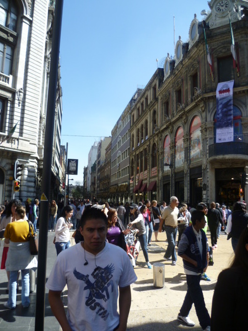
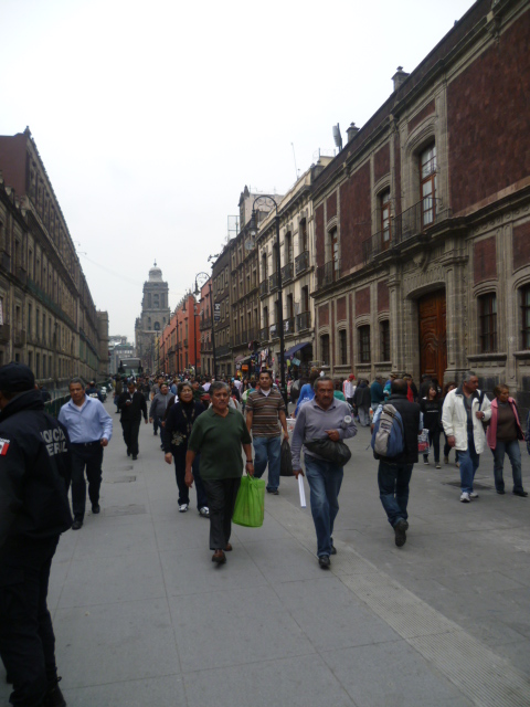
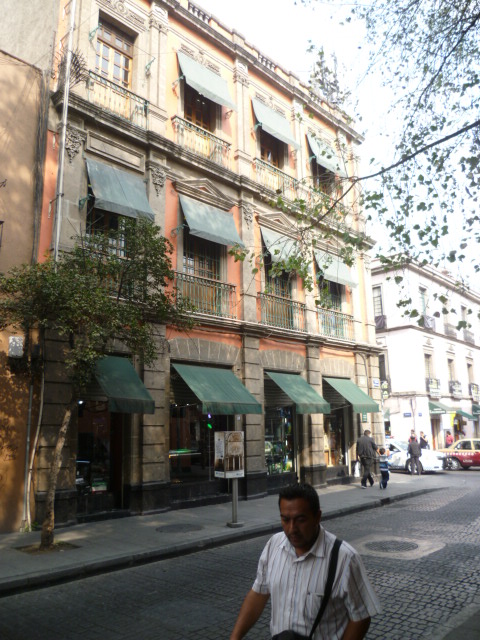
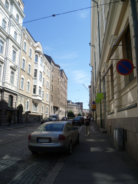
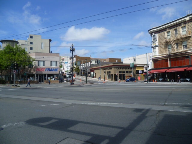
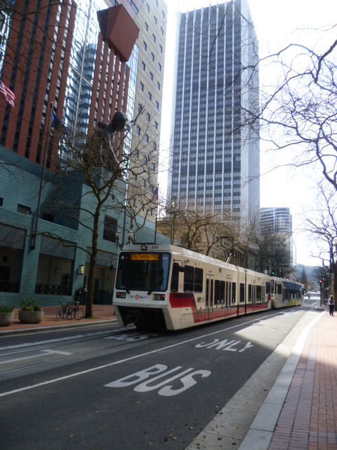
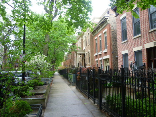
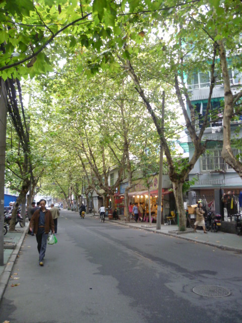
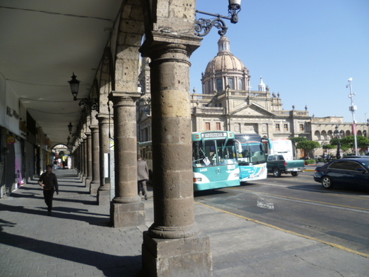
Madero Street , near the main plaza in Mexico City.
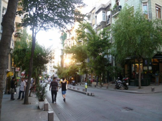
Walking along the beautifully pedestrianized Madero Street in the heart of Mexico City, I was struck with nostalgia for Istiklal Street in Istanbul. Istiklal is the famous pedestrian street, lined with elegant buildings, stores and restaurants, that runs southwest from Taksim Square in the old European heart of Istanbul (see image below and my previous posting on Istanbul here). 

Comparing a street in Mexico City to a world-famous street in Istanbul might seem a provocation - and that it is. I want to lure readers into the mental exercise of repositioning Mexico City into a different category of place. 

Shedding some preconceptions opens the mind to a revealing comparison that extends beyond two lively pedestrian streets. These cities have a range of things in common and, in fact, if I had to choose a city that Mexico City most reminds me of, it just might be Istanbul.

Mexico City and Istanbul are very old cities, built upon layers of earlier civilizations, with huge populations (well over 10 million inhabitants each). They are filled with a vast array of historical and architectural treasures and have teeming streets, vast markets, elegant neighborhoods, and share an exhilarating vibrance. Incidentally, both cities were built on water, although in Mexico City's case the water has almost entirely disappeared. Comparing these cities also makes sense from an economic perspective: Mexico and Turkey have roughly equivalent incomes per head. It's illuminating to see the contrasts between cities of similar resources and size managing the challenges of creating an attractive and healthy urban environment.  

But while Istanbul is a mecca for tourists from all over the world, Mexico City remains a relative tourist backwater in comparison. It hasn't yet gained the recognition it deserves for the positive changes it's experienced over the last years and for its wealth of attractions and the impressive ambience it has in so any areas. 

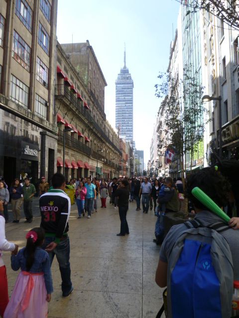
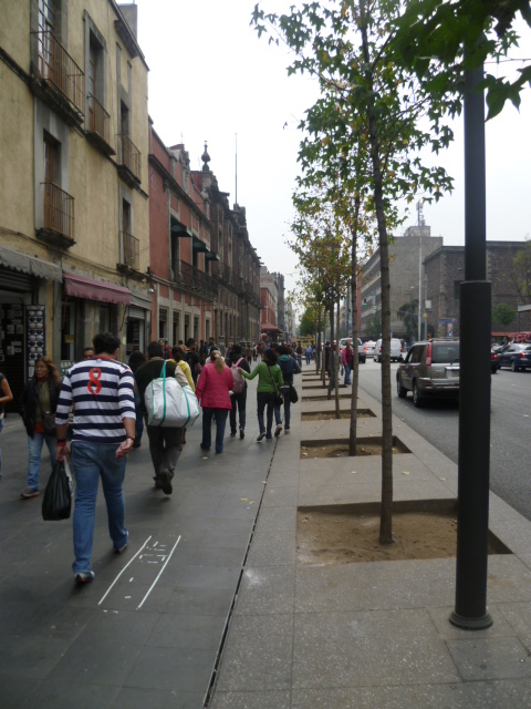
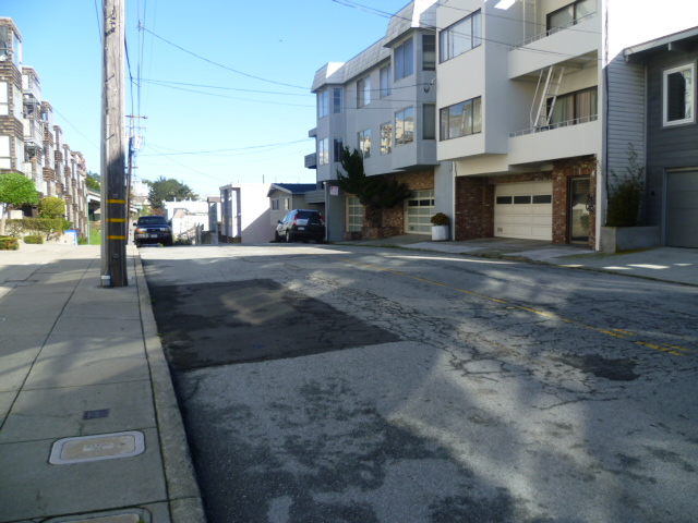
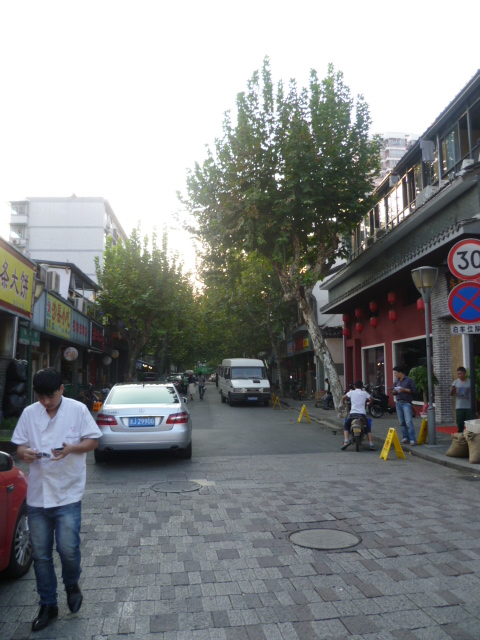
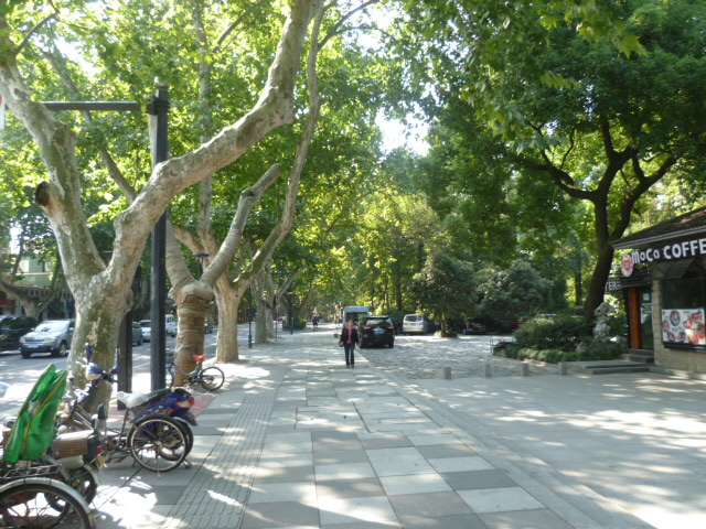
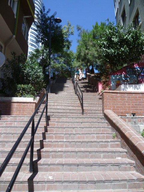
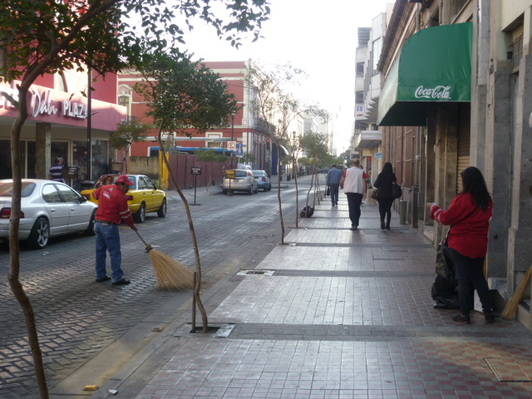
Below is another image of Madero Street in Mexico City (left), and a picture of Istiklal Street in Istanbul (right).

Picture
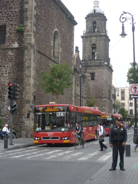
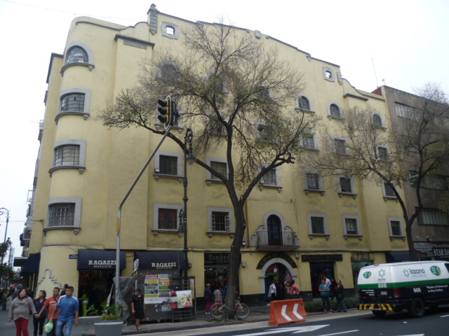
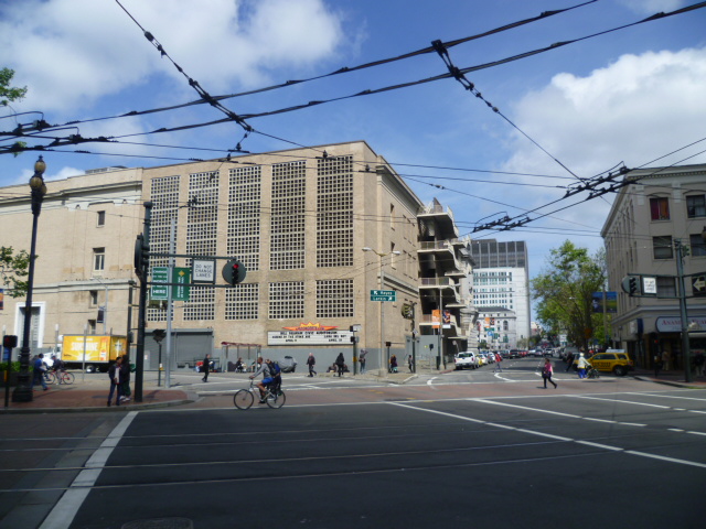
Lázaro Cárdenas Avenue near the historic center.
Up front let me say that my verdict on Mexico City is in: you don't have to fly across the Atlantic or Pacific to visit a dynamic, exotic and captivating global city. 

Mexico City has pretty much everything any tourist, adventurous or not, could ask for. It has countless museums, shopping for all tastes, regional and international food, and overall a breathtaking level of urban vitality. 

There are only two cities in North America that offer this kind of dense city experience: New York and Mexico City. In Mexico City, however, you can immerse yourself in the urban scene for a small fraction of what it would cost in New York. I think Mexico City qualifies as one of the best kept secrets of North American travel. 

What I imagine to be Mexico City's unglamorous reputation is mostly a relic from the past that will fade as this city continues to improve and gains the attention it deserves. 

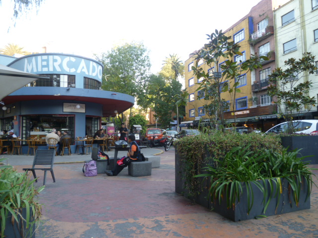
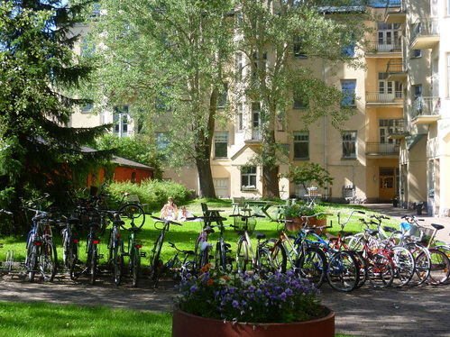
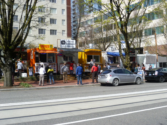
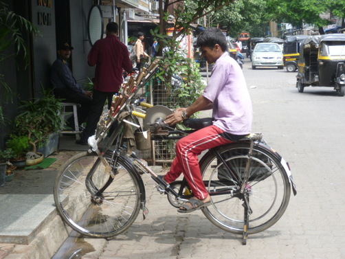
One of the things that makes Mexico City such an engaging and fascinating city is that it is over-endowed with a lot of friction. Friction, in this sense, is the the density of details on streets, details that make you want to stop and take a look, buy something, or have a seat and get something to eat or drink. You can see this in most of the pictures I've included in this posting. Mexico City just overwhelms your senses with the array of things on offer. A walk along the streets here is rarely uneventful.

Picture
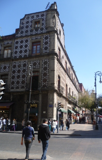
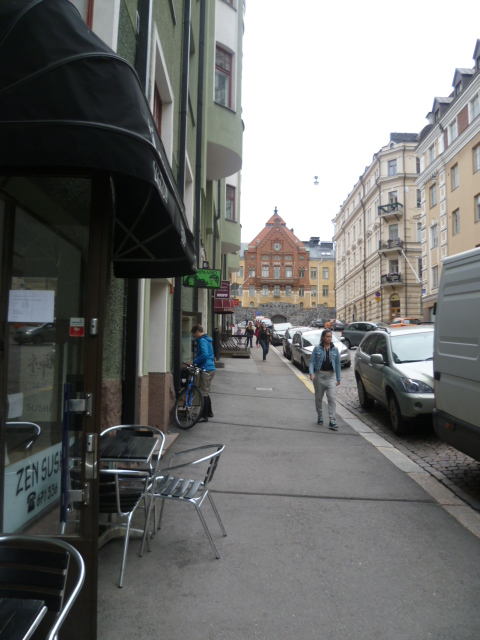
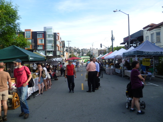
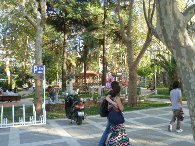
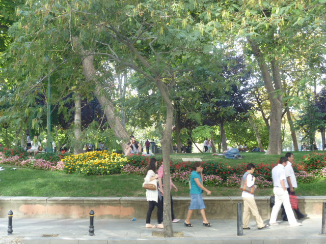
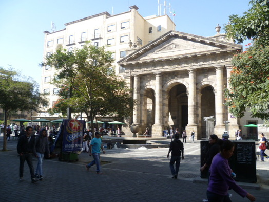
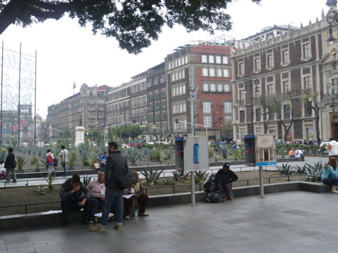
Looking away from the main cathedral on the plaza, under hazy skies.
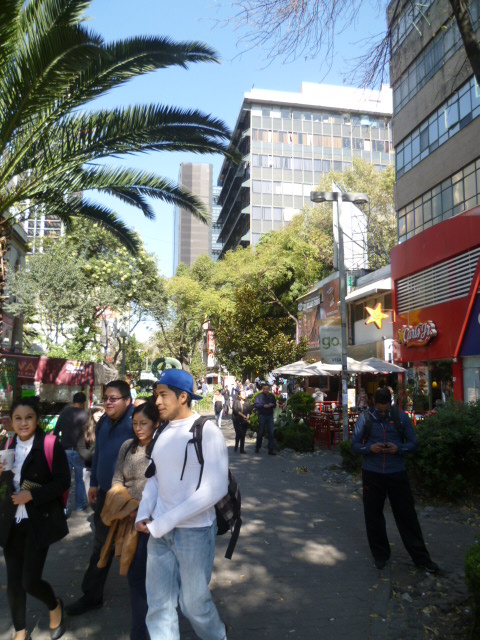
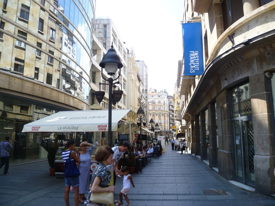
An obvious starting point of a visit to Mexico City is the historical center. This area exudes character and, with the slightest help from the imagination, elegance. It is arguably the most extensive area of historic architecture in the Western Hemisphere. Few cities I've visited in North or South America can compare, although Buenos Aires gives Mexico City some serious, if more recent, architectural competition. Thanks to a concerted effort at restoration and revitalization, it now rivals even great European cities in terms of its attractiveness and beats most of them hands down when it comes to verve and dynamism. 

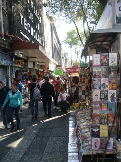
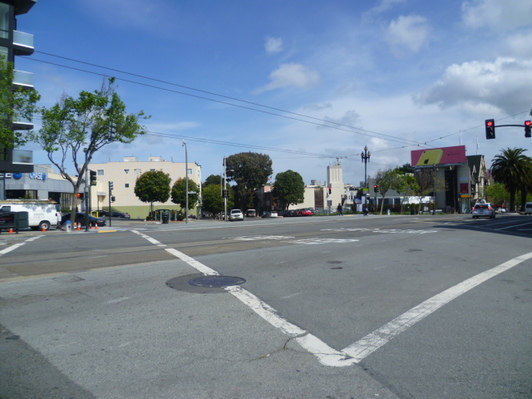
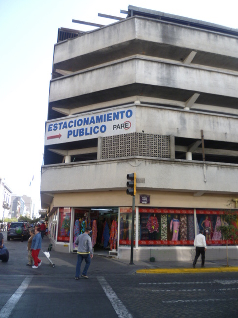
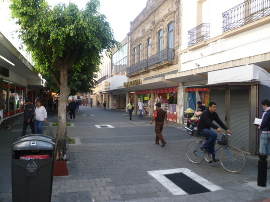
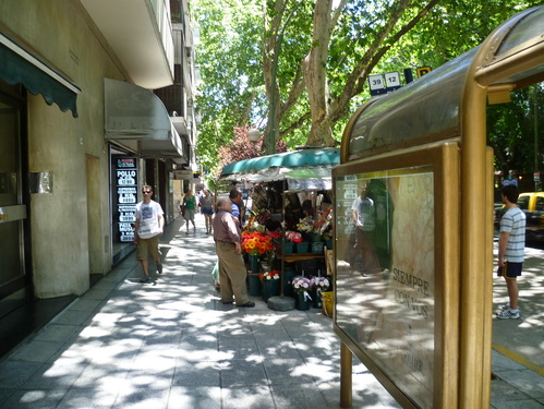
Below are images of some of the vibrant (often pedestrianized) streets of the historical center. 

Picture
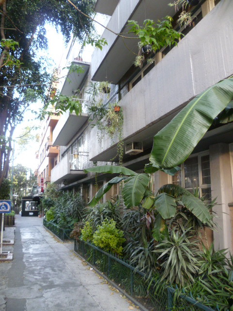
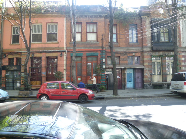
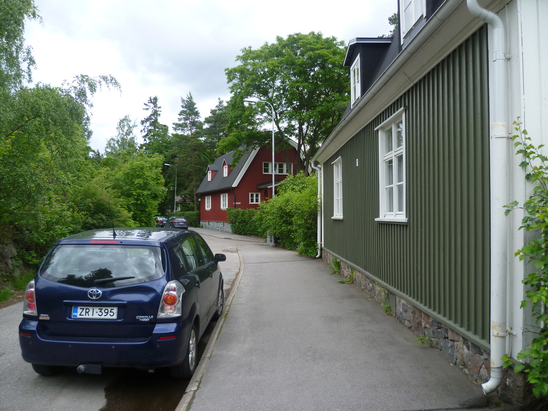
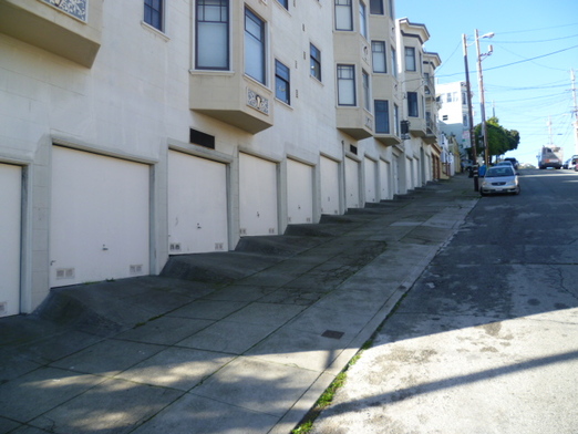
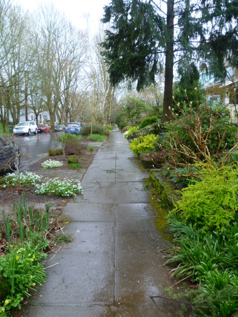
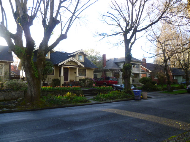
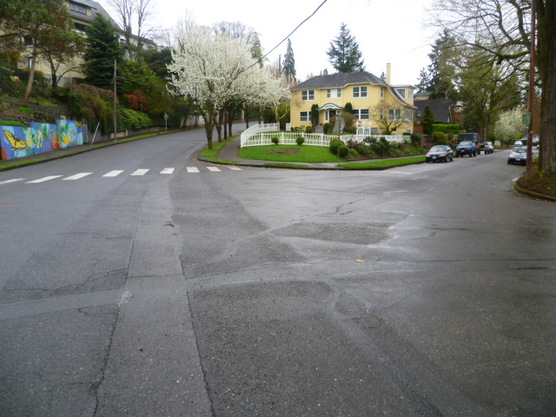
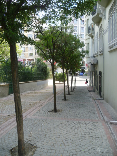
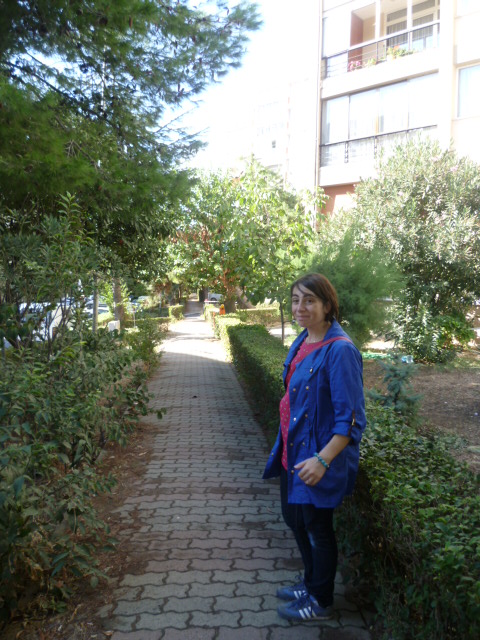
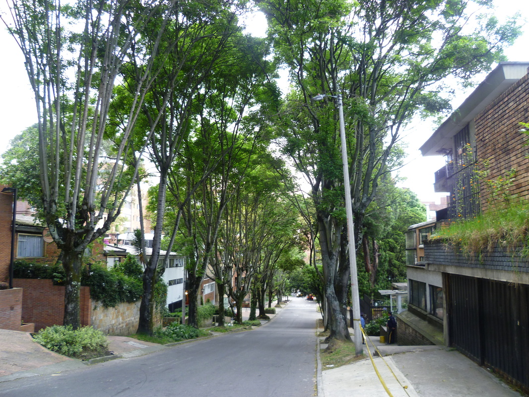
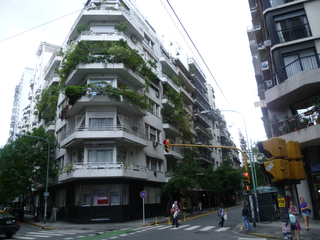
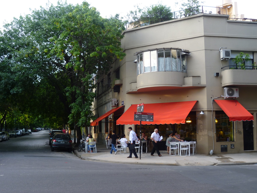
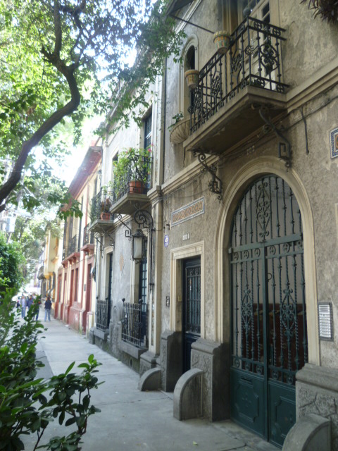
Residential street in Condesa.
Although tourists might imagine spending the bulk of their time in the historic center, this is just the beginning of what's on offer in this complex city. There are several extensive areas with rather dramatically different personalities. 

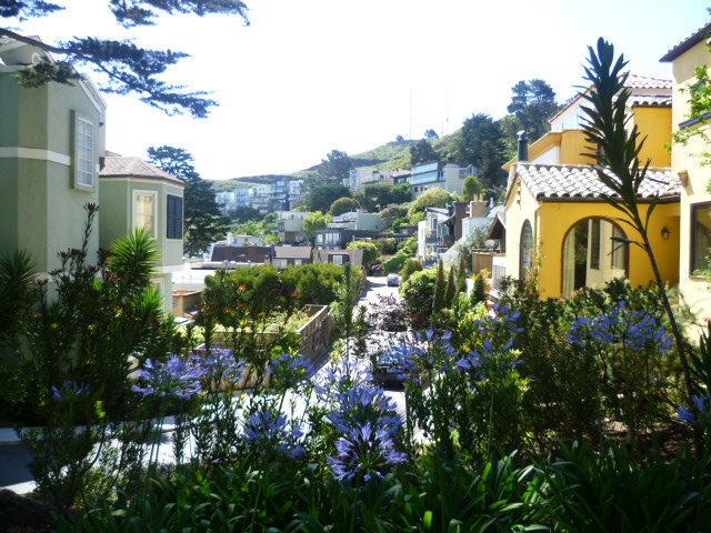
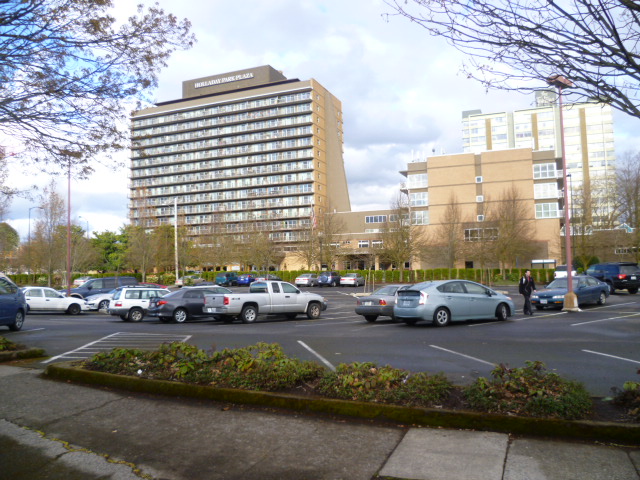
West of the center is Zona Rosa, which reminds me of modern areas of European cities, such as Barcelona or Madrid. Zona Rosa was once the wealthiest area of the city, but went into decline after the 1920s. It has since reinvented itself as a major center for shopping and entertainment. I think most tourists probably stay in this area because of its convenience, wealth of hotels and restaurants, and general attractiveness. Maybe it's the least exotic part of the city and most accessible for visitors. 

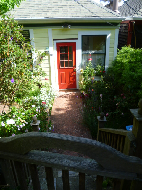
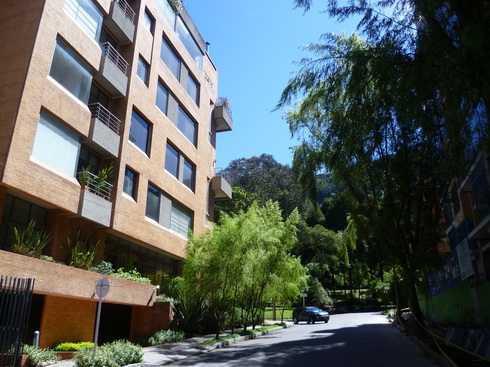
South of the Zona Rosa lie the Bohemian neighborhoods of Condesa and Roma. These areas, like Zona Rosa, have a history of being wealthy neighborhoods that went into decline as wealthy populations moved further west. They are built on a smaller, more intimate scale than Zona Rosa, and from what I observed, are gentrifying rapidly. This is the place to go to find trendy cafes and restaurants set in generally quiet and green streets. 

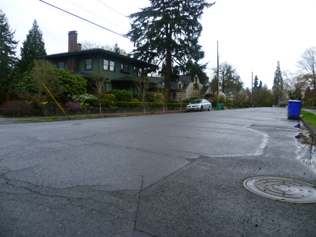
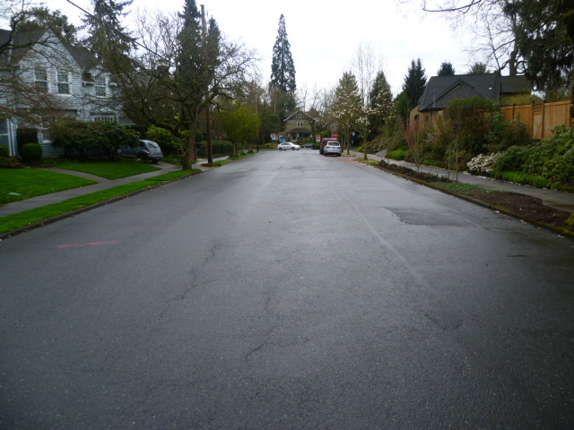
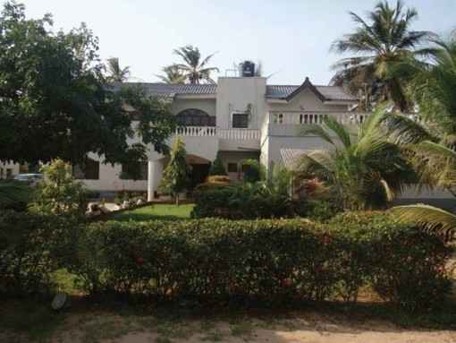
Further west of the Zona Rosa you will find the very exclusive and newer centers of wealth in neighborhoods such as Polanco and Lomas de Chapultepec. These areas, like clusters of the super wealthy in most large cities around the world, impress you with the extraordinary riches on display including high-end restaurants, stores and hotels.  

This is just a quick summary of some of the neighborhoods I've visited in this city.  A week or two here would barely scratch the surface of what's on offer. 

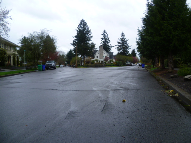
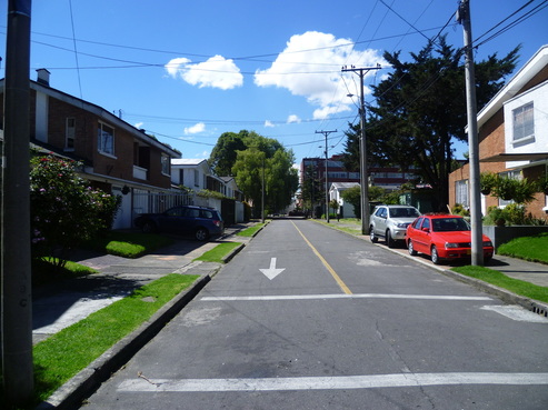
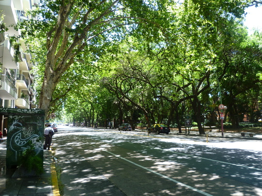
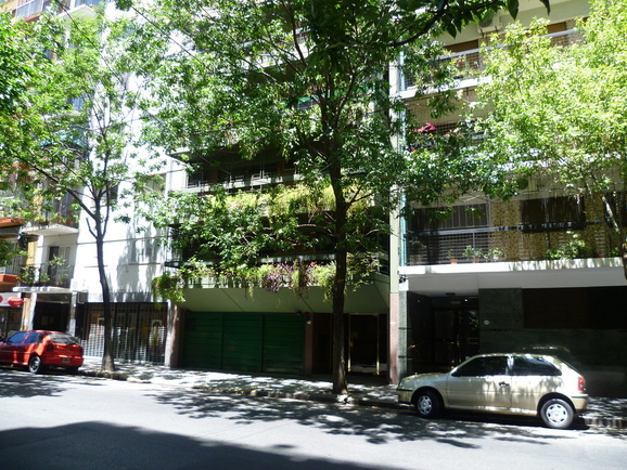
Below are views of streets in Condesa and Zona Rosa.

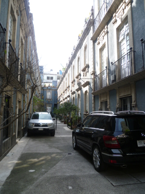
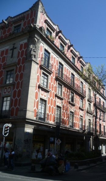
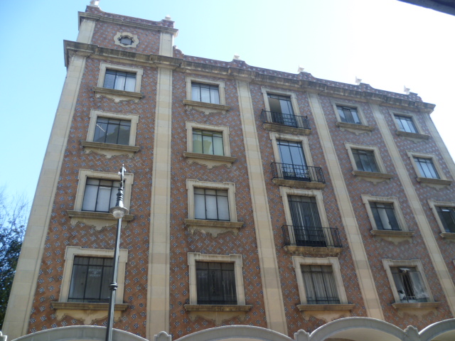
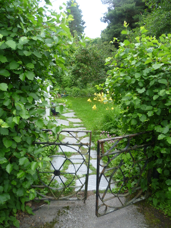
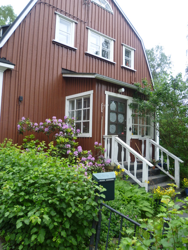
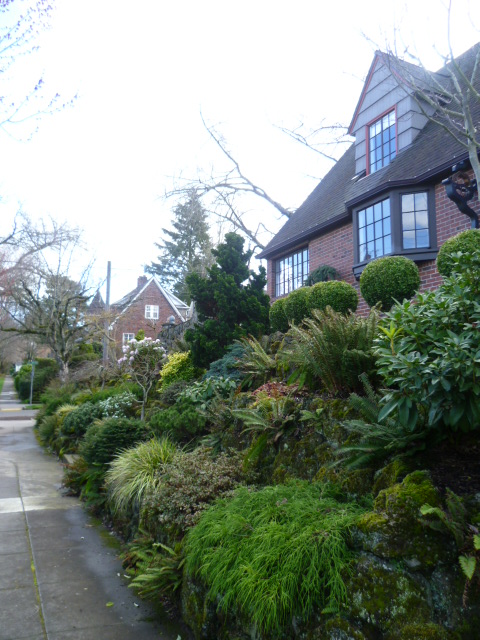
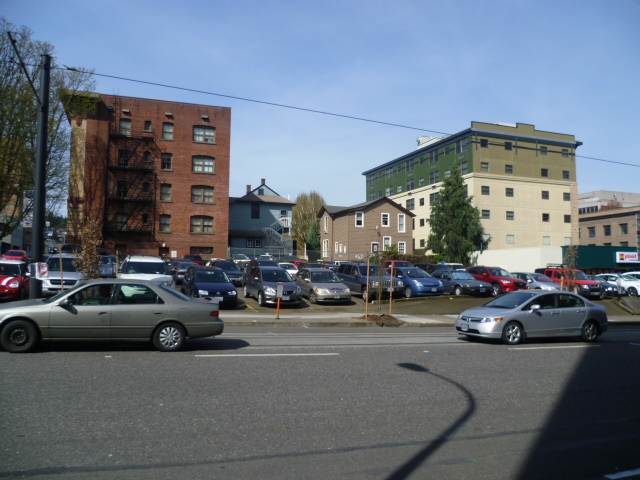
And below, a sampling of of the lovely buildings I encountered on my walks around the city. Most of these structures are in the historic center and in the Zona Rosa. 
Picture
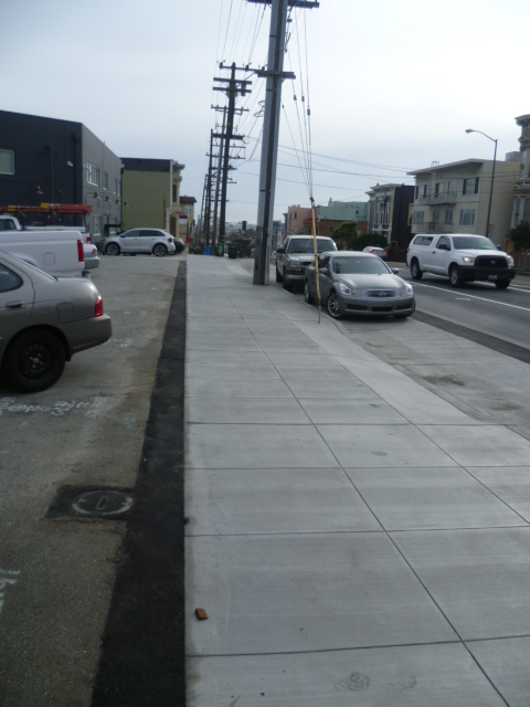
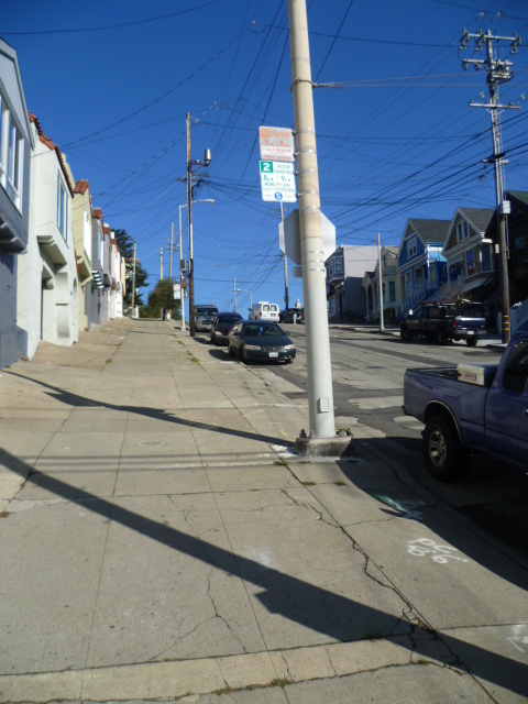
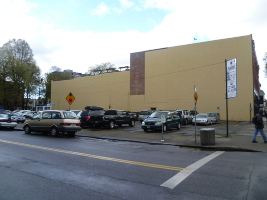
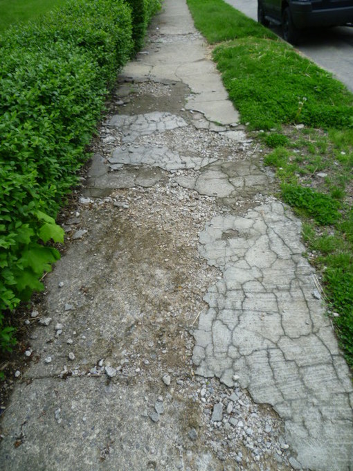
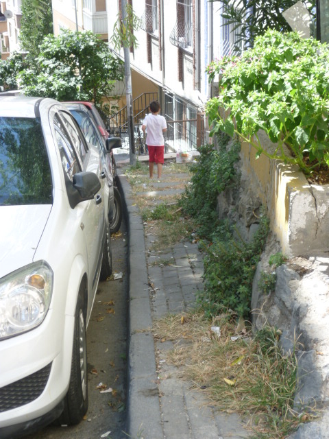
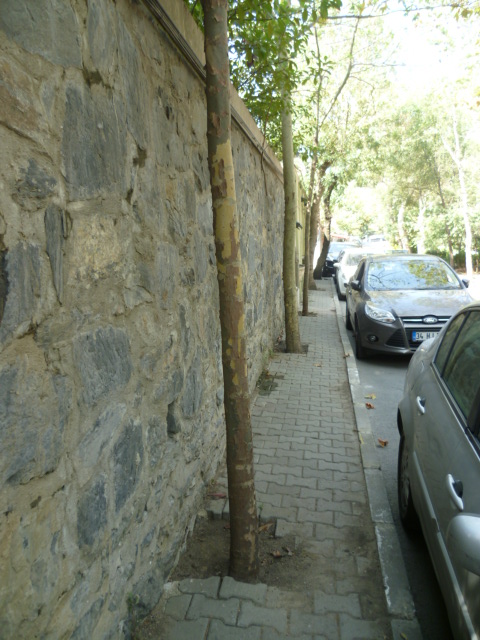
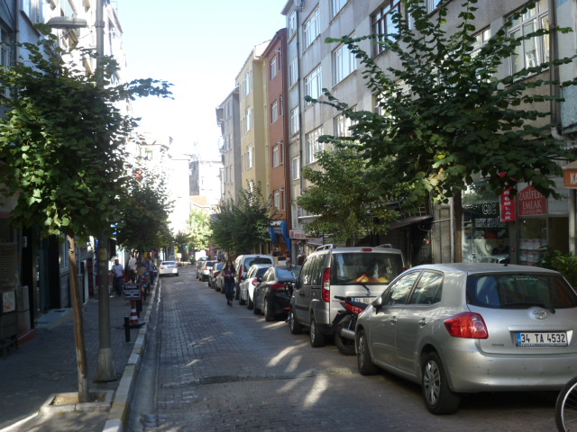
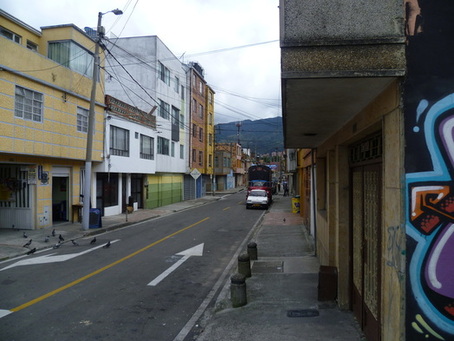
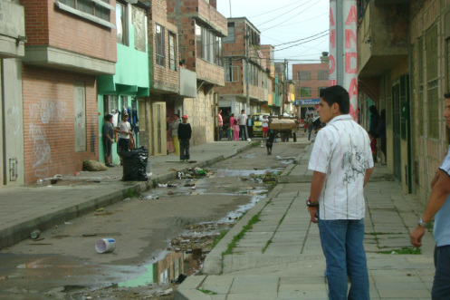
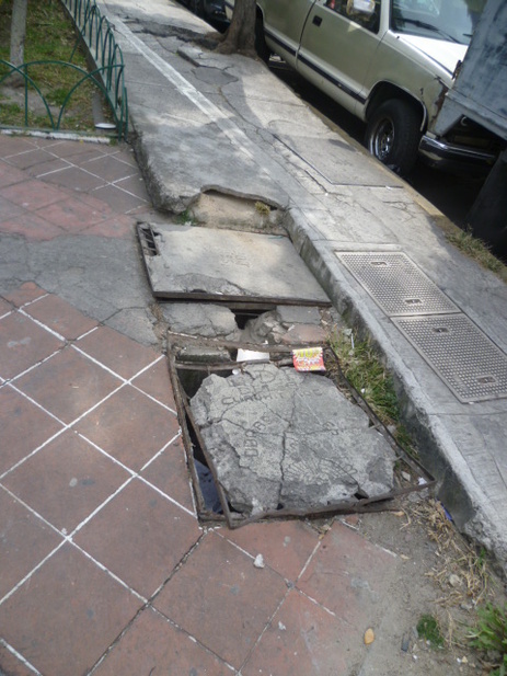
Rather typical hodgepodge mess of a sidewalk in many parts of Mexico City.
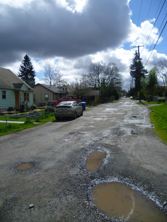
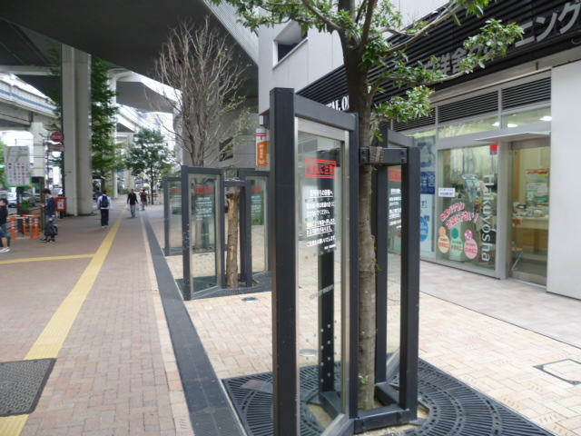
My case for parallels between Mexico City and Istanbul weakens critically, however, when you wander beyond the nicer sorts of neighborhoods I've described a bit above. The differences do not generally speak in Mexico City's favor.

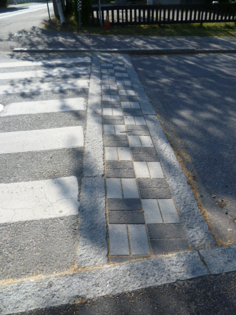
The divergence is immediately evident in the differing attention to the details of infrastructure such as streets, sidewalks and other public spaces. It's plain to see in the obviously far more inequal society that Mexico is. And in all neighborhoods, rich and poor, the difference is there in the far poorer (if somewhat improved) air quality. These issues are important to raise because together they conspire to significantly drag down Mexico City's quality of life. Without addressing them effectively, Mexico City will never be as great a city as Istanbul.  

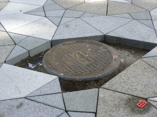
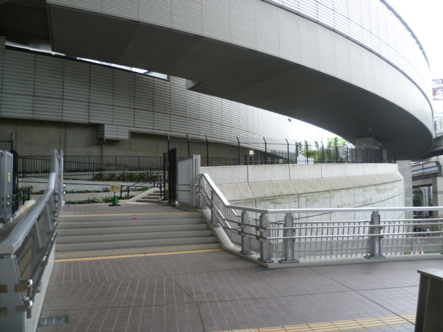
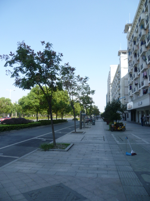
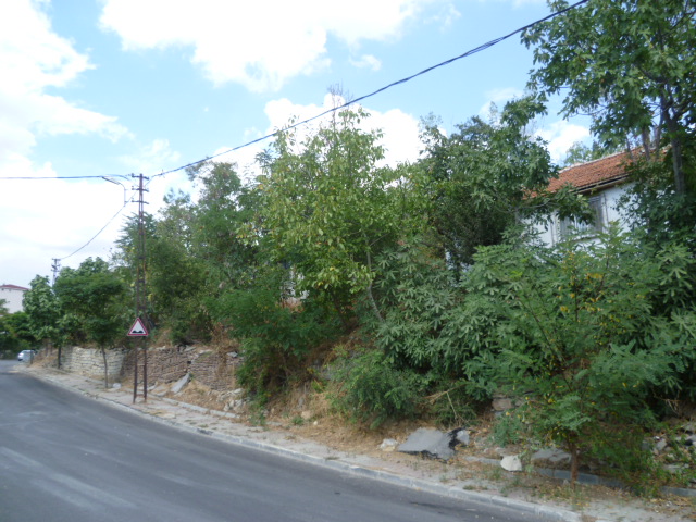
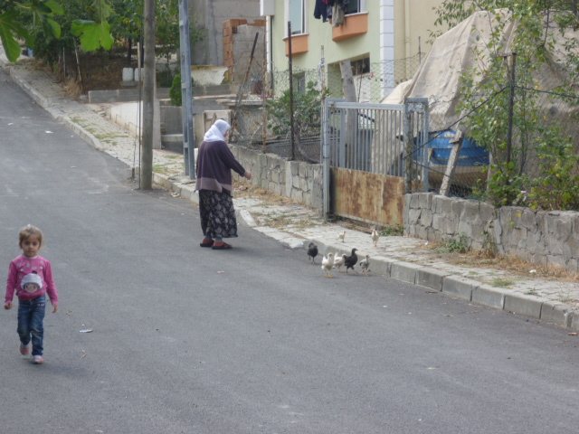
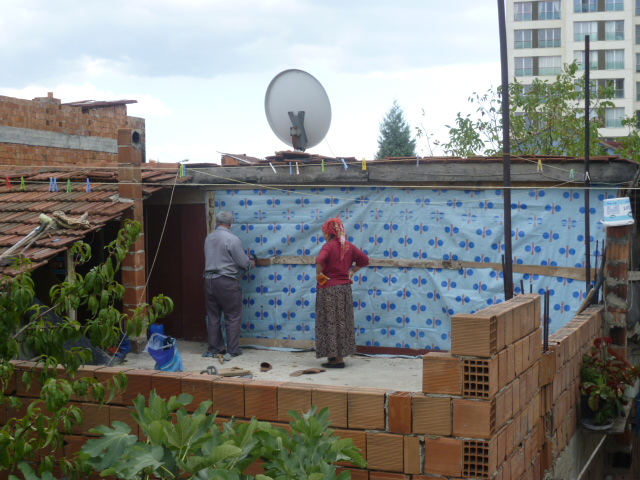
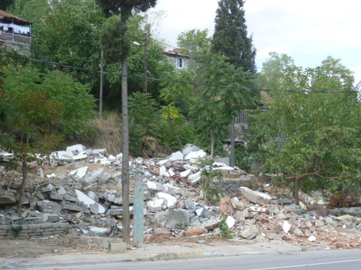
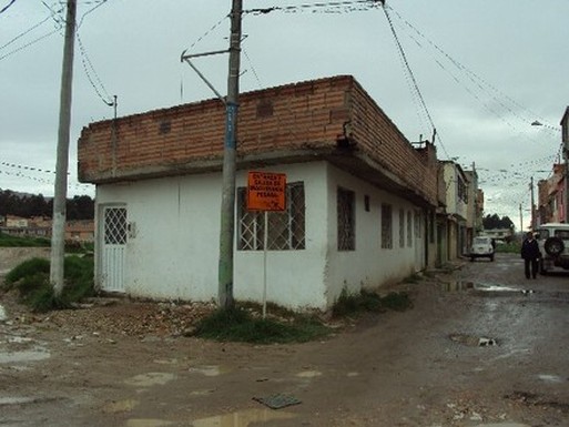
Ramshackle infrastructure is one of the characteristic features of Mexico's cities. It's apparent almost everwhere you go, with some exceptions, notably the infrastructure used by the upper classes, such as international airports.  The state of most streetscapes is stunningly apocalyptic. There is a haphazard look to construction, a seeming lack of any master plan, scraggly trees where they exist, and vast expanses of roughly poured concrete, with garbage strewn everywhere. This raggedness, combined with unattractive buildings spread out in a kind of low-density sprawl, makes for a uniquely unpleasant city experience in a large part of Mexico City's area. What I've written above about the delightful neighborhoods is true, but they make up a just one part of the city. Mexico City is so big that even if only 30% of its area is pleasant, that provides a huge area for tourists - and the wealthy - to enjoy. But it is truly a different world when you get away from the nicer areas.

Istanbul, in contrast, is a proud European city. It obviously takes pride in its general tidiness and sense of order in all of its neighborhoods, even the poorest. Istanbul, also a city of great contrasts, has much smaller areas of despair, and these are being renovated at a feverish pace (often to the dismay of those fighting for the rights of the poor). One reason for the less striking contrasts is the lower level of inequality in Istanbul. The poor are poor, but seemingly not as desperately poor as in Mexico City. 

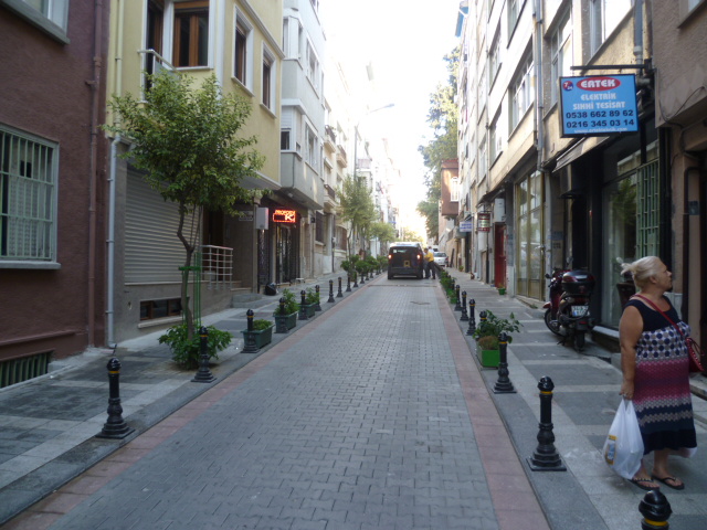
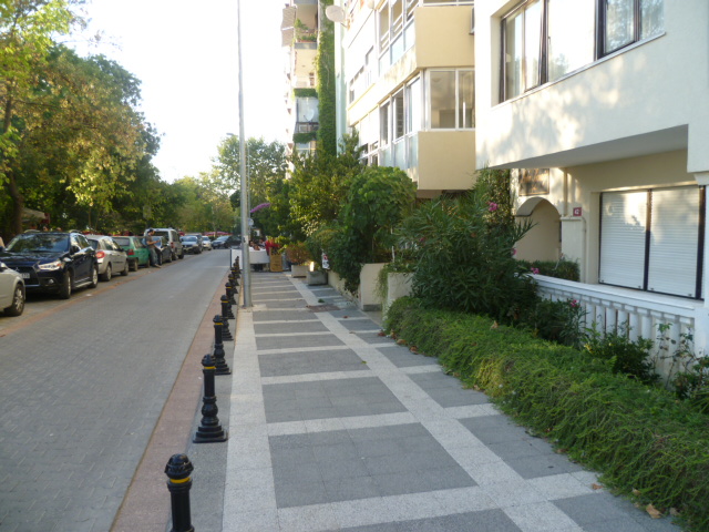
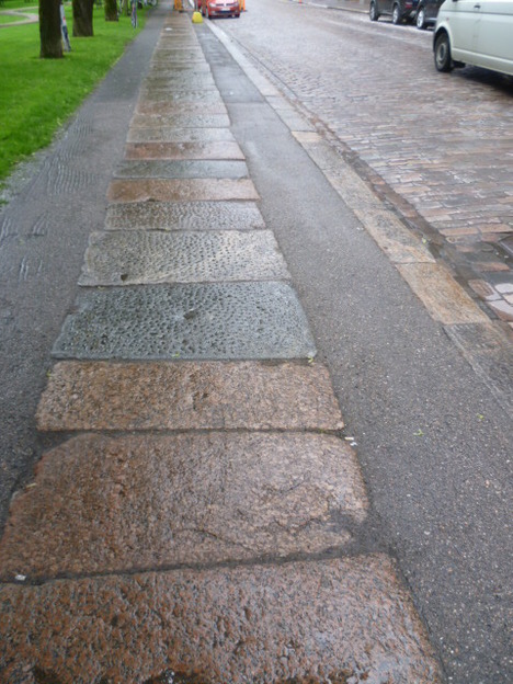
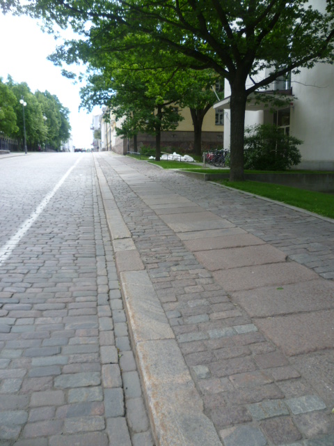
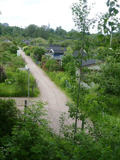
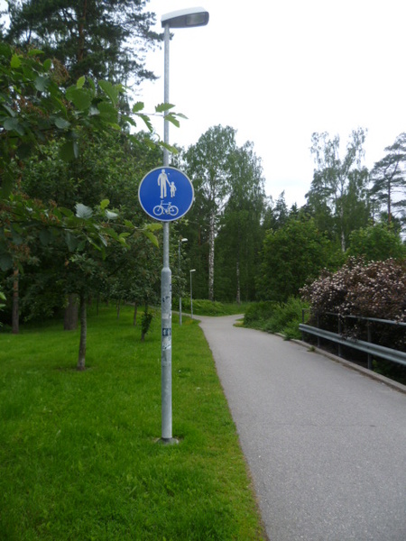
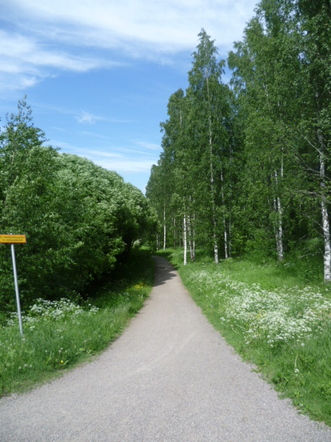
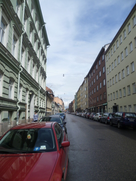
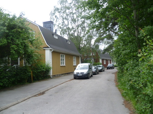
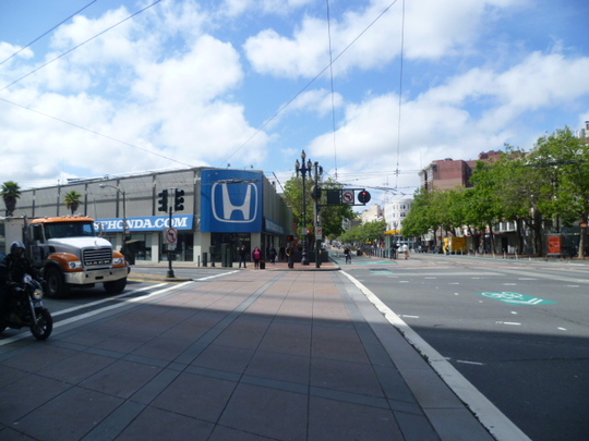
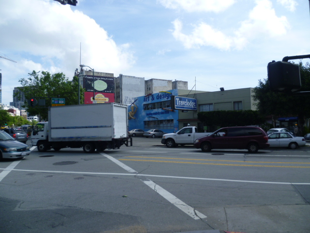
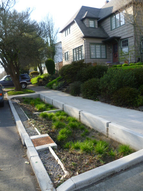
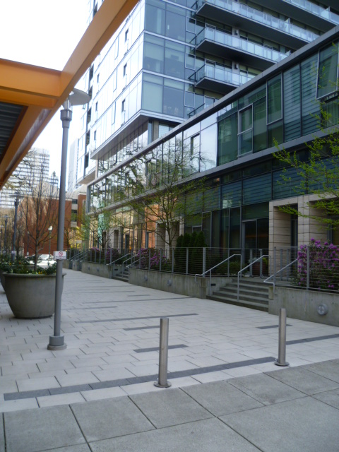
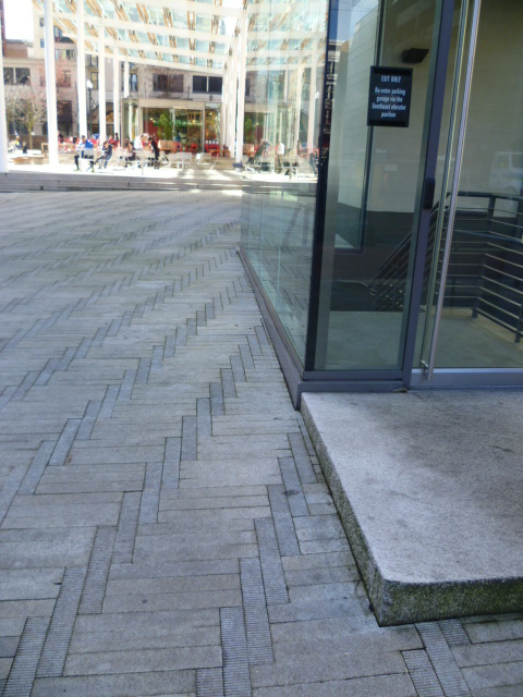
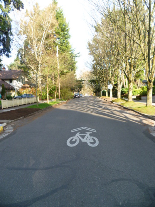
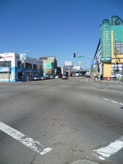
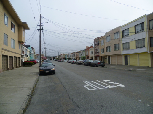
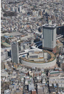
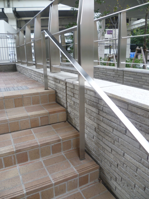
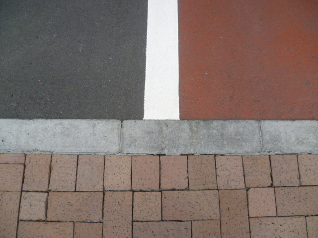
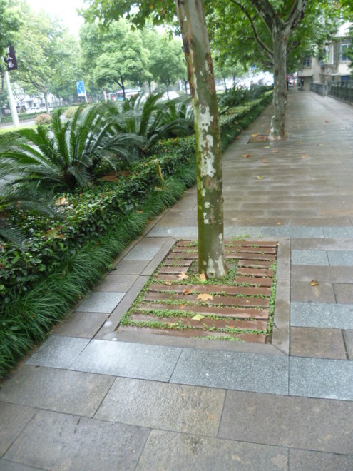
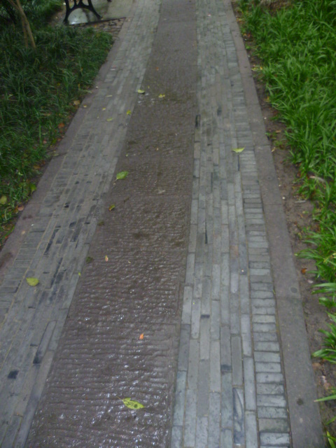
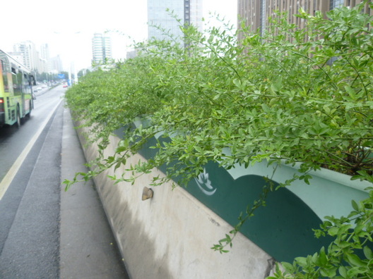
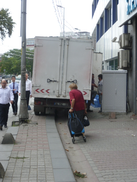
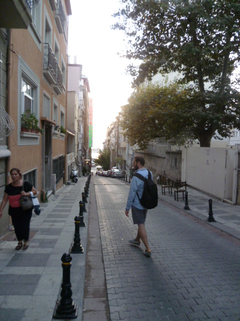
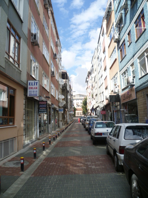
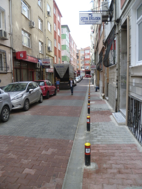
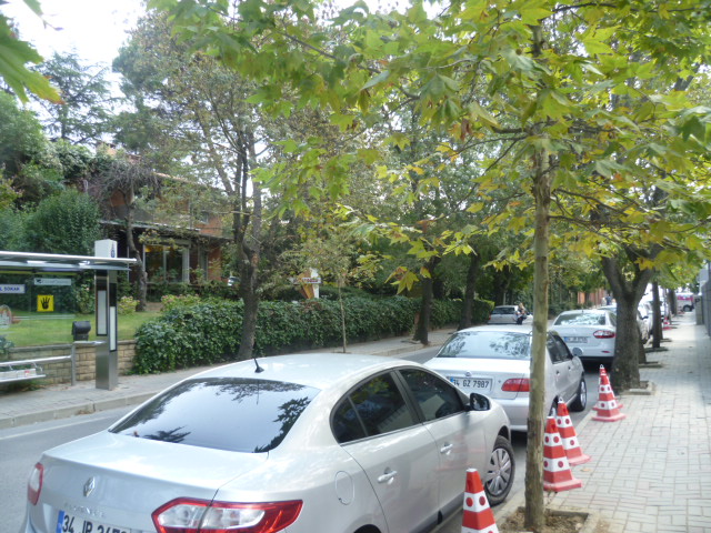
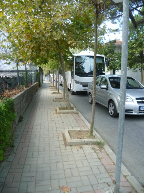
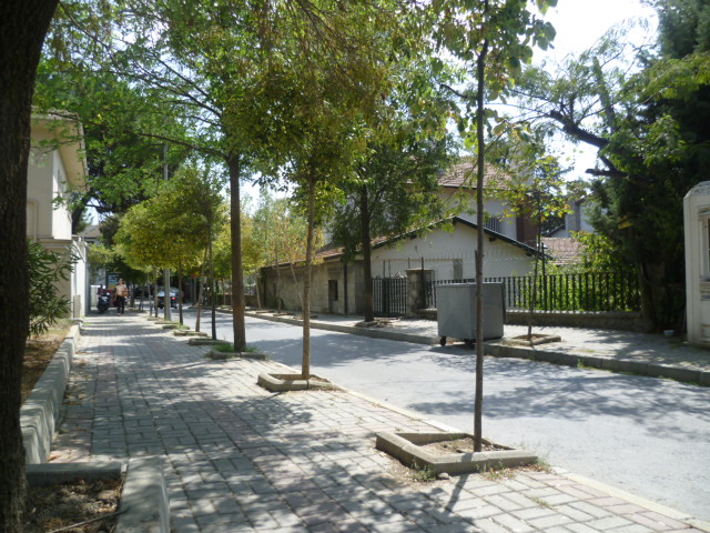
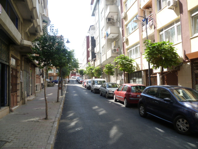
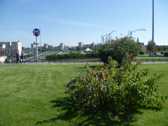
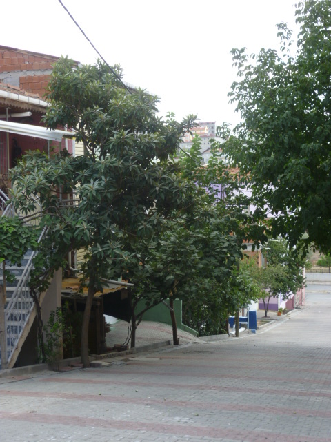
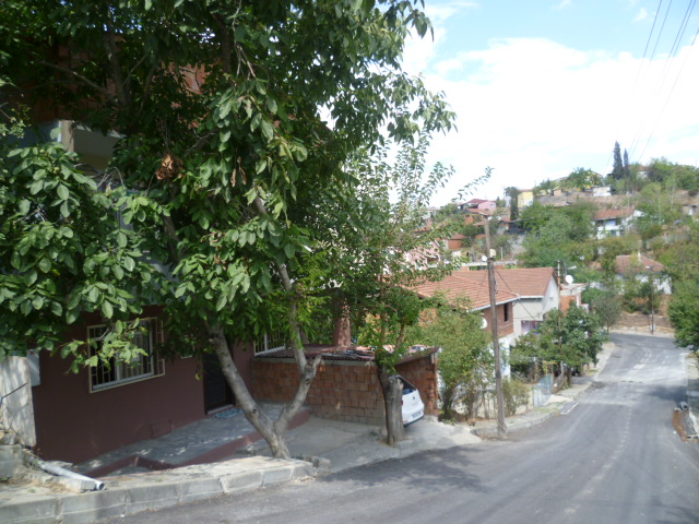
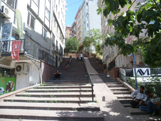
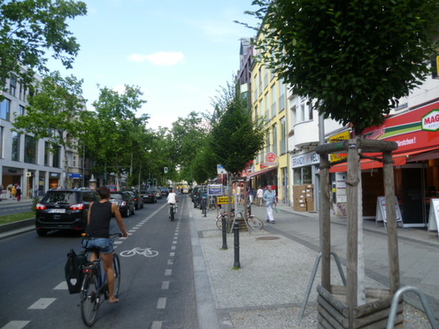
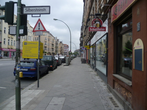
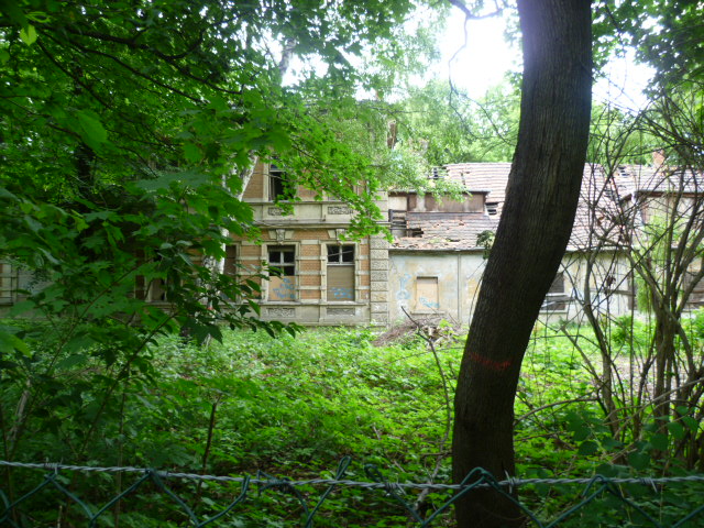
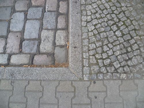
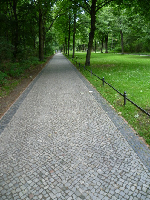
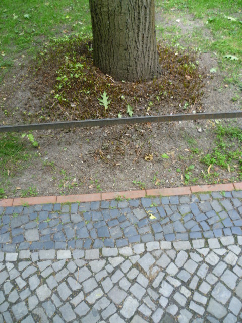
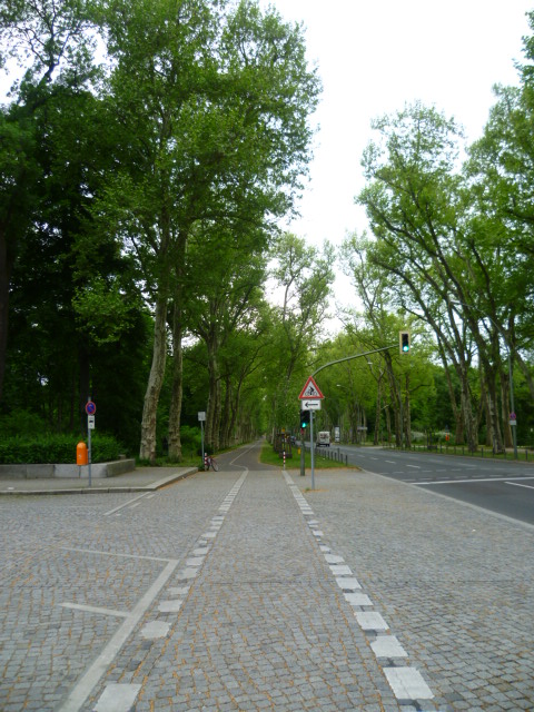
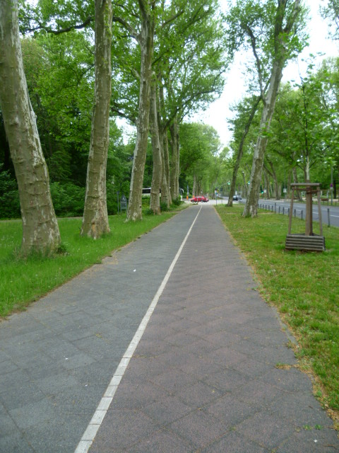
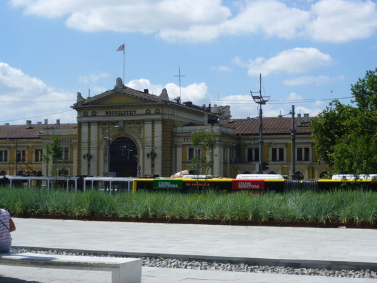
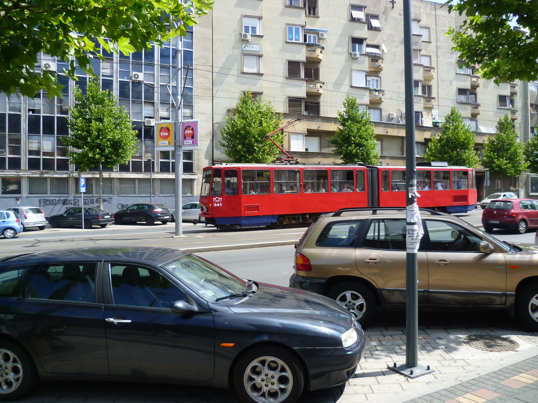
The pictures below contrast the streets of Mexico City (top 3 pics) with those of Istanbul (bottom 3). Although I may have chosen nice examples from Istanbul, these are the norm, not the exception. I don't think I saw one street in Mexico City as nicely laid out and constructed as most common newer streets in Istanbul. Istanbul is another world, a city exhibiting a high level of urban organizational competence. 

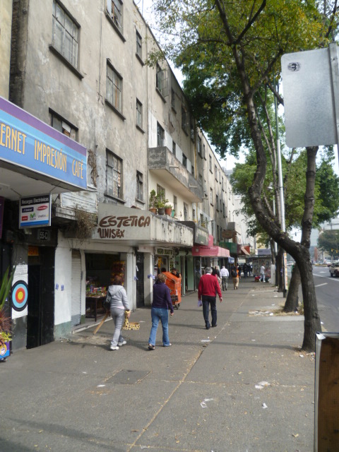
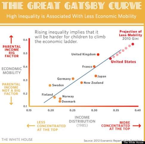
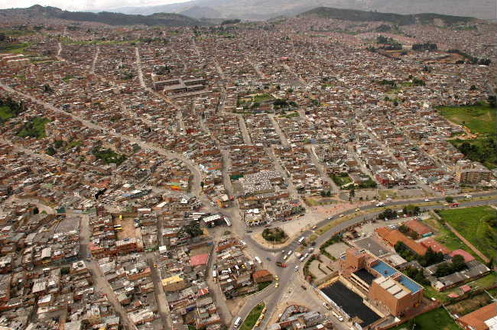
Radical inequality is the root cause of most of Mexico City's problems, including its vast ugly side. On measurements of inequality, Mexico scores as one of the most unequal societies in the world. In Mexico City this is on clear display in the stunning contrast between the areas of the wealthy and those of the poor. It is obvious in the tired, worn faces (and clothes) of the lower classes in evidence on public transport and on the streets of the poorer neighborhoods. Societies and cities with mass inequality uniformly display a kind of schizophrenia. There are the cozy, isolated bubbles of wealth and privilege, and then the ignored domain of the poor which seems to be of another world. National and city resources are obviously not invested  equitably, which is why streets in rich areas look so nice, and those in poor areas so utterly atrocious. 

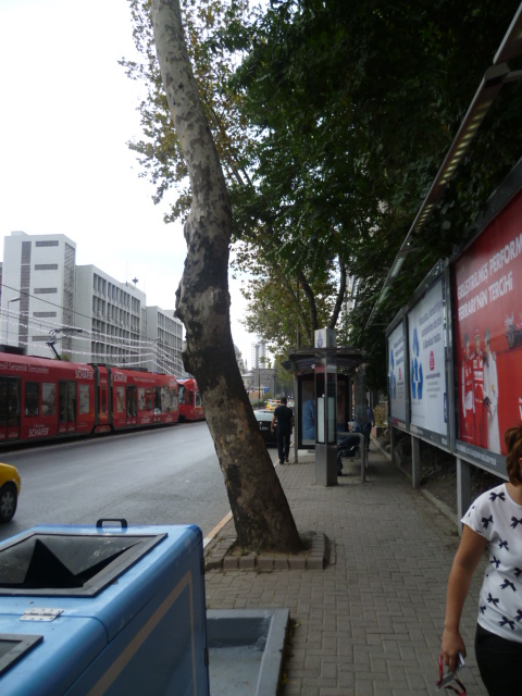
Finally, air quality is another constant reminder that Mexico City has a long way to go to reach a high quality of urban life. In most of the pictures I have included here, you can notice the smog and a general haziness to the air. I wonder about the incidence of respiratory disease in this city and have read that children are particularly impacted, with high rates of asthma. Mexico City is ranked right up there with Beijing in terms of its horrible air pollution.
Picture
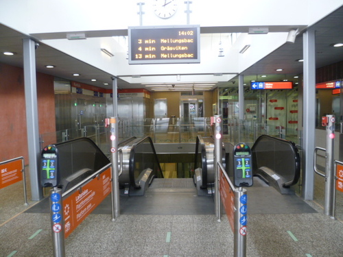
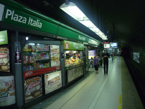
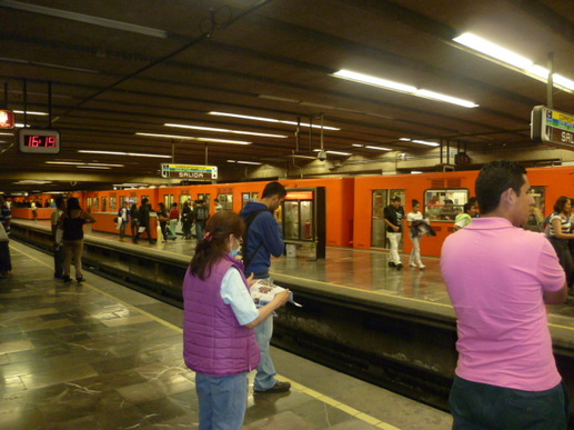
Subway platform, squeeky clean.
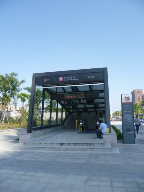
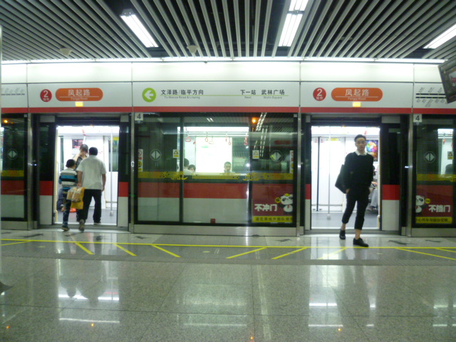
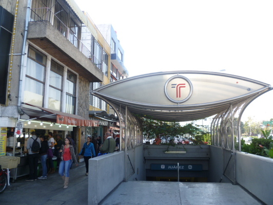
An area where Mexico City compares favorably to Istanbul is in its extensive metro system. The system covers wide parts of the city and compared to cities in the United States and Europe, is very inexpensive (about 35 US cents for a ride anywhere the system goes).

During rush hours the metro is extremely crowded and not pleasant to use, but otherwise it's a great way to get around the city. I was impressed with the general level of cleanliness (easily cleaner and better maintained than the New York subway) and the polished stone floors. It's also an ideal place to see a wide spectrum of people and to witness the never-ending drama of vendors, musicians and others passing through the cars. 

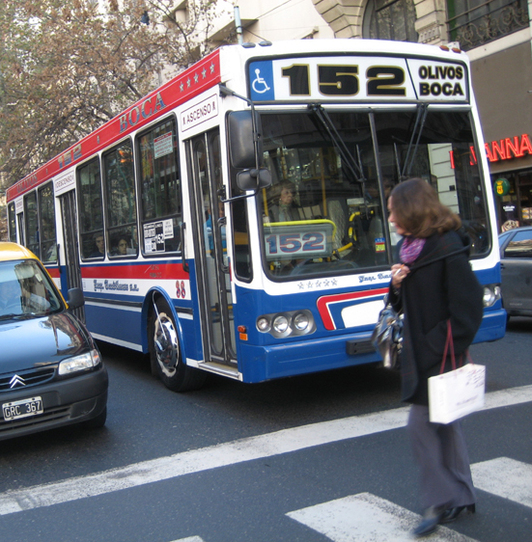
The metro does not, however, cover all of the city. In fact, considering Mexico City's population, the system is smaller than it should be. Far too large a share of public transport takes place on terribly crowded buses (often privately run) that are not integrated with the metro system. If a low-wage Mexican worker has to take a couple of buses, or a bus and then the metro, to get to work, this can add up to a huge amount of time and significant cost. There are plans afoot to modestly expand the metro system in the next few years.

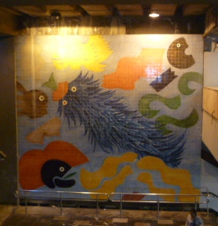
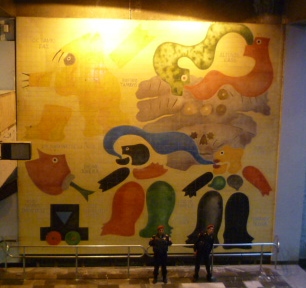
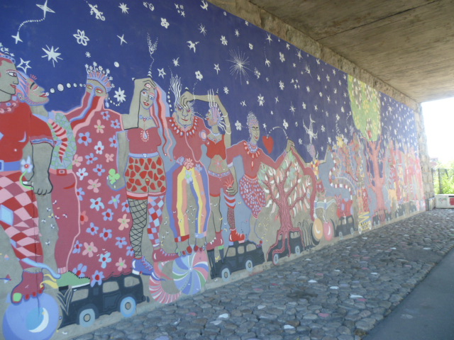
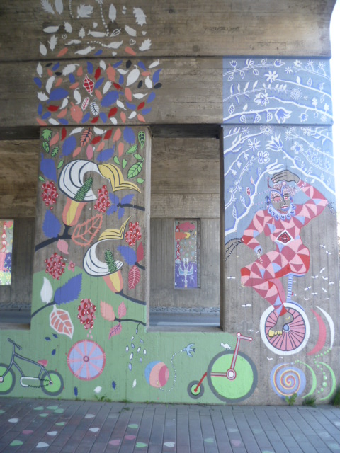
Below are couple of pictures of the artwork in one station and the unusual rubber-tired trains (as in Paris) which make for surprisingly quiet and smooth operation. 

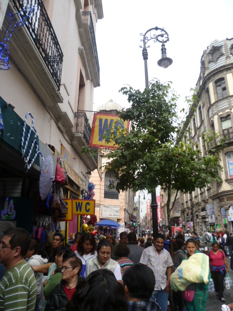
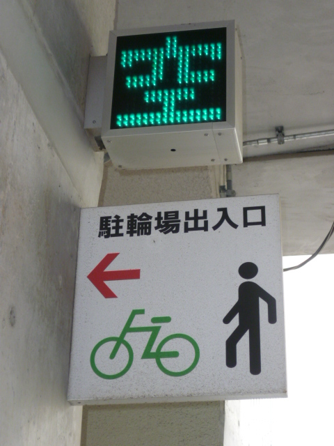
There is one additional feature of Mexico City that truly stands out. I've never been to a city with such a proliferation of public washrooms. They are literally everywhere and cost less then 40 US cents to use. Just look for a WC sign. See shots below.
Picture
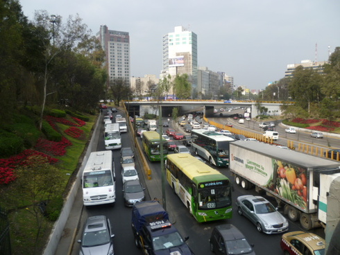
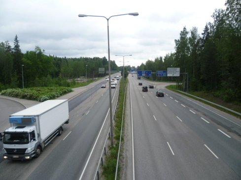
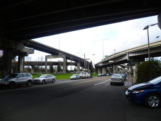
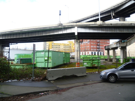
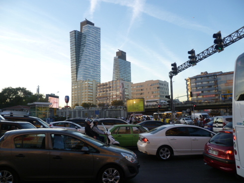
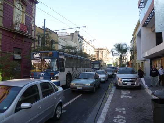
I think it's fitting to end with a picture of a congested highway in the middle of the city (left) because autos are both a symptom and a cause of so many of Mexico City's problems. 

Because the upper and middle classes generally don't use public transport, cars dominate the streetscapes of this city. And because this influential constituency doesn't use the trains or buses, they don't demand improved public transport. The problem perpetuates itself. With ever larger numbers of cars on the crowded streets, bus transport becomes slower and slower and air pollution stays at levels that are totally unacceptable. 

Despite being a place very well worth a visit, without addressing its serious societal inequalities, including the stark divide in mobility, Mexico City will be condemned to an average quality of life well below its peers around the world. For tourists on a one or two week visit it's rather easy to ignore most of these quality-of-life issues. I believe most visitors will come away positively surprised and charmed. I know I will be back.

1 Comment

Helsinki: Skies Bluer than the Ocean

10/30/2014

 
“One of the most effective ways to learn about oneself is by taking seriously the cultures of others. It forces you to pay attention to those details of life which differentiate them from you.” 
― Edward T. Hall, The Silent Language
PictureHouses along bicycle path nestled in green surroundings in the north of Helsinki.
On a sunny summer day, under a Nordic blue sky, the vast web of Helsinki's forests, fields, beaches, and other green spaces conjure an urban wonder: a city thoroughly interwoven with nature. After four months of living in the capital of Finland, I'm of a mind to say that life here is very good. 

The good life that Helsinki offers may not be immediately apparent to the short-term visitor. This Baltic city is not a cosmopolitan center brimming with dazzling shopping, a vibrant food scene, or a pulsating nightlife. Instead it's a rather homogeneous, predictable place where the everyday is given priority over the spectacle. In fact, tourists here have often told me that they find the city boring, and boring it may be if you are looking for big-city life of the sort on offer in Paris, London or New York. 

The beauty of Helsinki is found in the ordinary, in its steady attention to the banal underpinnings of a secure, pleasant and healthy urban environment.  My time here convinced me that it delivers an exceptional quality of life, across many measures, for the majority of its inhabitants. It's not surprising that Helsinki typically ranks among the top ten cities in the world for quality of life. This quality of life is based upon factors such as safety, state of its infrastructure, access to nature, and quality of education and health care. It results from a high level of what I call urban organizational competence (the level and sophistication of a city's ability, through a variety of agencies, entities and experts, to organize and run itself) - a concept I will be writing more about in the future.

PictureThe backyard of my good friend Simo's building in central Helsinki, with many bicycles.
Finland has one of the most melodious national songs I've ever heard, Finlandia, by the Finnish composer, Jean Sibelius. 

An American composer used the melody in a hymn called This Is My Song (click and take a moment to listen), which I like because it makes clear, in such a beautiful way, the relativity of love of one's country: a recognition that although I may think my country is the most beautiful place in the world, people in other countries believe the same about their own countries. 

The following segment of the lyrics brought me to another place:

My country's skies are bluer than the ocean,
and sunlight beams on cloverleaf and pine;
but other lands have sunlight too, and clover,
and skies are everywhere as blue as mine.

Although the sentiments of the song appeal to me, a worrisome realization comes to me that maybe, in fact, skies are bluer in some places than others, at least figuratively.

Before coming to Helsinki, I spent over three months in the United States, with long stays in Portland, Oregon and San Francisco, and shorter stays in Chicago, Columbus, Ohio, and New York. Arrival in Helsinki (like arrival in most northern European cities after time in the United States) presents a sharp, uncomplimentary contrast. Americans are often immersed in stunningly shabby physical surroundings, with urban planning and design (not to mention maintenance) decades or more behind other countries at a similar level of economic development.  Not only is their physical environment bluntly inferior, but they must contend with systemically ignored, but intense and simmering, social problems which impact security and much else. Because of inadequate investment, public institutions such as schools and government offices are also often poorly run and shabby. This is not an exaggeration. If you have experience between the two worlds, you know what I'm talking about. 

If Helsinki and Columbus (cities of very similar size and income level) were two types of cars, Helsinki would be a newish BMW 3-series (the European sort, nothing particularly fancy) and Columbus a 15 or 20 year-old Chevrolet Cavalier. The contrast is truly that profound. The aged condition of the old Cavalier represents the physical infrastructure of American cities. The technology in the car represents the sophistication of its public institutions, and the safety features, the city's crime situation. You might plug some new expensive equipment into the Cavalier - maybe a fancy new stereo or navigation system (which might correspond to a great university or fancy office building in a city) - but you still have the hugely outdated, run-down automobile (and city). The same goes for most other American cities in comparison with cities in the northern areas of Europe, Australia, and the wealthier countries of East Asia. Portland, Oregon may be one of the notable exceptions, but is itself still far behind. It's a national embarrassment for the USA, readily apparent to visitors from other wealthy countries who often are polite enough to say nothing about their surprise to rather patriotic and proud Americans.  

This posting on Helsinki will shed some light on what makes for really blue urban skies, and maybe help Americans understand their perennial overcast condition. Please note that I don't revel in my role as an annoying gadfly raising uncomfortable questions about urban life in the USA.  How happy I would be if America, instead, were an inspiration to the rest of the world that was leading the way in quality of urban life. 

PictureStone slabs laid with precision between asphalt.
Where's the cement?
An American arriving in Helsinki might experience a certain unease, a sense that something essential is missing. It's that comforting frosting of absolutely featureless, cheap cement covering all surfaces. Its absence will be noted because cement by the square yard is one of those things that makes American cities, well...American. 

In Helsinki, a needy cement junkie will have trouble tracking down any reassuringly vast expanses of the substance. It is used commonly in things like highway overpasses (and even here with much more finesse than is the norm in North America), but not in pedestrian areas or generally on streets. 

Why is there such a striking difference? A simplified answer that pops into my head is that the appearance of US cities is simply a reflection of American society and its values. Fundamentally, Americans don't care much about how their cities look. Design has given way to expediency. Low cost is the driving force in urban design and maintenance decisions. Americans are happy to accept  an unattractive physical environment, with a kind of rough functionality, if that saves them money and allows them to consume more of other things (including fighter jets and missiles). Besides, as they drive rather than walk or bicycle, why worry about the details? In a car-centered society, it's easy for streets to simply become high-speed corridors for driving, with little or no reason to stop and take a stroll.

Another more disturbing possibility is that most Americans simply don't know the difference between good urban design and bad. As they've rarely seen examples of beautifully constructed and managed cityscapes they believe that their streets and pedestrian areas are actually quite nice and as good as (or better than) streetscapes anywhere else. This seems to be confirmed by the boosterism and pride I encounter in American cities. What's most surprising is that many Americans have visited cities abroad with world-class design and infrastructure yet still don't expect or demand such standards at home. This could confirm the notion that they simply aren't able to see the differences and are aesthetically neutered. 

A disturbing consequence of America allowing its cities to sink to such a low level is that the skills and craftmanship required to orchestrate and build beautiful streets may have become a lost art in the United States. Even if we wanted to catch up, we would need to import talent to do it right. 

Below are some pictures of the beautiful, high quality, and carefully maintained street and sidewalk surfaces in central Helsinki. 

Picture
Wherever you go in Helsinki, you are faced with first-rate infrastructure. It seems that the Finns don't bother building it if they aren't going to do it well, and subsequently maintain it rather impeccably. I've found the same to be true in other Nordic countries, the Netherlands, Germany, Switzerland and Austria (not to mention Australia and wealthier East Asian countries). These are the countries that do public infrastructure best. These are also the countries with incomes most similar to those of the US. They are therefore ideal to use for comparison purposes. 

I mentioned above that the car-centered nature of American society might account for the lack of detailed design and attractiveness in its urban streets. But this would hardly explain the parlous state of much of the USA's highway infrastructure. In Finland, highways are smoothly paved and streets do not have potholes. I really don't think I ever saw a pothole on a Helsinki street, and this in a climate that can be brutally cold in the winter. What explanation, I wonder, do American cities give? It certainly isn't that their residents, on average, are poorer than those in their northern European counterparts. Average incomes are rather similar. It may however, be related to the massive inequalities in income which don't show up in typical averages. I will come back to this question later.

The quality Finnish infrastructure extends to bridges, public buildings, sports facilities and even the water pipes that I've seen replaced during construction projects. Below are some scenes of cutting edge infrastructure and architecture that surrounds you in Helsinki. 

PictureGarden allotments in central Helsinki, in the area known as Central Park
The most outstanding physical feature of Helsinki is it's wealth of green and natural spaces. Helsinki is a wooded, rocky peninsula jutting out into the sea that at times seems to just incidentally have human settlements interspersed throughout.. 

From where I lived in the north of Helsinki, in the Paloheinä neighborhood, I could ride my bicycle almost all the way to the center of the city (a 45-minute ride) without ever crossing an intersection and without seeing any cars. This is because Helsinki is designed in such a way that wooded and natural corridors (as well as protected seaside areas) extend like a circulation system throughout and around the city. They give residents quick access not only to peaceful, natural areas but also to safe routes for bicycle commuting . Even Oslo, another city with a wealth of green, doesn't have this same connected system of green spaces and corridors penetrating so deeply into all sections of the city.  

My typical ride took me through what is called Helsinki's Central Park, and along the way, I was ceaselessly amazed at the range of uses I found for the open spaces that dominate the city. The pictures below show some of the natural spaces, all without the artificial feeling that over-engineered green spaces often have in cities.  They include clean rivers, farmland, vast areas of garden allotments, seashore, and most commonly, forests that go on and on. This despite the fact that the population density in Helsinki is higher than in comparable American cities such as Columbus or Portland. 

Picture
A highlight of life for me in Helsinki was the ease of movement around most of the city by bicycle. In all but the center of the city, Helsinki has an uncommonly good system of paths for bicycles..

Bicycle infrastructure in Helsinki seems to be divided into three main types: 
1) shared sidewalks (pavements) along streets; 
2) shared paths through green areas, and less commonly; 
3) dedicated bicycle lanes.

As is common in Norway, Sweden and Finland, most sidewalks along bigger streets are wide enough to accomodate both pedestrians and biyclists. Often there is a line demarcating walking and cycling areas. Just like people walking, bicyclists on shared pavements yield to cars at intersections, although they are generally protected by raised crosswalks that dramatically slow traffic down, making bicycling safe along streets even for children. 

The most pleasant, and fastest, way to get around by bike in Helsinki is on the shared paths through green areas, or along the coast. These paths are not specifically for bicycles, and are used by pedestrians, joggers, skateboarders and others (see picture above), and can be covered with asphalt or finely crushed stone. Although they are multi-use, they are almost never crowded and it's very easy to quickly cover large distances, totally isolated from automobile traffic. All streets and roads encountered are either crossed by dedicated bicycle/pedestrian bridges or avoided via underpasses. It's a lovely way to get around as it's safe, you have beautiful scenery all around, and the air is fresh and clean. I used paths like this every day to get into the center of Helsinki. 

Helsinki has a few examples of dedicated bicycle lanes, the most interesting bit being the Baana Bicycle Corridor, built along an old rail line. This is a very cool stretch of urban bicycling. Take a look at the link. 

The three types of bicycle infrastructure, sadly, disappear in many of the older core neighborhoods of Helsinki. In these areas it's necessary to ride on the cobblestone streets with traffic. If this part of Helsinki were all you saw, you would not think Helsinki is an excellent city for bicyclists - which in fact, it really is. 


Picture
I wrote a bit above about the ample green space in Helsinki, but I want to focus a bit more on the impressive array of outdoor recreational facilities on offer to the public here. 

Not only are forest areas and green belts within a short walking distance of all inhabitants, but there is a very generous allocation of well-maintained playgrounds, sports fields, swimming pools, beach areas. marinas, and more - among the best I've seen anywhere in the world. 

Although these facilities are well used, because of their abundance they rarely appeared crowded. There seems to be space for all.  I was highly impressed with the quality of materials used and general upkeep.

Below are some pictures of the kinds of generally free, meticulously maintained public facilities that most city-dwelling Americans could only dream of. 

PictureEntrance to Helsinki's metro line.
When not riding my bicycle, I used public transport in Helsinki. In comparison to most European cities I've lived in, Helsinki is underserved by metro lines. There is one main line, which runs from west to east, but most of the city is not covered. There are commuter train lines that go to the suburbs, and these serve some parts of the city. The city also has many tram lines in the central area, as well as ferry routes linking the city to its islands. On the whole, however, I imagine most people using public transport in this city rely on buses. 

As I was living in a neighborhood far from train, tram, or metro lines, I used bus to get around. Buses were frequent, very clean and pleasant to ride.  A nice thing about Helsinki's well-organized bus system is that generally you know rather precisely when the next bus will come. Nearly every bus stop has a digital display that tells you how many minutes before a particular bus arrives. See the middle picture below, showing that bus 63, a line I used frequently, would arrive in 2 minutes. This sort of system is not common in the United States, but it's the norm in much of Europe and East Asia. 

Picture
Like any city, Helsinki has its relatively low income areas. These tend to be on the eastern side of the city, but there is no clear division between wealthy and poor areas here: the eastern parts of Helsinki have wealthier districts, and the western parts have poorer districts, too. 

Finns are uncomfortable with any suggestion that a class divide exists in this city, but it certainly does. In fact, many of the conurbations outside of center are rather forlorn looking and unattractive. There are signs of social problems such as alcholism and poorly integrated groups of foreigners. What does not exist in Helsinki is a green divide. Even the relatively poor here are blessed with an embarrassment of well-maintained green spaces close at hand. 

What struck me most about the lower-class parts of the city is that people are often living in large, high-rise apartment blocks (such as the buildings in the pictures above and below), rather isolated from other buildings, and often quite a walk from any stores. In the summer, it's somehow bearable because of the profusion of green in all directions. But I imagine that in the winter it would be rather bleak, as there is little activity in the environs. Most of these high-rise developments are like islands in the middle of forest. The developments are often centered on a metro stop, where there is always an adjacent shopping center. These commercial centers themselves can be fairly unattractive. I think urban design of this type is a legacy of bad planning ideas from the 1960s and 70s. Most Finns wouldn't want to live in places like this today. However, from disussions I've had with local people involved in urban planning issues, the shopping center-centric style of development continues in Helsinki, continuing to breed car dependancy and continuing to isolate people and deprive them of lively, interesting streets. Timo Hämäläinen writes an interesting blog, called from Rurban to Urban, discussing the challenges Helsinki faces in creating lively, engaging streets and communities. 

Below are more examples of high-rise apartment blocks in the east of Helsinki.

Picture
Even in the expensive center of the city, (especially here, I think) there is a lot that can be done to improve the experience of being a pedestrian or bicyclist - and improve the quality of life for local residents, as well. 

Several things strike me about streets in the center. They are:
* narrow sidewalks
* excessive space allocated to car parking
* a lack of trees and other green elements
* a lack of bicycle lanes, and 
* a general low level of activity (and hence, perhaps, the perception of tourists that this is a boring city).

In terms of street design in its old urban core (a rather small part of the city), Helsinki is behind the times. The streets, although often lined with beautiful buildings (and also many bland ones erected in a misguided period of urban renewal in the 1960s), lack beauty because so much space is devoted to automobiles. The streets are rather lifeless and drab as there is no leftover space for trees, cafe-lined sidewalks, and bicycle lanes. Wandering these streets in the winter could be quite depressing. 

I wonder why so little interesting retail and so few restaurants and cafes line most of these streets. Perhaps there are zoning regulations that keep many business out or maybe high taxes act as a discouragement. It's certainly not that Finland lacks an interesting retail sector. In fact, its shopping centers are full of innovative Nordic chain stores (from Denmark, Norway, Sweden and Finland itself) that would be a hit in the US or other parts of Europe. The outside world only knows about IKEA and H&M, but there is much more.  If only Helsinki could manage to get these stores (and restaurants) out of the shopping centers and back onto its streets - this would no longer be a boring city for foreign visitors. 


Below, some streets that could use a bit more life (the first from Itäkeskus, a major hub in eastern Helsinki). 

Picture
I can't end this posting without sharing a bit about my favorite neighborhoods in Helsinki. 

Although I love the elegant central districts, with their Jugenstil architecture, the places I find most charming and most uniquely Finnish are the areas of wooden houses and wooden apartment buildings in neighborhoods such as Käpylä and Vallila. It would be a dream for me to have a house in one of these areas. 

There's something about these neighborhoods that make you want to settle in. The scale is very human, there's a lot of common green space, and fundamentally, it's just beautiful. Below are some views from Käpylä.

Picture
Helsinki is a great foil to the American cities I've most recently visited and blogged about. It provides a contrast, and ultimately an excellent model for how pleasurable city life in the USA could be. 

There are many reasons for Helsinki's superiority. One is its outstanding urban organizational competence: Helsinki is a metropolis under professional management and benefits from a highly evolved ecosystem of actors who cooperatively create a great city. 

Another underlying reason for its high rank in urban quality of life is the relatively low social inequality, and very high social mobility, in Finland. Residents of Helsinki have a shared destiny and work together to make their city a wonderful place to live. People here are not condemned to an inferior life if they are born in poorer areas. Social mobility is very high. 

I miss Helsinki. Beyond all the wonderful things about life there, and the lessons it holds for American cities, what I miss the most are the friends I love dearly. I was unfortunate enough to have an accident the day before I was scheduled to leave Helsinki. This led to knee surgery. My friends Pia and Jan took care of me for several weeks while I began my recovery. The silver lining to this situation was that it gave me more time to spend with them, especially with their precious kids, Lilya, Linnea and Linus. Below are pictures of my constant companions, Linnea and Linus. I can't wait to get back to Helsinki for a visit next summer. 

Details from Helsinki

7/8/2014

1 Comment

 
1 Comment

The (Weary) Streets of San Francisco

5/5/2014

0 Comments

 
PictureView from balcony at my Buddy and Orie's place in the Castro.
Taking in the view on the balcony of my friends' home in the Castro district of San Francisco (picture, left), it's hard to imagine a better city to be in the world. There are the hills, the fresh air, and the lovingly maintained gardens in the back of most of the neighboring buildings. It's simply beautiful.  

There are few cities where I feel as good and at home as San Francisco.  The city justifiably has important symbolic value throughout the world as a bastion of individual freedom and human dignity, and this is undeniably a desirable feature of life in this area.  The Bay Area, San Francisco's region, is my favorite part of the United States.  I lived in the East Bay (Berkeley) over 10 years ago while in grad school, and I never forgot the unique feel to this area.  The climate is mild, the vegetation is Mediterranean, the people are generally tolerant and open-minded, and there's simply a spontaneity and sense of possibility in the air here. Most residents wouldn't think of living anywhere else. 

PictureView from Corona Heights Park
From another height, looking out over the city from one of its rocky hilltops, it would be easy to idealize this city and imagine it as one of the most sophisticated and livable in the world. San Francisco, however, is usually experienced at ground level, and the experience here strays from any idealization of that sort. 

This city is no earthly paradise, although it has an incredible charm and many attractive attributes.  But its global reputation and image are bound to disappoint on closer examination, as many foreign visitors have told me.  This extremely expensive city has seriously rough edges that drag down its quality of life in multiple ways. Despite being virtually the wealthiest large city in the United States, it often has a ramshackle, dirty and run-down look to it.  This shabby appearance comes as a surprise to many visitors from abroad who expect more from this legendary city.  In fact, in the face of incredible natural advantages, a highly educated population and wealth, it settles for a second-rate quality of life for the bulk of its inhabitants.  Yes, I did say San Francisco has a second-rate quality of urban life.  In this blog posting I will explain my view.  Brace yourself as I dig further into the pathologies of American cities. 

But first a little glimpse of beauty from this city (it is rich in beauty like this), to highlight the shame of allowing so much of it to be so mediocre.

There are four outstanding things I will focus on, common to American cities, that stand in the way of San Francisco reaching its very high potential. They are poor infrastructure, lack of human scale, autocentric design, and immense social problems.  
PictureA typically weary-looking street surface near the Castro (Dolores and 18th, I think).
The American Society of Civil Engineers, in their 2013 Report Card for America's Infrastructure, gave the United States an overall grade of D+ for its crumbling infrastructure.  This is close to a total failure.    
I am rather astounded at the general public's apathy in the face of our country’s shamefully ill-maintained infrastructure.  I'd expect outrage, really. Perhaps Americans have gotten used to this state of affairs, and don't know what quality public infrastructure looks like in other wealthy countries around the world.

This rough infrastructure is, in fact, one of the things most characteristic of American cities.  San Francisco is no exception, and a walk around this city can be a big surprise to visitors from northern Europe, Japan or Australia. Things are simply not well maintained, or maintained in a manner fitting a poor, developing world city, not one of the wealthiest and potentially most beautiful cities in the world.  Sidewalks and streets are haphazardly patched, public transport is rough, and city parks are often in poor condition.  

The poor infrastructure of this city is highlighted by the liberal use of cement, frosting all surfaces often without leaving any space for trees and vegetation or other features.  Although San Francisco is politically 'green', the city itself is in desperate need of more trees.  SF ranks 17th of the 20 largest cities in the US in terms of its urban forest and in terms of street trees, I'm sure it must be at the absolute bottom.  Many, if not most, streets of San Francisco are uninviting urban deserts, despite enjoying an exceptionally good climate.  Below are a sampling of San Francisco's cement-covered and lifeless streets.  

PictureRamshackle Market Street, one of San Francisco's main arteries.
Streets in San Francisco, like those in most other American cities, are often exceptionally wide.  Their breadth is totally out of proportion to the height of the buildings that run along them, making for unattractive and often very uninviting streetscapes. Streets seem to be simply thought of as corridors for mobility. Other functions of streets, as public space, for example, are just an afterthought.  

For most of the world's urban history, cities and streets were built on a human scale.  Streets in older cities around the world tend to be relatively narrow, and these streets seem in scale with the buildings that line them.  Americans seem to have forgotten what makes for exciting, engaging and beautiful streets.  The key is a profound sense of humanity in design. This is quickly recognizable.  Streets and public spaces designed with humanity attract people, not just passers-through, but people who stay for extended periods of time.

Exacerbating the scale issue in San Francisco is what I call a low density of detail in many areas, making streetscapes unappealing and unengaging. Great streets have many details, complex details, providing many reasons to stop and do something, if it only be to sit on a comfortable bench and admire the fine paving stones and beautiful landscaping.  This density of features can be called 'friction'.  Streets with friction are destinations in and of themselves, places you go to do many things at once (without having to get in your car and go elsewhere) and places that bring people together.  San Francisco has many streets like this (for example, Dolores and Mission Streets), of course, but far too many of its streets are rather lifeless.   This is a shame, as open spaces in cities are opportunities for the common good and streets are generally the most common open spaces citizens have to enjoy.  Streets should be the most important public spaces in a city.

Its easy to see when a street has become a successful public place because it will attract people.  Streets that are unsuccessful have few people and are lifeless.  Naturally, cities need a full range of street types (including quiet residential streets), but San Francisco has vast wasted street spaces that could instead be alive with street life and business opportunities.  

Picture
Market Street is emblematic of what's wrong with many of San Francisco's streets.  It is a low density, extremely wide expanse of cement and asphalt, with generally very low friction (except in the heart of downtown and near Castro Street).  I would never want to spend time on most of it.  It is ugly, a haven for San Francisco's homeless and really a showcase of the city's social problems.   

Maybe I should applaud SF for not hiding America's reality of haves and have nots, but still, Market Street is generally not a pleasant place to be, despite its key location running from downtown to the Castro.  It should be San Francisco's most vibrant and attractive street, without excuses.  

PictureA lifeless San Francisco streetscape characterized by cement and garage doors.
A main driver of the scale problem in San Francisco is the autocentric design of its streetscapes.  

In American cities, people on opposite sides of a street are usually separated by wide swathes of fast-moving traffic.  Cars, and space dedicated to cars, eat up the bulk of the open space streets provide, Streets are not primarily thought of as places for people to gather and do things, but instead as spaces to facilitate the rapid movement of automobile traffic.   

In San Francisco, the car-dominated street design spreads over into the design of sidewalks and buildings to an extent that I have not seen in any other densely populated American city.  Despite having decent public transportation within the city (decent, not great), a high proportion of residents of San Francisco have cars and use them to commute, particularly if they work outside of the city.  Regional public transit in the Bay Area is inconvenient and expensive.        

This reliance on auto transport created a problem:  where to park all the cars in this densely packed city. The solution was to build housing with garages on the first floor, in addition to allocating much street space for car parking.  A distinctive feature of San Francisco, therefore, is the garage doors facing the streets throughout much of the city, as you can see in the picture above.  This proliferation of garages along the city's streets drastically distorts the function of the city's streets by creating dead zones along sidewalks.  There is no space for shops or cafes,  The streets are bare of trees and vegetation because cars cannot leave garages if trees are planted along the street.  The result is an abundance of lifeless and treeless streets that are wholly unattractive and serve no social function.        

Allowing car owners to dominate so much of a city's open space is not only detrimental to urban livability, the use of this space by cars costs a city money.  A study from Connecticut shows how much allocating and subsidizing parking spots actually costs a city (in the case of Hartford, it comes to about $1,200/year per parking place).  In San Francisco's case, as sidewalk and street space in front of the endless garages cannot be utilized for anything else, there is a huge hidden subsidy that must be considered beyond the subsidized street parking the city provides.  

PictureHomeless women in San Francisco (from SFGate)
Finally, San Francisco shares the American problem of vast, inadequately addressed social problems.  Visitors to San Francisco will quickly note the huge numbers of homeless people on the city's streets.  

Riding public transport is another way to come into contact with large numbers of people with serious problems.  You simply don't see this kind of thing, on this scale, in other wealthy countries. Crime is also higher than it is in most of Europe, Canada, Australia or Japan. 

San Francisco has, it must be said, a very racially and economically diverse population.  The varied groups have different needs and interests, and the national and local governments have not been very skillful at managing the situation, resulting in severe problems such as homelessness.   

PictureStreet trees planted with the help of Friends of the Urban Forest
What I write about San Francisco may seem harsh and clearly, to some extent, stems from my frustration with the same sorts of problems I see in every American city I visit. The solutions seem so obvious to an outsider, but they are never simple.  San Francisco, in particular, pains me because the city so obviously has many of the ingredients required to make it one of the great cities of the world.  It is surrounded by natural beauty, is a welcoming and accepting place, has a very vibrant city culture by any measure, including a remarkable food scene.

Some tweaks to the system are underway that will make San Francisco a better city. 

For example, an organization called 'Friends of the Urban Forest' (FOF) is helping city residents convert some of that great expanse of concrete in front of their homes into gardens and tree planting spaces. (See picture to right) My friends Buddy and Orie (whose veranda is featured in the first photo of this blog posting) have just participated in a project in their neighborhood with FOF.  The results are wonderful. However, like much of the urban improvements going on in San Francisco, projects like this tend to be driven by the educated and wealthy, and are not benefiting all areas equally.  I rarely saw urban greening projects in the poorer parts of town.  

Another encouraging sign is that the generally rather dreadful Market Street, which I write about above, is undergoing massive development now that will no doubt clean it up and restore some of its traditional role as one of the great streets of San Francisco. New high rises are popping up along several areas of the street, and new shopping and commercial development will follow to bring life back to this area.  

Finally, I've just read that a law involved with major urban planning projects is changing in California to be less car friendly.  This will allow for public transit projects to get approval more easily and speed up developments such as San Francisco's new bus rapid transit line.    

When I look at my pictures from San Francisco, I really miss this city and my good friends there.  I'm hopeful that San Francisco will tackle its quality of life issues and move towards a respectable position in the group of the world's most livable cities.   It has a long way to go.  

0 Comments

Portland:  American Outlier

4/3/2014

2 Comments

 
PictureCharacteristic Portland house with vegetable garden out front.
I spent the month of March in the lush, green and rather beautiful city of Portland, Oregon. Portland will serve as my entry point into American cities on this trip to the USA.  I chose to visit it because of its almost legendary status among urban planners. 

Soon after arrival I recognized how unique this city is in the United States. Portland capitalizes on its assets in a way that creates a flourishing and very livable city - the best I've seen in any major US city.  It offers a vision of what a medium-sized American city can be with the right policies, planning, and execution.  It's a world apart from the typical American city, both in its well-designed urban environment and its stunning natural surroundings. 

Picture
Portland's differences, however, go beyond its great urban design and rich nature. There is a major demographic difference here.

I flew to Portland from San Francisco and upon entering the airplane immediately noted something odd.  As far as I could see, there were only Caucasians on the plane. The impression of a relatively homogeneous population was supported by what I saw in the center of the city.  It certainly seemed to be a very white city. In fact, Portland's population is 74% white, the highest of any major city in the United States. By comparison, only 45% of San Francisco's population is white.  (See core city populations in chart at right.)  

As the cities in the United States with the highest livability rankings all tend to have large white (or in the case of Honolulu, Asian) populations, this is a significant point to grasp when struggling to understand America's urban problems and blight.   It illustrates the continuing damage America's history of slavery, racism, segregation and unwillingness to effectively deal with social problems has wrought in those cities with large non-white populations.  I will write more about this in a subsequent posting.

I came to learn that Portland's relatively few non-white inhabitants (both blacks and Hispanics) have gradually been pushed to the edge of the city, far away from many of the things that make Portland such a livable city, due to gentrification.  I stayed in what had previously been an African American neighborhood in NE Portland (Irvington), but today there are relatively few black Americans living there.  I became friends with one of my neighbors, Susan, and her good friend Ed, a homeless African American who sometimes sleeps on Susan's porch.  They told me about a pervasive, if not overt, racism that exists in this supposedly very progressive town.  Ed's life story was probably not atypical for a black American man.  From the start he had no advantages and faced multiple hardships.  It's amazing to me that he still has an optimistic life view.  

PictureStorefronts along Alberta Street in NE Portland.
I felt it important to bring Portland's demographics to the fore because they may help explain its unique character.  

It is a strikingly clean city, with innovative street design, excellent public transport, an enviable food scene, and a large population of active bicyclists.  

It is also a city of vibrant and lively local neighborhoods.  I found its many independent coffee shops to be an excellent indicator of an active and vital community. These local coffee shops provide social and work spaces where people can interact, and these interactions extend out into the sidewalks and streets. They are important social hubs that tie neighborhoods and the city together.  

For a city of low diversity, Portland also has an amazing range of ethnic foods and overall a food (and beer) scene considered to be one of the best in the United States.

PictureA moist sidewalk in Portland, surrounded by lush early spring vegetation.
Typical neighborhoods in Portland are impressive, and really seem almost suburban. Beautiful homes are the norm, with large lush gardens surrounding them. In this respect, living standards appear to be very high in Portland, and would vie with those in the richest countries around the world.  

The vast majority of streets are lined with trees, and there is almost always a planting strip, or green right of way, between the sidewalk and the street that is planted with trees, bushes, flowers and grass.  A planted right of way is rather common in American cities. What is not common is the exuberance of vegetation (this is a moist and temperate climate) and the high number of plant species that are grown around houses.  As you can see in the picture to the right, this typical Portland street does not show large lawns, but instead a variety of vegetation and high species diversity.  This is a city where gardening is taken seriously and front yards are really more like gardens.  

See some typical Portland streets scenes below.  

PictureWashington Park, above downtown, in NW Portland
In terms of public green space, Portland has among the most public park space per person of any major city in the US. In a recent study, it ranked 5th in the US, after cities such as Raleigh, NC and Lincoln, NE.  And even without the public parks, the city's large yards and private green spaces keep you enveloped in green at almost all times. It's hard to get away from it, except in the very core of the city.

PictureA swale in the right of way of this street, helping to control water run off.
Portland also stands apart in its innovative street design in many areas.  Like most American cities, sidewalks here are generally artlessly covered with cement, and streets are often rather roughly covered with asphalt (and are very often in need of repair).   

But there are signs that Portland is trying to do things a bit differently.  To the right you can see a picture of a swale, an area designed to absorb rainwater runoff from the street and keep it from overwhelming sewers.  You find these all over the city, planted with species that like water.  

There are also a variety of curb extensions (often at corners) that make pedestrians more visible to traffic, make street crossing distances shorter, and also slow traffic to improve safety.   

Traffic is also slowed in some neighborhoods with features such as speed bumps and mini-roundabouts (often with very nice plantings within).

Below you can see a few pedestrian surfaces that break with the generally bleak cement pedestrian landscape.  

PictureMax train running through downtown.
Wherever I go I rely on public transportation (or bicycle or foot) to get around, and immediately upon arrival in Portland, I experienced the seamless transition from the airport terminal to the region's light-rail system.  I felt as if I were in a northern European city with the well-designed system quickly and quietly taking me to the center of the city, often through beautifully green neighborhoods.   

I continued to use Portland's buses and trains on nearly a daily basis.  For an American city with a relatively low population density, Portland has rather excellent public transportation. It's not at all unpleasant to use and it's often possible to get to even marginal areas of the city with only one transfer.  Buses and trains are clean and well-maintained.  

The city's investment in light rail transport has, according to studies, helped the city retain its core population better than cities that didn't create light rail systems. But contrary to my expectations, and despite the obvious huge investments the city and region have made, the percentage of commuters using public transport in Portland has actually decreased over the last 30 years.  Cars have become more and more dominant. See research here. 

The underlying problem is that driving is still heavily subsidized here as elsewhere in US.  Gasoline taxes do not cover the cost of building and maintaining roads.  Parking, even when there is a charge, is also usually heavily subsidized. There are few disincentives to drive.  This is where Portland and other US cities differ greatly from cities in most other developed nations. American cities make driving far too attractive and hence steer people away from public transport. Some might say that if driving is the preferred form of transport for city dwellers, why not subsidize it?  The problem is that car-centric cities are less attractive and healthy places to live.  Automobile dependence undermines the development of cities built on a human scale, places that are pedestrian friendly, where walking is easy, and where local community life thrives.  It's interesting to note that the most walkable areas of US cities, those areas most similar to older cities in Europe, are generally the most sought after and expensive. What's more, car dependence is unsustainable and is adding to environmental problems, such as air pollution and smog.    

PicturePrime riverfront area on east side blighted by overpasses.
Portland may have one of the highest livability rankings of any American city, but it still clearly exhibits why US cities lag behind their wealthy counterparts in other parts of the world. The problem is inconsistency and unevenness.  The city's fantastic attributes are often not nicely tied together and some areas and some details are jarringly unattractive.  

The problems, as above, often go back to the automobile. The domination of the landscape by automobile infrastructure robs it of human scale, creating many central sectors where pedestrians (and pedestrian associated businesses and features) are rare.  Highways bisect the city and create vast zones along their edges that are cut off from areas on the other side.  These areas are generally undesirable places to live. Motor vehicle infrastructure also deprives vast areas of the center of development.  I saw extensive empty spaces, very centrally located, that could provide land for development.  But I don't imagine anyone would want to develop property beneath or adjacent to a highway overpass.    

The picture above shows the almost completely lifeless (with the exception of auto traffic) east bank area of Portland. There are virtually no shops, no restaurants, and no housing.  There is no reason to come to this place except to pass through by car, although it has some of the best views of downtown Portland.  This barren no-mans-land seals the eastern side of the city off from the river and the promenade that runs along it.  I find it hard to grasp how anyone envisioned or approved such an incredible destruction of potentially highly valuable space right at the city's core.      

You can see more pictures from this area below.  

PictureTell-tale sign of American city: Prime downtown corner, now a lifeless parking lot.
Another telltale sign of the American city is the ubiquitous parking lots on vacant land in city centers and surrounding shopping centers and other businesses and institutions. Prime downtown areas of most American cities, including Portland, have barren parking lots, even on corners of major intersections as in the picture at the left.  

Everywhere I went in Portland, I was met with parking lots, whether it be on vacant central city lots, in front of unsightly strip malls, or in immense proportions surrounding malls, office towers or institutions such as hospitals. The parking lots are dead zones in the city, and break up the texture of downtown and other areas. They break the flow of pedestrians walking between businesses.  See more examples below.

Portland, I should mention, has made one significant improvement to parking lot blight.  In certain central city areas, these parking lots are surrounded by the city's excellent food carts.  These food carts bring life and vibrancy back to these areas. 
Picture
Food carts surrounding parking lot in central Portland.
PictureElegant residential area's wide paved streets.
Another thing that catches my attention (and probably anyone coming from Europe or East Asia) would be the extraordinarily broad areas smothered, really, with a coat of asphalt. Streets in Portland are incredibly wide, and vast areas, particularly at intersections, are large enough to house sizable sporting facilities such as tennis or basketball courts. There is a huge amount of not only wasted, but possibly permanently destroyed land, in this city.  Once again, the desire to give a majority of the city's public space to automobiles brings unappealing results.  The vastness of these streets takes away charm from neighborhoods, encourages cars to drive faster, and in hot sunny weather, must create a strong heat-island effect. You can see some examples of Portland's remarkably wide streets below.  

I should also mention here that although sidewalks are not allocated a particularly generous amount of space, they are likewise generally covered rather artlessly with a non-permeable frosting of absolutely unadorned cement.     

PictureBicycle infrastructure in Portland.
Portland is renowned in the United States as a kind of bicyclist's paradise. Having lived in the Netherlands, Germany and Japan, I found the bicycle infrastructure, like much else in the city, not up to the highest international standards. In fact, I believe that riding a bicycle in Portland can often be quite intimidating.  

This will come as a surprise to many bicyclists in Portland, who I think live in a bit of a bubble (without exposure to cities with far better biking infrastructure). 

In this city, bicycles generally share the streets with cars, with no marked bicycle lanes on most streets. I am aware that some people believe this state of affairs is actually better and safer.  But for children, the elderly, and those not particularly comfortable riding bicycles (like new riders), the major streets are intimidating. In the center of the city and along some main thoroughfares there are rather poorly marked bicycle lanes, but they are incomplete and confusing.  

These bike lanes are intimidating for most potential users because they are not well demarcated and not fully separated from traffic. In the downtown area, bicyclists share the crowded city streets with fast-moving traffic.  With the incredibly wide streets this city has, why can't dedicated and separated bike lanes be added at least to major thoroughfares?  Portland prides itself on being a bike-friendly city, but the enthusiasm for biking is not, as far as I can see, based upon excellent biking infrastructure.  There are, certainly, better-than-average bike parking areas and many excellent bike shops. But people here simply love to bike and those who bike a lot are apparently comfortable sharing space with automobiles. 

PictureUnpaved street in poor neighborhood with no sidewalks and few street trees.
I normally write about the green divide wherever I go.  Portland is no exception in having a green divide and the divide here is driven by the same factors as it is throughout the country.  

Many of the policies that make Portland so attractive to many young people (and not only the young) are similar to those of upscale suburbs. Portland's urban growth boundaries and other regulations raise land prices and render housing less affordable, just as large lot zoning and expensive building codes do in some wealthy suburbs. 

They both contribute to reducing housing affordability for historically disadvantaged communities, and push these people out of the nicer areas. 

Above you can see an unpaved street in the poor, eastern side of Portland.  Houses here are small, often in poor condition, and the surrounding infrastructure is dramatically different from the center of the city.  There are often no sidewalks, streets are in poor condition even when paved, and there are fewer trees planted along the street.   

PictureStreet in center with lots of interesting detail.
Despite its status as a leader in urban design and livability in the USA and the obvious investments in improved transport and infrastructure, Portland is still far from a Sydney or Zurich, two examples of beautifully integrated cities with very highly ranked livability.  

Portland certainly has what it takes to bring it to the top.  It has a progressive orientation, wealth, a vibrant street culture in many areas, a mild climate, and beautiful natural surroundings.  A few things hold it back.  First, Portland is part of the United States and is therefore integrated with a national system that brings about a high level of inequality without adequately addressing the related severe social problems.  It also is part of a culture that prioritizes the use of automobiles in urban transport.  Most people do not want to use public transport, no matter how good it is.  

Catching up with world leaders will not be easy.  Portland and other US cities need to make difficult and sometimes initially unpopular choices.  A broad vision needs to be developed that leads to policies and plans that maximize the quality of life of the majority of a city's inhabitants. Window dressing of the failed auto-centric model won't do. Fortunately there are excellent examples throughout the world of how cities have reinvented themselves and created a far better urban environment.  As social problems seem less severe in Portland than in most large US cities, it has an inherent advantage that it can build upon further. 


One area that the city can start on right away is making driving less attractive.  As long as driving is the easiest, fastest, and often cheapest option for most of the population, even improved bike lanes and better public transport won't make much of a difference.  For starters, drivers should bear the full cost of driving, including its externalities. Subsidies and other incentives for car transport should to be eliminated.  Cities should not distort their fabric to provide space for cars.  Parking availability should be reduced and parking rates hiked to cover the true cost of providing parking spaces. Congestion pricing should be implemented.  Gasoline should be taxed at a level that pays for necessary auto infrastructure.  Auto-insurance rates should be linked to how much people actually drive. All of these changes would make a huge difference in how people choose to move around the city.  The money saved from eliminating driving subsidies could go into building better public transport, safer and more welcoming bicycling infrastructure, and improved sidewalks.  Sadly, these options are probably politically near to impossible in the United States.  

American cities are dynamic places in the midst of constant change.  Portland is moving in the direction of improved livability and is really a delightful place in so many ways, but there is much more it could do to make great strides forward.  Auto dependence, coupled with America's serious social problems, is at the core of the problem.  However, if any American city has a chance of climbing up the global rankings, it might just be Portland.  


2 Comments

American Cities: Puzzling Disappointment

3/3/2014

1 Comment

 
It's a mistake to think you are an activist, championing some movement.  That's the path to mental stagnation.  The job is just to try to understand what's going on. 
PictureUrban blight on east side of Willamette River in Portland.
I started this posting upon arrival in the United States at the end of February of this year.  As my re-entry to American life continued, I decided to hold off on publishing.  Now I retrospectively add it to my blog.  In total, I’ve spent over 3 months in this country, with month-long stays in Portland, Oregon and San Francisco, and shorter stays in Chicago, Columbus, Ohio and New York.  This posting may surprise some Americans, but that’s great.  I want my postings to be provocative and I would love to stir up a bit of controversy. 

Coming back to the USA and its cities always presents me with a perplexing mix of feelings.   There are certain delights, some incredibly alive and exciting neighborhoods, and abundant areas of promise.  On the whole, however, I am left wondering why American cities seem to be so far behind other wealthy cities around the world in terms of physical infrastructure and the attractiveness and liveliness of their streets.  I’m writing about this because I believe we as Americans can and should do far better.  Somehow we have generally forgotten how to grow and sustain great cities, the kind of cities where streets don’t simply serve as corridors for getting from one place to another, but are engaging destinations in themselves.  I recognize that many cities in the US are enjoying a revival, but they have a long way to go to compete with the most livable cities in the world. 

PictureDeveloping world city? No, central San Francisco.
In light of our long history of economic advantage (the US was the world’s wealthiest society for most of the 20th century), American cities should be vibrant places that lead the world in terms of quality of life and beauty.  We’ve decided to settle for something far less.  The majority of American urban environments don’t engage and delight, they don’t respect their vibrant pasts, and very often they feel lifeless, lonely and forlorn.  More importantly, they are environments that perpetuate divisions and social problems.  

There are many ways to evaluate urban environments, such as the methodologies used in livability rankings by firms such as Mercer and the Economist Intelligence Unit.  In my research I focus on my own subjective experience as a pedestrian, cyclist and public transport user in a broad sampling of a given city’s area.  I never drive a car, although I occasionally become a passenger in one.  I don’t gravitate to tourist attractions (what do they really tell you about a city?), but instead try to see the face of urban life across socioeconomic lines through a kind of random sampling and, honestly, aimless wandering.   I think I’ve developed a good nose for sniffing out interesting and representative areas wherever I go.  I try to put my observations into a more objective context through reference to statistics and other information about a city.  My goal is to get closer to understanding how the ‘whole’ of a city comes together and how smoothly it functions for all its inhabitants, especially those at lower income levels.  In fact, as I’ve written before, I believe you can learn far more about a city and society by observing how the lower socioeconomic classes live than by observing how the wealthy live.    

PictureGrey and treeless street in Sunset district of San Francisco.
If I’m pressed to come up with a set of characteristics that typify the backwardness of American cities, I would include a combination of poor space utilization, shoddy building construction, a general roughness and sloppiness in terms of infrastructure (and  even institutions), and gross social inequality and its concomitant social problems.  

You can see the poor land utilization in the unsightly parking lots that line streets and often dominate suburbanized city centers.  You can see the shoddiness in new construction that utilizes low-grade materials that are not designed to last and improve with age.  The roughness is clearly evident in the poorly paved streets and sidewalks.  You can experience the backwardness on the generally outdated, unattractive and inconvenient public transportation systems.   Most jarringly, perhaps, you are faced with the astounding social inequality whenever you leave behind the enclaves of the middle class and wealthy, especially when out of the isolating cocoon of an automobile.   The social problems are not impacting merely an isolated fringe.  Statistics on urban crime, health, homelessness and education put American cities into a league of their own in the developed world.  In fact, it is the huge gap between wealthy areas and the rest, combined with auto-centric transport, that most uniquely identifies American cities.

PictureLifeless central city dominated by parking lots. Columbus, Ohio
Improving urban quality of life in the US will depend on grappling with our enormous social problems, returning to a more inclusive, equal society, and shifting away from the auto as a primary means of transportation.   Moving away from the auto will allow us to bring our cities back to a human scale. Human-scaled cities accelerate positive social change.   They provide for stronger local communities and increased safety.  With excellent public transport, cities and their regions become better integrated and urban social connectivity rises.  This increase in social connectivity provides new opportunities for the poor and fosters increased civic participation and pride.  This 'reconnectedness' and revitalization, along with increased investment in infrastructure and improved institutions such as schools, will support healing of the damaged social fabric.

When I ask Americans about the problems facing American cities, I quickly realize how foreign my view of American cities is.  Americans are generally proud of their cities and have few suspicions that they suffer in comparison with cities in Europe or other wealthy countries.  Ask a western European, Canadian, Japanese or Australian for their candid opinions on US cities, however, and an array of negative characterizations arise.   Beyond conversational anecdotes, American cities do rather poorly, as I've pointed out, in the most famous international livability rankings.  When considering America's long history of wealth, it’s rather astounding to realize that no American city makes it to the top 20 cities in the world (Honolulu makes it in one ranking) in terms of quality of life, while almost all of Canada’s and Australia’s major cities do. 

PictureCrumbling sidewalk, central residential area, Columbus, Ohio.
Presented with this information, many Americans are defensive.  They are loathe to consider the relatively poor standing of American cities in comparison with their global peers.  Maybe this is because we grew accustomed to seeing ourselves as number one in the world and are uncomfortable with the reality that our position has slipped rather dramatically by so many measures. 

Americans have come to settle for a kind of rough functionality in their cities without focusing on the finer points of city life.  Maybe Americans tend not to notice the details of their cities because they are generally racing through them in their cars.  If they took more time to walk, ride a bicycle, or use public transportation, their views would probably change.  In fact, one of the reasons automobiles may be so popular in the US is not only that they provide the quickest or only means of getting around, but they also provide a relatively safe isolation from the frequently unattractive urban reality they traverse.  

PictureCharming neighborhood, near west side, Chicago.
Cities are a reflection of a society's values.  As the US has its own set of values, I don't expect American cities to be replicas of cities in Europe or elsewhere.  But are our values so different from countries such as Canada and Australia that our cities should present such a different face?   Most cities in the US seem downright rough, unpolished and run-down compared to those in their rich-country peers.  Outside of the wealthier neighborhoods and suburbs, streets, highways and sidewalks are in generally poor condition, there are large areas of urban blight with little street life to speak of, and there is poor public transportation to connect the disadvantaged with opportunities in other areas.  Overall it's an aesthetic embarrassment and livability challenge.  The roughness adds stress to the daily life of city dwellers and degrades their quality of life.  What's more, I believe a society's values are also be formed by the nature of its physical environment.  The roughness of American cities is not only a product of the country's social problems, but actively creates and perpetuates these problems.  
This state of affairs is an unnecessary shame, as American cities still have many positive qualities that could be leveraged to create pleasing urban environments.  These qualities include remarkable friendliness, a lot of green space, cultural diversity and economic dynamism.  

PictureFarmer's market in the wonderfully lively and diverse Castro neighborhood of San Francisco.
At least superficially, American cities have to be among the most friendly and welcoming in the world.  Outside of big eastern cities such as New York (and even there, really), people are not afraid to smile at, or talk with, perfect strangers. This is an important, but maybe undervalued, element of urban quality of life. America, in my experience, is at or near the top in this hard-to-measure attribute.  I find it addictive.  It seems to happen in all sorts of places: a person you pass will say hello, a fellow customer in line will strike up a conversation, or a fellow passenger on a train or bus will ask you a question.  

American cities also tend to have a lot of green, particularly in their residential neighborhoods.  Green right-of-ways are common in most cities, which often support a healthy canopy of street trees.  In denser cities in Europe, this is often not the case. 

Another hallmark of many American cities is incredible diversity.  There are often large ethnic, racial and cultural minorities.  In most major cities there is no longer a white majority.  This diversity creates a dynamic social atmosphere full of all sorts of surprises including a huge range of authentic ethnic restaurants. I believe it's rather easy to find a niche and feel at home in many American cities.

Finally, it's obvious that the American economic system is overall very productive.  There is a general feeling in wealthier and middle-class districts of incredible material abundance. This wealth, combined with a relatively low population density in most areas, makes for generously proportioned homes surrounded by green.  It's rather stunning to see how well so many people live on a continental scale.  

In my postings that follow on four American cities, I will delve further into these thoughts, try to get to the bottom of what ails America's cities, and look for examples of both troubled and thriving streets and neighborhoods. 

1 Comment

The Tantalizing Complexity of Tokyo

1/24/2014

1 Comment

 
PictureBuilding with tiny footprint and artsy wall texture in Ikejiri-Ohashi, crisscrossed by utility wires.
Tokyo is arguably the greatest city in the world.  It is certainly the biggest and is a world leader in things ranging from safety (safer than Zurich) to the number of Michelin 3 star restaurants (more than Paris). 

What makes Tokyo so tantalizing to me is its unrivaled density of alluring features and its profusion of things to do and see.  The very structure of Tokyo is based upon adeptly and intensively utilizing every square meter of available space.  This intensity, flavored with Japanese culture, is the alchemy that creates this city's good life. 

The beauty of Tokyo is not the sort of beauty people associate with cities such as Paris.  Paris and Tokyo do have certain things in common, including incredible food, high culture, and general sophistication.  But Tokyo's beauty is not visible on a grand scale.  Instead it resides in the small details of every street. 

PictureStreet scene at night from Shibuya (courtesy cocoip)
These details are evident on every street you walk along.  But in Tokyo's main shopping and entertainment districts, the density of detail is like nothing you will see anywhere else.  The picture to the right shows a street in Shibuya, with signs advertising fast food, convenience stores, restaurants, karaoke boxes and pachinko parlors among many other businesses.  It's a kind of madness that plays out on multiple levels in all the multi-storied buildings.  It's quite normal to go up 6 floors to visit your favorite bar.  The strangeness to most foreigners of the written Japanese language makes Tokyo appear even madder than it is.  But reading the language is like turning on the lights!  There is so much information. 

PictureDrug store in central Tokyo.
The intensity of details and features is not skin deep.  It penetrates into most any business you enter.  You can see it in the tightly-packed 24-hour convenience stores that are everywhere.  They are brimming with products and services often unlike those in any other country, with astounding variety, including prepared Japanese foods, an enormous variety of beverages, and a broad selection of groceries and toiletries.  While living in Japan for 10 years, I was always disappointed to come home and see the relatively barren, often dirty, 7-11 stores in the US.  I wondered how they could afford to utilize their retail space so poorly. 

Drug stores are equally full of density and surprises.  The picture above shows Matsumoto Kiyoshi, one of my favorites, in Yurakucho (near Tokyo Station).  I don't believe you can find intense organization and variety like this in any store outside of Japan.  Shelves and all available spaces, literally, are carefully and artfully filled with seemingly unending products.  This product variety, I believe, is partly due to Japan having a dualistic medical system based on both Western medicine and traditional Japanese medicine (similar to Chinese medicine).  I wonder if product developers from the US and Europe come to Japan for new product ideas.  The stores are full of them!

PictureAn incredible selection of insoles to insert in shoes, at Tokyu Hands.
The retail abundance in convenience and drug stores is not an anomaly.  The remarkable cornucopia extends into many other types of businesses, from bountiful bookstores to exhaustively stocked do-it-yourself stores such as the eight-story-tall Tokyu Hands in Shibuya,. pictured at the right.

In my opinion, it's difficult to find retail rivaling Japan's abroad, at least when it comes to the variety and quality of products offered. 

I'm interested in Japan's hyper-developed retail spaces because, like Japanese cooking (which I wrote about in my last posting), they help provide a kind of framework for understanding the uniqueness of Tokyo and other Japanese cities.  They're a window into Japanese culture that showcase characteristics that permeate and define Tokyo's general physical environment and urban infrastructure.

PictureAerial view of the Ohashi Junction project.
A striking example of the Japanese approach to urban design is Ohashi Junction in Ikejiri-Ohashi.  This traffic management project includes a new covered highway interchange enmeshed in a complex of apartment buildings, retail outlets, a public library, a soccer field and a 'rooftop' park (including a rice paddy) extending along the cover of the circular junction (see the picture to the right).  This project exemplifies the detail-oriented, space intensive, innovative design that makes Tokyo unique. 

As this massive project was only minutes from where I stayed in Ikejiri-Ohashi, I had plenty of time to explore the details.  As you can see in the pictures below, very little space went to waste and high quality materials were used throughout.  I marveled at the pristine and seemingly perfect cement used throughout the structure.  If a project of this quality, complexity and innovativeness were to arise in New York or London, it would be world famous.  Nowhere else have I seen highway infrastructure so fully and tastefully integrated into the urban fabric that it actually improves a neighborhood. 

I took the elevator up to the Meguro Sky Garden above the interchange and ventured out into the lush landscaping high above the streets of Tokyo.  It was hard to imagine that I was walking on the roof of a highway junction.  The park space was comfortable, with plenty of places to sit and enjoy the view.  It was remarkable and a true green oasis in what would normally be a wasteland used only by vehicles. 

If you want to see what it's like to drive through the interchange and then further along a covered highway emerging in another part of Tokyo, check out this video.

Below are a few pictures I took on my walk around the project. 

PictureStream and diverse vegetation on the Meguro Green Promenade.
Almost directly across the street from the Ohashi Junction project is the entrance to the Meguro Green Promenade, another example of unusual design and evidence of the surprising complexity and diversity of Tokyo.  I was in Ikejiri-Ohashi because the friends I stayed with live here, and I just happened to discover these things within five minutes of their home. 

The Green Promenade runs for several kilometers along the surface of a covered portion of the Meguro River and has been designed as a peaceful oasis in the middle of this hectic city.  It is filled with biodiversity and features a little stream with crystal-clear water which provides a home for small fish, crayfish and water striders. 

The surrounding landscaping is atypical, especially for Tokyo, in that it has a high level of plant, insect and animal biodiversity.  Although I was in the center of the biggest city in the world, I saw many birds, butterflies and other insect life.  This totally artificial creation has become an important refuge for nature.   

In the video below, you can walk with me along the Promenade. I need to improve my video-taking technique, but it's a glimpse into another part of Tokyo few visitors see. 

PictureSign for Machi-ing Hongo, which works to maintain and green the neighborhood
One day I went to visit my old central-Tokyo neighborhood of Bunkyo Ward (where I lived for 10 years), and was pleased to see the evidence of citizen involvement in maintaining the urban environment. 

The sign to the right is from a local non-profit in the Hongo neighborhood. The organization works to keep the streets clean and green.  This NPO (non-profit organization) is called something like "Towning Hongo" if translated into English.  This sign illustrates the flexibility and acquisitiveness of the Japanese language.  Japanese unabashedly appropriates words, acronyms and even grammatical phrases from foreign languages with no fear of diluting itself.  The Japanese may at times be a bit xenophobic, but their language isn't.  The top line of the sign reads "NPO Corporation 'Machi-ing' Hongo.

New citizen-based movements are taking to the streets as a reaction to poor economic conditions, lower government resources and a shift away from small, private businesses to chain stores and restaurants.  The locally owned stores were apparently better neighborhood stewards. 

PictureMy friend Sachiko on the platform waiting for our train to Tochigi Prefecture.
Finally, a word on transport.  Tokyo has by far the most comprehensive and complex public transportation network in the world.   It is as dense and complex as everything else in this city but makes getting around very easy and stress-free (except, perhaps, during rush hour).  Tokyoites tend to take public transport, walk or ride their bicycles instead of driving cars. 

This city is also connected with all other major cities in Japan by the world-famous bullet train system (picture at left).  The stations and trains are spotless and trains are almost always perfectly on time. 

Below is a map of the full Tokyo metropolitan commuter rail network, including subways and the many other private rail lines Tokyoites use to get around their metro area.  There are over 1000 stations.  No system anywhere else comes close in scale. 

Picture
1 Comment

Tokyo:  Cooking and Urban Design

1/5/2014

5 Comments

 
Picture
The miracles of the Japanese kitchen, particularly in the home of a highly skilled cook, begin in a place like you see in the picture to the left.  The kitchen is a densely packed space, assembled with function, not aesthetics, in mind.  There are dozens of tools and utensils that would puzzle most anyone from outside this East Asian island.  But somehow the complex orchestration of cooking items becomes a thing of beauty - particularly when you understand the nuanced delicacies that emerge from this space.  This is the kitchen of my dear friend, the extraordinarily talented cook, Sachiko Onishi.  Sachiko was surprised that I wanted to take pictures of her kitchen.  It's a place I had become very used to over the many years I lived in Tokyo.

It may be odd that I'm writing about a Japanese kitchen in a blog focused on urban design, but I was struck with the parallels between this Japanese kitchen and the lively and engaging urban spaces in Tokyo.  And furthering the culinary link, while in China and Japan on this trip, I spent a lot of time thinking about food, and how good food and good urban spaces have certain key things in common.  More on this later.

PictureDrawer with bowls, chopstick holders and small tea cups.
First a look at a kitchen drawer to the right, with a collection of rice bowls, bowls for miso soup, and small tea cups. Note that the high-quality bowls and cups are not matching, as would be common in the US or Europe.  Instead each is unique, providing additional variety and aesthetic pleasure to a meal. 

In the pictures below you get a peek into four cupboards in Sachiko's kitchen.  Here are arrayed the widely varied set of dishes required for Japanese cuisine.  The Japanese do not generally eat meals on one large plate.  Instead, each individual food item (and in a typical Japanese meal there are many items) has its own, often small, dish. 

You can see that even the western-style coffee and tea cups hanging in one cabinet are different and not matching.  It's an extra pleasure to have a different, beautiful cup with your coffee every morning. The visual and tactile dimension of dishes is very important to the Japanese. 

Let me add that while staying with Sachiko's family for 10 days, the morning coffee was meticulously and artfully prepared by Sachiko's husband, my good friend Nozomu. 

PictureA mouthwatering plate of natto (fermented beans) fried rice with chirimen jako (dried small fish).
Good food in Japan is an obsession.  It's a very popular conversation topic and the Japanese seem to always be in search of great new culinary treats. 

One of the keys to good Japanese cooking is a fine balancing of quality, fresh ingredients in complex combinations of subtle flavors, smells and satisfying textures.

The picture above is a very simple example of the unexpected combinations that Sachiko puts together that taste simply amazing.  This is probably not a dish that Sachiko would like me to post, because it was something she just threw together quickly, but it shows her sophisticated understanding of food and how flavors, smells and textures complement each other.  There is a bowl of miso soup at the top right, cucumbers with miso paste top left, and a plate of Japanese-style fried rice featuring natto (a strong-smelling, sticky form of fermented soy beans) and chirimen jako (chewy, dried baby sardines).  It was bliss.

PictureA range of cooking sauces
A visit to any local Japanese supermarket illustrates how blessed the Japanese are with thousands of sophisticated ingredients.  There is an extraordinary range of picture-perfect vegetables, mushrooms and fruits.  There is a huge selection of very fresh seafood.  And then there are the many aisles filled with all sorts of other ingredients, ranging from sauces and condiments to dozens of types of dried seaweed and kelp.

A typical American faced with a basket filled with a normal day's food shopping in Japan would be at a loss.  I don't imagine they would find anything edible or have any clue how to put together a meal using the ingredients.  I smiled while recently standing in line and peering into the shopping baskets of those around me.  It was marvelous to see so many people with an intimate connection to cooking and what I imagined to be an ability to prepare an excellent meal using all sorts of fresh seafood and vegetables. 

Below is a sampling of the types of delicious food Sachiko prepares at home on a daily basis.

So back to my thoughts on the Japanese kitchen, cooking and urban design.  When I experience a neighborhood that feels great, like Sachiko's kitchen it's not some austerely designed sanitary creation of an architect or urban planner.  Instead it's a messy combination of elements that have evolved together and whose sum is greater than its parts. 

A great neighborhood has a variety of shops, businesses, restaurants and residential buildings, and lots of people of all sorts walking, shopping, riding their bicycles and even passing by in buses and cars.  No single element (like a huge road with speeding cars) should dominate the scene.  It may not always be pretty, but it will be comfortable, convenient and engaging.  People will be drawn to a good neighborhood.  In Tokyo there are so many neighborhoods of this kind, tightly packed with attractive and enticing features, and with a constant stream of people engaged in many different activities.  Neighborhoods such as this are exciting and make you feel like you're in the midst of something wonderful. 

The elements and features that make up a wonderful neighborhood are much like the ingredients found in great food. Quality ingredients skillfully combined, and served in beautiful dishes, create excellent cuisine.  Likewise, the quality and complexity of elements, naturally fused over years, create wonderful neighborhoods.  In my next posting on Tokyo, I will go into the details of the 'recipe' for a good neighborhood. 
Picture
To close,  I share a picture of Sachiko and her family.  They are my good friends of nearly 20 years and were kind enough to host me while I stayed in Tokyo this last time. 

In the picture to the right, we are just about to enjoy a dinner of oden, one of my favorite winter foods in Japan.

Nozomu (the family intellectual) sits on the left. Sachiko (the gifted chef and one of the highest energy people I have ever met) on the right.  And Rui (their very kind, smart and hospitable son) in front.  Life is good with friends like these. 


5 Comments

Hangzhou, China:  Exuberantly Green

11/15/2013

1 Comment

 
PictureThe beautiful Shuyuan Park in Hangzhou
I've got my biases. One of them is that urban greening and infrastructure design is way ahead in the rich world, particularly in northern Europe and countries like Singapore and Australia. 

Travel, however, melts away prejudices.  My recent three-week stay in China certainly altered my elitist views associating beautiful city infrastructure and urban greening with the so-called rich world.

China is on many peoples' minds.  I believe it's a generally poorly understood country that, due to its growing economic and political power, tends to give rise to fears in other countries.  In this sense, China is a bigger version of the demonized Japan of the 1970s and 80s.  While I think fears of China are misplaced - China's rise offers more benefits than disadvantages to the rest of the world - I can see how its rapid move into the future could be unnerving to some.  Some of the nasty side effects of its massive industrialization are alarming, particularly the air and water pollution.  But on the whole, I would say its advances are positively breathtaking.  Based on decades of living and traveling in East Asia, I believe China's future is quite bright and shows clear parallels to the rapid economic rise of countries such as Japan, South Korea and Taiwan, albeit on an enormous scale. 

In my recent three-week stay in China, I visited Hangzhou and Shanghai.  It would be odd to classify either of these two cities as 'poor' and typical of the developing world.  Although China is ranked at the same per capita income level as countries such as Colombia and Thailand, in terms of physical infrastructure Chinese cities have more in common with those in far wealthier countries.  As a matter of fact, I believe statistics on China (at least regarding the coastal areas) are misleading.  This country is far ahead of where most people think it is. 

PictureA map of the historic Grand Canal, showing Hangzhou's location in China.
In this posting I will focus in particular on Hangzhou, the capital of Zhejiang Province in eastern China.  It's a city I knew little about and which I had never before visited.   Hangzhou came as a surprise. It enchanted me with its beauty, exuberance of green and sense of order and well-being. 

Hangzhou is a mid-sized Chinese city of 6 million people but, according to the Chinese government, it has a metropolitan area population of 21 million.  Yes, 21 million. Population numbers in China are mind-boggling.  Nearby Shanghai (only an hour away) has a metro population of 23 million.  Ningbo, Suzhou and Nanjing, also within roughly an hour of Hangzhou, each has a metro area population at or near 10 million.  These cities, like Hangzhou, have populations in the range of a Paris or London, but remain virtually unknown to much of the outside world.  They deserve (and will get) more attention.

The history of Hangzhou stretches back over 2000 years of Chinese history.  Marco Polo claimed to have visited Hangzhou when it was the capital of China, saying that it was 'greater than any city in the world'. It lies at the southern end of the famous "Grand Canal" (see map above), the largest artificial waterway in the world (built in the 6th and 7th centuries A.D.), which wends its way over 1700 kilometers from Hangzhou to Beijing. 

PictureHushu North Road, near my hotel. Note the finer details and cleanliness.
This ancient city must be one of the most pleasant in China.  I arrived from steamy Hong Kong in an ideal season.  The autumn weather was not too warm and the blooming sweet osmanthus filled the air with a captivating scent - so good I wanted to taste it (and in fact there are sweets based on osmanthus flowers here).  It was a magical experience.  

I quickly came to the conclusion that Hangzhou is, in many respects, a nicer place to live than very rich Hong Kong.  There is a sense of open space here and an incredible proliferation of green wherever you look. 

Hangzhou has also protected many  historical areas and structures, especially around the beautiful West Lake.  Further away from the lake, however, it's less likely to find much of anything old.  Rapid growth has meant the redevelopment of much of the city.  The upwardly mobile Chinese prefer new, modern streets that are as clean as those you would find in Japan.  And I must say these streetscapes are well-designed and well-built (see picture above). But the loss of the older neighborhoods is sad in that the streets and alleyways in these areas are especially vibrant.  They are abuzz with life and activity, and there seems to be more leeway in these places to stretch out and relax, whether it be people sitting on a curbside or restaurants extending their tables and chairs out onto the pavement.  Somehow these older streets are the 'authentic' China to me. 

Below you can see a couple of scenes from back streets and alleys, the places I would typically go to find a fresh bowl of steaming noodles or dumplings.  Although these are really remnants of the past in Hangzhou, they are alive with energy.  And it's interesting to note that like all streets in Hangzhou, they are tree-lined.  The Chinese have been at the street-tree planting thing for a long while.

PictureExample of impeccably landscaped street, with trees allocated plenty of room to grow
City planners in Hangzhou  are the most determined group of tree enthusiasts I've ever come across.  The evidence surrounds you.  Rarely have I visited a city, anywhere in the world, that has lavished so much attention and care on the planting and maintenance of trees, both in parks and along streets and roads. 

Tree planting is not done haphazardly.  Instead planting areas for trees are large and well-designed.  The Chinese seem to be well-versed in the latest research on urban tree planting and landscape architecture.  Trees here won't suffer from lack of space as they grow.  The landscaping along the edges of streets was also impressive, and brought back memories of super-organized Singapore. 

You would be hard pressed to find a large American city that lavishes as much care on its trees and landscaping,  and universally uses such a high quality of materials in the construction of its streetscapes.

Below are some pictures of tree-lined streets in Hangzhou.

As I mention above, the city of Hangzhou pays close attention to the choice of materials it uses on new sidewalks and pedestrian streets.  Instead of poured concrete or asphalt, sidewalks and other pedestrian surfaces tend to be paved with carefully laid, high-quality paving stones.  The streets and landscaped areas are also edged with stone curbs.  It gives the city a classy feeling and a sense that it is being built for the long term.  Things may move fast in China, but that does not necessarily mean that things are done shoddily.  See some paving examples below. 
PicturePlanters along edge of highway bridge
I noticed many urban greening innovations while in Hangzhou.  The city is doing its best to green areas that normally are barren and lifeless. 

At the right is an example of planters placed on top of the barrier along the edge of a highway bridge.  These planters are filled with flowering bushes, and include an irrigation system. 

Another typical eyesore that the Chinese manage to green are multi-level parking garages.  I saw planters placed along the edge of all levels of parking garages, where the cascade of plants and bushes camouflages the structure.  These parking garages were transformed from urban blight to vertical gardens that can be green centerpieces of their neighborhoods.  For years I've wondered why unsightly parking garages have to mar our cities.  There is a solution. 

PictureHangzhou East Train Station, where the new high-speed intercity trains arrive and depart.
When considering urban quality of life, it's impossible to leave out ease of mobility in and between cities.  China provides an excellent example of how good transport is planned and developed.  This country is investing heavily in public transportation, ranging from new subways to high-speed intercity trains.  It is arguably developing one of the world's most sophisticated transport systems, on par with countries such as Japan and Germany.   

Shanghai already has a very extensive (and still growing) modern subway system.  Hangzhou has built its first hyper-modern subway line, and has 6 more lines under construction or planned.  You can see an entrance to the metro and a shiny subway station platform in the two pictures below.     

PictureOn the platform, about to board the high-speed train to Shanghai
In terms of intercity mobility, China has built the world's most extensive, and most heavily traveled, high-speed train network.  This has all come in only the last seven years.  There are now over 12,000 kilometers of these elevated train lines, and the network is expected to grow 50% by 2015.  I took a high-speed train from Hangzhou to Shanghai, leaving from the shiny, new Hangzhou East Train Station, pictured above.  The experience was not very different from taking a shinkansen (bullet train) in Japan, although the Chinese have still not cultivated polite queuing behavior.  This is one of the interesting contrasts you find in China - strikingly modern infrastructure but a civic culture still catching up. 

PictureA bike-sharing station in Hangzhou.
An unpleasant reality of life in Chinese cities, Hangzhou being no exception, is very bad air quality.  Heavy industry and coal-fired power plants make the air hazy and unhealthy to breathe.  I didn't really notice the bad air in Hangzhou or Shanghai, but I was aghast at the haze I saw when I left Hangzhou by train.  A heavy smog hangs over the countryside.  Some of this may have simply been water vapor evaporating from rice paddies, but it's obvious that the country has an air-quality crisis on its hands. 

The rapidly growing numbers of automobiles on Chinese roads (more cars are sold in China than in any other country) is exacerbating this air pollution problem.  Some cities are trying to limit car ownership through license plate lotteries, and Hangzhou is considering this, as well.  But as the city is a center for auto manufacturing, strong limits are unlikely. 

A bright spot is the universal system of bike lanes on all major roads in Hangzhou.  Biking in this city is a pleasure as you are totally separated from automobile traffic on wide, well-paved bicycle lanes surrounded by lush green landscaping.  These lanes are at least double if not triple the width you would find in a city like Amsterdam.  There are separate traffic lights for bicycles and even covered shelters at intersections for bicyclists waiting in the rain or strong sun. 

Hangzhou also has the world's largest bicycle sharing system, with (as of January of last year) over 66,000 bicycles available at 2,700 stations.  The Citi Bike system in New York, by contrast, has about 6,000 bicycles. Hangzhou plans to extend the system to 175,000 bicycles by 2020.  You can see a bike-sharing station in the picture above. 

PictureWest Lake, with Leifeng Pagoda (with more than 1000 years of history) in the background.
The most famous tourist attraction in Hangzhou is West Lake.  It's been a source of inspiration to Chinese artists and writers throughout China's history and historically an inspiration to gardeners even in Japan and Korea.  It's now a UNESCO World Heritage Site,

The temples, pagodas and gardens around West Lake make up a rare, ethereally enchanting place.  For me, the closest parallel to the otherworldly beauty of this area is the fringe of temples along the edges of Kyoto in Japan.

The rather vast area of picturesque landscape and mountains surrounding the lake (more than 8,000 acres) give Hangzhou a green heart and I think may be the inspiration for the well-tended greenery throughout the city. 


PictureStairway into a beautiful park along a canal.
A special characteristic of Hangzhou, and a showcase of its horticultural genius, is the well-tended parks along its many canals.  These canal-hugging parks run all over the city and go on for kilometer after kilometer, offering a very quiet refuge from the noise and commotion of the city. 

I was amazed at how carefully designed and constructed these parks are. One day I rode my rented bicycle for hours following canal after canal.  I filmed a video of my ride along one canal, and you can see this below. 

Please note a few things about the video before taking the plunge.  It was taken while riding a bicycle and is rather shaky.  This can make for a nausea-inducing experience (maybe best not to watch it in full-screen mode).  The bicycle I rented had extremely squeaky brakes, and you can hear these throughout the recording.  Finally, I was suffering from a nasty sore throat and am clearing my throat often while I speak.  In its defense, the video gives you a great picture of a part of Hangzhou that most tourists never see.

Picture
As usual, I end with a glimpse of a few of the tasty meals I had in Hangzhou.  China is a country with a serious food culture.  Hangzhou is filled with restaurants of all kinds and levels and I must say the food is absolutely delicious.  Somehow I hadn't expected the food here to be so good.  But it was mouthwateringly tasty.

On the left, a local restaurant with scrumptuous food and a convivial atmosphere.  The men at the left really wanted to talk, although they could speak very little English.  We enjoyed a few beers together.  My friend Ting, who guided me through the culinary scene in Hangzhou, is a bit camera shy but joined me for many of my most memorable meals.  I want to extend my thanks here to Ting and the many other Chinese people who welcomed me and spoke with me about urban greening in Hangzhou.


Below are pictures of a few simple dishes, all very inexpensive, but very delicious. 

1 Comment

Mumbai:  Cheek by Jowl in Bandra

10/10/2013

1 Comment

 
PictureThe view from the apartment where I stayed in Bandra, a well-to-do district of Mumbai.
India is a notoriously chaotic place.  That chaos hit me head on upon arrival on my latest trip to the country.  

I arrived in Mumbai on a flight from Bahrain and soon discovered that my luggage had not arrived with me.  There was no information from the airline (Jet Airways) nor agents to help.  Large numbers of angry passengers, seemingly resigned to this sort of thing in India, stood in a long line near customs waiting to provide their details and sign a rather comically complicated, needlessly long form.  I was finally told that I would have my bags delivered the following morning.  In fact, it took seven days to be reunited with my things and I was promised (but never received) the whopping equivalent of US$20 in compensation.  

Adding to the stress of not having any of my things for a week, the place I'd arranged to stay for a month in Bandra (an inner suburb of Mumbai) rather suddenly informed me I would have to vacate.  There had been a change of plans (another tenant was moving in) and I was to leave.  No effort was made to help me find new lodging.  I was basically out on the street in Mumbai with no clothing.  Compounding the discomfort was a serious Dengue fever outbreak, along with the normal endemic malaria.

PictureHigh-class high rise towering behind two dilapidated, but very middle class, apartment blocks.
My anarchic entry into India somehow provides a fitting segue into a description of the upscale Mumbai district of Bandra.

Nowhere else on earth but India will you find such astounding contrasts: vertigo inspiring heights of wealth surrounded by harrowing depths of poverty, restaurants brimming with mouth-watering delicacies and starving children begging for crumbs, tree-lined avenues with luxury apartment high rises and crammed, steamy slums amid piles of garbage, with no water and almost no room to lie down. 

This is urban India.  It's an often startlingly ugly urban reality that many in the upper classes willfully ignore.   But an area such as Bandra is also a thrillingly lively place where the classes mix and where there is a sense of possibility infused into the complex urban jumble. 

Bandra is a wealthy area in Mumbai, part of the city's so-called Suburban District to the north of the city center (see maps below).  In many parts, it's a trendy residential zone that is also a center of upscale shops, fancy restaurants, cheaper markets and a lot more.  It includes many Christian churches and schools originating in the time that it was a Christian settlement.  Along the sea, it has a rather ramshackle, but popular, promenade (which is sadly marred by the refuse and human excrement deposited openly along its edges).  All in all, Bandra is an eye-opening amalgam that is always busy with life, but that somehow becomes most attractive at night. 

PictureA knife sharpener doing his rounds.
A surprising, and refreshing thing really, about Bandra is that although the classes are clearly segregated by neighborhood and the types of buildings in which they live, there is a rather comprehensive mix of people and businesses of all social strata here.  Unlike most wealthy areas in the world (some African cities being an exception), luxury apartment blocks will often be cheek-by jowl with crumbling wooden shacks that serve as all sorts of small businesses.  Bandra also has its share of older, decaying apartment buildings that although rather unpleasant to look at, must by the standards of slum dwellers look heavenly. 

A thought that plagued me throughout my stay was, how is it that the millions of forgotten poor continue to go along with a system that offers them so very little?  I can't escape the thought that a city like Mumbai is a powder keg that could explode at any time, particularly if there is a serious economic shock.  

There is no doubt that the difficult circumstances I faced impacted my experience this time around in India.  I want to make clear that in so many ways this is an unusually fascinating and exciting place.  There is a hum of energy in the air, a complexity to the streets that make them worthy of hours of exploration, a food culture on display that is one of the best in the world and, most importantly, many wonderfully welcoming and kind people. 

In my rather short stay of 9 days, I met academics, city planners and volunteers all involved in making Mumbai a better place to live.  I'm grateful for the time they gave me. 


1 Comment

Istanbul

10/7/2013

4 Comments

 
PictureThe charming Cihangir neighborhood of central Istanbul
While living in Berlin last summer I conceived of a research project that would take me across Asia, a continent that I spent a good part of my life in, but about which I have never written.  This was a large gap in my research about the 'green divide' and I decided to revisit some representative cities in the Middle East, South Asia and East Asia. 

Istanbul struck me as an ideal starting point from Berlin.  It's a city that straddles both Europe and Asia, combines both European and non-European characteristics, and is a global megacity where I was sure I could learn a lot.  It turned out to be an unexpectedly good choice that changed my thinking about developing world cities on many fronts. 

PictureMaslak business district at metro stop with green roof
As with most every other city I've been to, Istanbul is a place that tourist attractions do not define or explain.  My previous short visit to the city followed the typical tourist itinerary of a few days in the old city, visiting the Egyptian Bazaar and nearby mosques, drinking tea and smoking the hookah.  This time around I rented an apartment for a month in the centrally located Beyoglu neighborhood, the historically European (ethnically and culturally) enclave of Istanbul.  It made an ideal base for exploring the far reaches of the city as this area, including Taksim Square, is the major hub of much of the city's transit.   My goal for the month was to meet as many people involved in urban studies and planning (academics, activists, government officials), and visit as many neighborhoods and parts of the city, as I could in a month.  Very quickly a new identity emerged from the mists of the tourist fog and I realized that I'd been hostage to an image of the country and city quite at odds with reality

PictureDolmabahçe Palace on the crystal-clear waters of the Bosporus
Istanbul is a a huge, modern Mediterranean city that has more in common with Rome than with Cairo or other Middle Eastern cities.  It is an elegant, hilly city surrounded by the Sea of Marmara, the Bosporus and the Black Sea.  Water is rarely far away.  Maybe most surprisingly, it is enveloped in expansive green forests like you might expect to see around some cities in Central Europe.  Few cities in the world have as much forest within their borders as Istanbul (although this forest is shrinking).  I would never have imagined it. 

Below on the left is a map of the Balkans, including the region around Istanbul.  Istanbul really is a European city.  On the right: a closer view of the Istanbul region.  The city is perched along the Bosporus, which connects the Black Sea and the Sea of Marmara.  It's easy to see its strategic historical position with control of movement between the Mediterranean and the Black Sea, and between Europe and Asia.
Picture
Picture
In addition to it's surprisingly green environs, Istanbul also surprised me with a higher level of organization and quality of infrastructure, including parks, than most other cities at this income level.  Mexico City or Sao Paolo (cities with a similar GDP per head), are far behind, both in terms of the quality of their streets and other public infrastructure.  Istanbul just looks far more developed and livable than cities in many of Turkey's economic peers.  As I talked with people about this, an explanation emerged:  the city has an ancient urban culture and has been a part of European history for thousands of years.  Istanbulites take pride in the central city and the city invests to keep it livable and attractive.  I believe another part of the explanation for the feeling of organization and well-being lies in the relatively low income inequality in Turkey.  Istanbul is certainly a city of contrasts.  Impressively wealthy areas line the waterfront contrasting with areas of poverty further inland.  But with a GINI coefficient quite a bit lower than Mexico's or Brazil's, the contrasts are not as extreme and there seem to be relatively few parts of the population totally left behind by Turkey's strong economic growth. 
PictureA typically jam-packed street during rush hour.
As delighted as I was with Istanbul, any city of this size has problems, and Istanbul has most problems typical of large urban areas.  Two things in particular, however, conspire to diminish the quality of life here:  the city's high population density and its growing dependence on the automobile. 

Istanbul's population density is readily apparent, as much of its large population is squeezed into neighborhoods along the coastline.  City neighborhoods tend to have multistory apartment blocks lining narrow streets.  And with a rapidly growing number of cars, these streets are overtaxed and bogged down with traffic for much of the day. 

The city is complicit in this expansion of automobile transport.  Its investments in bigger roads encourages more car usage, and comes at the expense of open spaces and forests. The automobile-traffic clogged streets hinder movement in buses, by far the most common form of public transport in Istanbul.  While there is one bus rapid transit line in the city (with dedicated lanes not shared with cars), it is not well integrated with the rest of the city's transport infrastructure and is itself overcrowded. 

The rapid growth of the city over the last decades, encouraged by expanded automobile infrastructure, has led to a massive loss in green cover over the last 35 years.  The pictures below, courtesy of an academic researcher in Istanbul, show how the city's (and region's) forest cover has dramatically shrunk since 1977.

PictureIstanbul's Disappearing Green

The reliance on the automobile in this densely populated city has not only led to a dramatic decline in forest cover, but has distorted the structure of neighborhoods.  In a city where streets and sidewalks make up a large percentage of available public space (there are not many parks in central areas), city sidewalks are often almost comically marginalized to make space for cars and car parking.  The images below show some typically vestigial sidewalks in Istanbul providing practically no room for pedestrians to walk.  This situation is often aggravated with the most confounding design and placement of bus stop shelters which totally block the sidewalk and force pedestrians to enter the busy street to pass. 

But as I write above, Istanbul strikes me as a highly organized, efficiently managed city.  Everywhere I looked I noted impressive infrastructure improvements, ranging from new subways and bridges to expansive new parklands along the waterfront.  The streetscapes themselves are being renewed with better sidewalks and newly laid brick streets.  .  There is a certain amount of dissatisfaction among many groups with the ruling party's conservative policies in Turkey, but it's hard to deny this government's success in making massive improvements to the physical structure of Istanbul.  In a city growing and evolving as rapidly as Istanbul, mistakes are naturally being made.  I will go into some of these further below.  But first, I share some pictures below of newly redesigned streets with protected sidewalks and carefully laid pavement bricks and stones.  These new streets are not the exception in Istanbul, but are becoming the rule. 
The city is also managing to plant trees in the sorts of narrow streets that typically remain treeless elsewhere.  In cities around the world urban planners tell me that there is no place to plant trees in narrow streets like those found in many poor districts (particularly informal neighborhoods).  But Istanbul provides a great model for what can be done. The pictures below come from several different neighborhoods in the city.  . 
Trees on streets provide many benefits, but they don't transform streets into areas where children can play safely and where people can spend leisurely afternoons away from the crowds and noise of the city.  Accessible parks are an essential part of the good life in any city, and this is an area where Istanbul has traditionally lagged.  The current administration recognized this shortcoming of the city and has embarked on an ambitious park-building program the scale of which I've seen nowhere other than China.  Vast areas of the city's shoreline, areas along highways, and significant portions of any new development are now being devoted to parkland and green spaces.  Even crowded, poor neighborhoods are getting new small parks.  I'm not exaggerating to say the developments are remarkable and impressive.  Detractors may say that these parks are cosmetic cover ups or used to direct attention away from land grabs elsewhere. But from what I could see, no matter the government's intentions, these are real parks used by large numbers of people.  Below are some images of Istanbul's well-tended parks and green spaces.
Picture
Where the city may be failing in its modernization and upgrading efforts is in the poorest parts of the city, informal settlements known as gecekondu ('geh-jay-kondoo'). This terms means something like 'built overnight' in Turkish.


Gecekondu are found throughout and all around Istanbul.  I visited several, but in this section will write about the gecekondu I encountered in the Tuzla district. 

A position I had rigidly maintained for years was that the 'Green Divide' (the unequal distribution of urban trees and green space in favor of the wealthy) uniformly exists across cities around the world.  Before coming to Istanbul, as I discussed my upcoming research with academics here, I was typically confronted with disagreement on this thesis.  I assumed that there was some communication problem, as many Turkish academics are not accustomed to using English.  How could it be that the poor would have street trees and green spaces while those of higher economic classes didn't?  This went against everything I had witnessed in urban Latin America, Africa and even the United States.  But in Istanbul the poorest really DO have more green, as you can see in the pictures below. 

PictureDestroyed gecekondu dwellings
Sadly, the somehow charming, green gecekondu settlements are under threat and are being dismantled, often replaced with soulless high-rise apartment blocks totally set apart from nature and dislocated from the pre-existing social fabric.  It's as if the Turks had learned nothing from decades of misguided urban redevelopment in Europe and North America. 

In Tuzla I saw widespread destruction of homes, especially along major streets.  I wondered what had become of the families who had built their Istanbul lives here.  There was no indication of what would follow this demolition, but with the rapid growth of this city, I imagine that cleared areas along wide thoroughfares would be converted to a mix of high-rise commercial and residential use. 

As a gecekondu neighborhood develops, population density increases and the settlements gradually take on the dense character of much of the rest of the city.  Trees and small garden plots disappear, and the buildings become taller and taller.  In some cases, gecekondu are destroyed to make way for highrise developments like those pictured below.  They seem like human warehouses to me.    You can see a couple of examples in Tuzla below. 

Picture
A feature of Istanbul that sets it apart from many other cities is its countless beautiful staircases, which connect neighborhoods and bring people up into the hills of the city, or down to the sea. 

The most wonderful thing about the staircases is that there are, of course, no cars.  They are in fact a model for what the streets of Istanbul could be like if they were pedestrianized. 

Staircases provide much needed, car-free public space in the city, and I would always see people sitting on these city staircases, especially in the evenings.  Often large groups gather here, enjoying a beer and sometimes even a barbecue while taking in the view..  

Below are a few shots of some staircases I climbed. 

People make all the difference.  My productive time in Istanbul was made possible by the dozens of extremely kind and generous Turks I met.  I don't believe I've ever met such a universally giving and hospitable group of people in all my travels.  `
Picture
Professor Adnan Uzun (left), an acclaimed landscape architect,  went out of his way to show me parts of Istanbul I would never have seen on my own.  Here he stands by the shore of the Black Sea. 

Picture
Professor Besime Sen, above, shared her valuable insights into Istanbul's urban development and also extended an invitation to her home.  I will never forget the coziness of her beautiful apartment, nor the regional specialties she shared with me from her home town.  Besime has become a special friend to me.  .

A small sampling of the wonderful people who helped me in my research and who often became friends. 
And as usually, I include some pictures of the wonderful Turkish food I enjoyed. 
4 Comments

Nature of the Fourth Kind: Berlin

8/22/2013

4 Comments

 
PictureFourth Nature on Display
As I've written earlier, Berlin is a uniquely green city - without a doubt one of the greenest large cities in the world.  This green reality has arisen through a long history of enlightened city planning, high level urban ecological understanding and, rather perversely, the incredible destruction of the Second World War and the city's subsequent political division.  In this posting I will write about a particularly German notion of urban green space, one that is occupying a more and more central role in the green identity of Berlin and that has arisen from Berlin's unique attributes and history.  I will start with a bit of a history. 

At the end of World War II Berlin found itself in an odd situation.  It was a divided city, ultimately between an East German controlled East and a West German controlled West.  This division separated the city not only politically, but also in terms of ecological study and practice.  The universities and practitioners in the western part of the city gradually became more and more detached from those in the eastern part, especially after the wall went up.  What's more, with the erection of the wall and strict travel restrictions, ecologists in the West were deprived of access to Berlin's green hinterland, the countryside surrounding Berlin, their traditional area of research.  This left ecologists and natural scientists with a greatly restricted area for research and ultimately redirected a group of them to the variety of open spaces within the city itself that supported nature.  Berlin had a large number of new habitats for these researchers to examine:  large tracts of empty land left over from destroyed buildings (rubble fields, really) and abandoned industrial infrastructure which were gradually being recolonized by vegetation and wildlife.

PictureThe old Baumgarten villa
To learn about this 'new' object of ecological study, I paid a visit to Dr. Ingo Kowarik, a warm and welcoming ecology professor at Berlin's venerable Technical University, TU. I visited him at his office in the Ecological Institute of the university in the upper-class Berlin district of Steglitz.  The physical appearance of the Institute, I must say, embodies much of the charm that characterizes Berlin itself today.  It is not a shiny, meticulously maintained facility, but instead a lovely old, somewhat timeworn former villa.  The gardens around the villa also reflect the condition of much of Berlin's green space.  There are no manicured gardens, but simply an un-fussily managed yard with lawns, bushes, trees and a few flowers.  It seems to benefit from a kind of benign neglect that gives it a cozy and welcoming feeling,  Berliners today seem to have a view of urban nature not as something pristine and manicured but instead a bit more messy and accessible, I think.

PictureSimplified chart from a paper by Dr. Kowarik.
Dr. Kowarik acquainted me with the details of the early history of the novel urban ecosystems that have arisen on rubble fields and old industrial sites, calling them collectively 'Nature of the Fourth Kind.'  This term positions these ecosystems in a conceptual framework devised by Dr. Kowarik.  The framework contains four types of urban ecosystems and ranges from "Nature of the First Type' to 'Nature of the Fourth Type' as outlined in the chart above.  The lower the classification number, the more 'wild' and similar an ecosystem is to the region's original, pre-human ecosystem.

PictureSüdgelände railyard in 1935
An excellent example of 'Nature of the Fourth Type' and its integration into Berlin's green infrastructure is the Natur-Park Südegelände.  This park has been developed on the site of a huge abandoned railyard, previously the largest in the city.  After the war and the division of the Berlin, the yard fell into disuse.  Over time vegetation grew on what had once been a very inhospitable surface of gravel, cement, and rail ties.  A whole ecosystem, including grasslands and groves of trees, evolved and was discovered by local environmentalist who lobbied for the site to be protected.  They won their battle, and today this popular park, full of biodiversity, is one of a handful of 4th Nature protected areas in the city.  More parks of this type are now planned, including one on the area of what used to be the Nordbahnhof, the North Train Station. Some may see a similarity between 4th Nature parks and the High Line Park in Manhattan.  The difference is that the vegetation in 4th Nature parks sprung up naturally, without direct human involvement.  It evolved on its own, creating an ecosystem over decades.   

Below are some pictures from the Natur-Park Südegelände.
PictureProfessor Wiedenmann: Part of Berlin 'Ecosystem'
A key lesson from my ongoing research project in many cities around the world is the incredible difference helpful local contacts make in understanding complex phenomenon, such as the urban environment.  A fine example is the ecologist Dr. Gottfried Wiedenmann who works at the Natur-Park Südegelände (see picture at left).  Dr. Wiedenmann generously gave me time and shared his deep knowledge of the history of Berlin's ecology and its 4th Nature sites.  It transformed my thinking about this topic.  It also reinforced my belief in the underlying strength and depth of Berlin's network of urban greening specialists.  

The lessons of 4th Nature parks for rust-belt cities in the US, and other declining industrial cities, are great.  Berlin makes me think a lot about Detroit (which in some ways resembles Berlin after the war), and I imagine there must be a huge potential for 4th Nature parks in that city. 

More sharing of best practices like this are required throughout the world, but especially in the developing world where cities have limited space and resources.  4th Nature parks use abandoned land that is often unsuited for other types of development and are relatively inexpensive to develop and maintain.  This is just one great innovation that I've learned about in Germany. 

4 Comments

The Berlin Green Divide

7/27/2013

3 Comments

 
PictureThe carefully tended Schloßstraße in upscale Steglitz.
Berlin is a city with an embarrassment of green riches.  44 percent of its territory is made up of green, open spaces including parks, forests, lakes, community gardens and even some farmland.  However, Berliners are not satisfied.  A coordinated combination of government agencies, experts, NGOs and private citizens are working to expand and improve upon the city's green spaces, with a common belief that access to urban nature is the foundation for a high quality, sustainable city life.   

Berlin's green identity is no accident.  There has been a long history of green urban planning, going back to the the late 19th century when Berlin became the new and rapidly growing capital of the German Empire.  There was early recognition in Germany that trees and natural spaces could act as a sort of remedy for the ills of 'modern' city life and so they were included in city planning.  These natural spaces took the form not only of parks and street trees, but also large segments of the natural landscape on the city's edge and in the suburbs.  Berlin is still surrounded by natural woodlands, lakes and fields, all readily accessible by public transport or bicycle.

PictureThe relatively desolate Hermanstraße in poor Neukölln.
The green spaces and the benefits they provide (such as fresh air, beauty and a place for recreation), were not, however, uniformly distributed throughout the city when it was built.  Upper-class districts of the city, for example wealthy Steglitz in the picture above, has far more green space than densely populated working-class areas, such as Neukölln, in the picture to the right.  Central areas of the city tended to contain tightly packed worker tenements and, due to regulatory weakness, only the layout of the streets was determined by the city. Property developers could maximize the areas used for housing, providing workers with small apartments in tall, densely packed buildings with very little public space.  The legacy of this early division continues to weigh heavily on the city as efforts are made to provide more equitable access to green spaces. According to the State of Berlin (Berlin is a state as well as a city), there should be six square meters of green space per inhabitant, and it should be within 500 meters of where they live.  Several inner-city areas are far from reaching this standard.

PictureMuddy path into the mucky edge of Tegel Lake.
An aspect of the green divide in Berlin which has come to my attention lately, during a period of unusually hot weather, is limited cost-free access to Berlin's lakes (there are 24).  Most of the lakes I've come to know in Berlin are either surrounded by private - or at least fenced off - property, or the waterfront is simply not designed for bathers.  Beach-like areas are not widespread, not well marked or publicized, and often getting into the lake to swim requires some improvisation.  It's not always a completely pleasant experience. 

An example is the Plötzensee, one of Berlin's most central lakes, in the lower income district of Wedding.  This lake is entirely fenced in on all sides, with private beaches and clubs surrounding it.  The only 'free' public access is unauthorized access from a very short promenade along one side of the lake.  People climb over the railings and enter the lake here.  This is not only potentially dangerous, as people are jumping and diving from the railings into the lake (splashing all those around), but the space is so limited that it is almost always extremely crowded, detracting from the positive experience of having a relaxing time at the lake.  There is little space to stretch out and sunbathe along the side of the lake, only a small, very worn grassy area in front of the promenade. I found a similar situation at other Berlin lakes I've visited.  The picture above shows my entry point into Tegel Lake yesterday, also in the north of Berlin.  I was with my friend Yasuko, and we watched two wincing Spanish women wading through the muddy bottom to get to deeper water to swim.  We winced a bit, too, but enjoyed our swim in the seemingly very clean water filled with many fish. Let me add here that I've been told about ongoing efforts to expand public access to the Berlin waterfront, and slow progress is being made. 

PictureA gravel road in a dense forest in the north of Berlin
It is important to note that the green divide in Berlin is nothing like that found in most cities.  Even in the working class districts of Berlin, residential streets are almost uniformly lined with a canopy of trees (The condition of these trees may not always be optimal, but they are there, as are the open spaces for planting them).  And there really is a huge amount of green space, even if it might be further than the ideal 500 meters and might sometimes require getting on a bicycle or the metro to enjoy.  From virtually anywhere in the city, you can be in deep forest in under 30 minutes by train.  While other cities, such as Bogota, Colombia have huge forested areas within the city limits, these areas are not open to the public or are not safe.  Even if they were open and safe, using public transport to get to these spots for most city dwellers is hardly as effortless as it is in Berlin.  Excellent public transport is a critical element to Berliners quality of life and access to nature. 

PicturePlaza upgrade underway on the rather depressing Karl Marx Straße in Neukölln.
What specifically has Berlin done to bridge its green divide?  Efforts at improving green access for the relatively poor were started as early as the late 19th century in the form of increased park construction and gardening allotments for the working class. These expanded steadily, especially during the 1920s.  Park and green space development continued through the 1930s, but after the war, so much had changed.  Due to the incredible destruction (nearly 30 square kilometers of Berlin had been destroyed) new trajectories were set. 

Initially, a green movement emerged that saw this destruction as a blessing in disguise.  The worst of the damage to the city had occurred in the central districts, the very districts where high density housing for the working class often existed.  It became fashionable for planners to envision a 'loosened' city, where open green spaces would be reintroduced to the dense center resulting in a more 'organic' structure of the central city. 

PictureRebuilt apartment building from 'building program' of 1950.
Barriers to reaching this goal quickly arose.  Despite the severe destruction of huge areas of buildings in the central parts of Berlin, the underlying infrastructure of sewer, water, electrical and gas lines was intact.  In the resource-short period after the war, it made much more sense to simply rebuild upon this existing infrastructure than to start from scratch somewhere else. Hence, the rubble strewn areas that could have supported new green spaces were often rebuilt with housing along the dense lines of what had existed previously. 

The political and later physical division of the city also limited the amount of land available for development in the West, leading to a pragmatic shift in planning away from nature towards economic and social development on the spaces left open after the war.  In the East there were far fewer resources available for development of any kind, and it lagged far behind the West in both green and social investment. 

PictureA former runway at Tempelhof on a sultry July day.
Instead of a fundamental reworking of the central city (a sizable portion of which was in the East), work in the West focused on linking existing parks with other open spaces, such as sports fields and playgrounds.  Green paths along rivers and other bodies of water were built that often served as connectors between larger green spaces.  This work continues today and has resulted in the 20 Green Main Routes, a system of green 'linkways' which crisscross the city and tie together key elements of Berlin's open and green spaces. 

One route runs very near my apartment and continues on through Tempelhof Feld (photo above), the former airport made famous in the Berlin Airlift.  I ride on it nearly every day.  Tempelhof Feld, a huge open space of grassy meadows and wide car-less surfaces of cement and asphalt, resulted from the decommissioning of the airport.  It's just another example of the growing collection of vasts open and green areas of which Berlin can be proud.  It directly abuts areas of lower socioeconomic level, and is filled every summer day with young people relaxing and drinking beer, picnickers, Turkish families enjoying a barbecue, and even wind surfers.

PictureData map of Berliners access to green space. Lighter green = lower access.
Critical to an understanding of the well functioning system of green space management in Berlin is the organizational complexity and competence of urban planning in Germany.  At work are a multidisciplinary network of academics, planning professionals, government offices, private groups and so many more that today bring a holistic, collective approach to creating a high quality of urban life.  This 'ecosystem" of urban planning entities has been growing and evolving for well over a century.  It has culminated in a very sophisticated understanding of the physical, ecological and social environment of Berlin, and is evidenced in the vast store of well-organized data the city has.  Without deep data, a typical problem faced in many developing world cities, effective policy formulation and planning is not effective.  An example of Berlin's excellent database tools is the Environmental Atlas, which provides data on a block-by-block basis on the socio-environmental conditions of the city and is available to the public. 

Urban environmental justice, and the green divide, is best addressed when approached as a multidimensional issue with the support of multiple disciplines.  Very few large cities in the world are as well-equipped as Berlin to meet the challenges environmental inequities raise.  The steady progress of environmental improvements in this city can serve as a model to other cities around the world.  

3 Comments

Kaleidoscopic Berlin

6/25/2013

2 Comments

 
PictureS-Bahn entrance in front of the facade of the former Anhalter Bahnhof.
Berlin, the always surprising capital of Germany, has been my home now for a little over a month, As the title of this posting states, I'm discovering it to be a city of many personalities with a diversity of urban scenery unrivaled by any city I know.

Berlin encompasses quaint villages, rebuilt central zones with cutting-edge modern architecture, 19th century bourgeois districts, vast areas of  worker and middle-class apartments from the same period, hundreds of kilometers of waterfront along rivers, canals and lakes, deep forests, countless mysteriously abandoned buildings, forlorn (but inspiring) pre-war industrial zones, and of course in the old east, the socialist architecture of the GDR.  This is a city impossible to characterize with a few simple phrases. 

Most people are familiar with famous Berlin landmarks such as the Brandenburg Gate, the Reichstag and the Berlin Wall.  I want to highlight some discoveries I've made that show the unique character of this city, and will start in this first posting with two elements that I find particularly fascinating:  the water that binds this city together and the abandoned buildings that are interspersed throughout the cityscape. 

PictureA scene along the park-lined Spree River in the heart of Berlin.
Berlin is a city where it's hard to get away from the water.  In any direction you go (and often without moving in this rainy city) before long you will see water.  The hundreds of bridges crossing its many canals or rivers are never far away.  I think this may be one of the lesser known facts about this city of water.  In total, there are 3 rivers, 11 canals and 24 lakes in Berlin.  The Spree River runs through the center of the city and along most of its length lie green parks that are somehow designed to provide small zones of intimacy and seclusion.  The string of parkland along the river is connected with well-maintained bicycle paths and I've ridden along most of its length. 

PictureThe Plötzensee, where I spent part of last Sunday swimming.
Last Sunday I discovered the wonder of Berlin's lakes.  My friend Yasuko (an artist I know from my time in New York) was having a birthday picnic in Goethe Park in the Wedding neighborhood north of the center. My friend Suh and I rode our bicycles to the park all the way from Neukölln (where I live), which took us an hour and a half. As we neared Goethe Park, we spotted a beautiful lake with a beach and later decided with a few others to go back and have a swim.  The water was a perfect temperature and seemed very clear and clean.  The beach charges an entrance fee of 4 euros, but we discovered that many people got into the generally fenced-in lake from a terrace along the edge on the other side of the lake.  When we went there, we encountered a boisterous, but friendly, group of middle-aged Russian men with a lot of beer on hand.  They had all been swimming, too.  

Only upon returning home and reading about the lake (Plötzensee) did I learn that it was adjacent to a rather notorious Nazi prison.  The next time I go I will look for the Memorial Center, which somehow we missed.  It's just one of the constant reminders of how heavily history weighs on this city.

The waterfront in Berlin offers views which seem to be from totally different worlds.  On the bottom left is a canal in a quiet spot in Köpenick (in the southeastern corner of Berlin), in the middle the Köpenick Castle along the Dahme River, and on the right a sculpture in the Spree called the Molecule Man by the American artist Jonathan Borofsky, If you look closely across the river behind the sculpture, you can see a remaining segment of the Berlin Wall (click on the pictures to enlarge).  

PictureEierhäuschen
Almost as hard to avoid as water in Berlin are the thousands of abandoned buildings (or ruins of buildings) that pop up in rather surprising places.  All have a history and all seem to be fairly well documented on German websites that specialize in this sort of thing.  While riding my bicycle south along the Spree yesterday, I came across this rather attractive structure, which turns out to be the old riverside restaurant Eierhäuschen (Eggs Cottage) which was a favorite getaway for Berliners before the war and for east Berliners until the fall of the Wall. Apparently the building was also used as a backdrop by East German television for some programs.  Due to legal issues, the site cannot yet be rehabilitated and used.

Below is a sampling of abandoned buildings I saw on the same bike ride yesterday - all on what was previously the east side of Berlin. The first is what seems to be an abandoned home.  My friend Simon and I saw a fox there.  When it spotted us it just froze and stared at us for a few minutes, at quite close range, before running back into the house, where it must live.  The second is a complex of buildings that I think were part of a factory.  Finally, on the right is an old building hidden in trees behind barbed wire.  There is more than one website devoted to buildings like this in Berlin.  You can check them out here:  http://www.modernruins.de/ or http://vergessene-orte.blogspot.de/

PictureA very typical border between a street and sidewalk here.
In closing my first blog entry on Berlin, I want to highlight a striking aspect of the urban infrastructure here.  This is the carefully planned and built surface of the city - infrastructure designed and generally maintained with a level of care unusual in most of the world. 

I should mention, before I get started, that although I'm very impressed with what's on display in Berlin, Germans seem to typically view Berlin as a bit of a mess with relatively poorly maintained infrastructure.  The city is living, to some degree, on the good design and construction from the past.  However, for an American used to cities covered with artlessly poured cement or hastily spread asphalt, there is a lot to impress. 

PictureA walkway in Tiergarten, the major park in the center of the city.
The pavements that make up the streets, sidewalks and bicycle paths in Berlin are almost never constructed of seamless concrete or asphalt,  The use of those materials is spared for high-speed roads.  Due to the use of a variety of paving stones, Berlin not only has beautiful sidewalks, but sidewalks that integrate very well with the green world around them.  And Berlin is an incredibly green city. 

The spaces between the paving stones or bricks allow for water to pass through to the soil below, not only helping to provide water for the trees and plants in the surroundings, but also decreasing the amount of storm runoff that occurs with rain.  The city more naturally absorbs water with built surfaces like these.

In longer established sidewalks, it's quite normal to see a variety of plants living in the cracks between stones and bricks.  Again, the streets and sidewalks do not exclude and dismiss nature...they are somehow a part of it.  It's interesting to note that most of these environmentally 'advanced' designs date from centuries ago,  The granite paving stones used in Berlin's streets almost certainly all date from before the war (they would be simply too expensive to produce today, I imagine).  . 

Below is a sampling of sidewalk and street surfaces.

2 Comments

New York:  The Green Archipelago

2/19/2013

2 Comments

 
PictureA breathtaking approach to Manhattan, along the East River in Astoria in Queens.
After more than nearly 4 years away, last summer I came back for a long visit to a greener and better New York.  Not only are many of the city's neighborhoods gaining a higher quality of life, but the city seems to be finally taking advantage of one of its greatest assets:  water on all sides.  New York is an archipelago, just like Stockholm or Hong Kong, yet pedestrian access to its waterfront has been rather limited for decades and often the wet edges have been far from glamorous.  Things are changing.

PictureWorld-class quality: Washington Square Park after its recent renovation.
I lived in New York City for 8 years, and had my first CitiNature project here in 2002.  At that time the city was starting some exciting projects.  Central Park was already beautifully restored, the Hudson River Park was under construction, beginning a total transformation of Manhattan's West Side, and the High Line park was conceived.   But in so many ways at that time, the city was far behind its peers around the world in the quality of its infrastructure and waterfront development.  Every time I would go to cities such as London, Sydney or Singapore I would feel let down, asking myself, 'If they can do it, why can't we?'  And biking in New York was hazardous.  I have always been a bike commuter, but riding my bike from the Upper West Side of Manhattan, where I lived, to any other part of the city was plain and simply dangerous. 

PictureBike path in Long Island City, Queens, right off the Queensboro Bridge bicycle path.
This last summer, I recognized that a process of fundamental change was underway.  The city was becoming a serious global contender in green design and sustainability and moving towards a higher quality of urban life.  In parts of Brooklyn I could have mistaken myself for being in Amsterdam or Dusseldorf.  In Manhattan new bicycle lanes, separated from traffic, were being built on many Avenues and it was now a pleasure (and safe) to ride my bike over large tracts of the city.  I could ride from E 45th Street, where I was staying, to the Bowery in 15 minutes - faster than using any form of public transport.  I could also ride from the East Side of Manhattan to Queens, over the Queensboro Bridge, in about 10 minutes.  The city was now bike friendly, although work is still underway to fill critical gaps in the network. 

PictureBike path on the Williamsburg Bridge, connecting Manhattan to Brooklyn.
I believe that New York is on its way to becoming one of the great biking cities of the world.  In my 2 months in New York during the summer, I discovered how easy it is to move around inside the boroughs and between them, as well.  There are 4 bridges with bike paths over the East River, connecting Manhattan to Queens and Brooklyn.  Throughout the city there are nearly 400 miles of bike paths and the network is becoming denser.  New York is no Amsterdam in terms of bike infrastructure density, but it is becoming easier and easier to get around this city solely by bicycle.  Recent news, however, indicates that this progress may be under threat.  Possible successors to Mayor Bloomberg are less bike friendly and have threatened cutbacks in bike lane construction. 

PictureA soccer pitch in a park on Roosevelt Island, with a view of Manhattan.
In addition to massively expanded bicycle infrastructure, I discovered park renovations going on throughout the city.  Formerly neglected parks in all boroughs are getting attention, making their neighborhoods more inviting places.  People are responding and in any newly created or renovated park I saw, there were lots of people walking, picnicking, rollerblading, biking, sunbathing and of course, just relaxing.  Poorly maintained parks were clearly not as popular and often almost empty  I think it should be obvious to anyone living in New York that quality green space is in short supply and there is strong public demand for it.

PictureCorroding iron fence, sadly typical of waterfront infrastructure in much of New York.
Although New York has made considerable progress in the last decade, a tour along the shoreline can be discouraging.  Large portions of the waterfront are still inaccessible and where it is open to the public, it is often in embarrassingly derelict condition.  By bicycle and on foot, I explored the entire shoreline of Manhattan, the full perimeter of Roosevelt Island, and the sides of Queens and Brooklyn facing Manhattan.  In contrast to the stunning Hudson River Park, most pedestrian waterfront areas of the city are in a crumbling state of disrepair.  Pavements are sinking and uneven, access is difficult for nearby residents (most glaringly, along the west side of Harlem), fences are corroding and falling into the rivers, and parks along the water are poorly maintained and litter-strewn,   Most readers of this blog, who live in the wealthier parts of the city, may be surprised to read this as parks in their neighborhoods are usually well maintained.  It certainly seems that there is a divide between wealthier and poorer neighborhoods in terms of park investment and maintenance. 


PictureNew park on the waterfront in Long Island City, Queens.
To be fair, the city has its work cut out for it.  Decades of underinvestment have left the present administration saddled with an unending list of urgent projects.  But the task of rehabilitating the city's shoreline, and opening it to pedestrians, is .  underway.   There are large scale projects planned such as rehabilitating, expanding and extending parks along the east side of Manhattan and building the Queens East River and North Shore Greenway.  There are numerous smaller projects, often associated with new development along the formerly industrial riverfront in Queens and Brooklyn.  The plan is to have these parks one day connected in a continuous sweep of green spaces and recreational facilities along the entire perimeter of all the islands within the city. 

PictureCarl Schurz Park, on the Upper East Side along the East River, nearing final restoration.
New York is without question one of the most interesting and dynamic cities in the world.  Few places can compare with its mind-boggling array of cultural, culinary, educational (and so many other) offerings.  But one place where New York has suffered in comparison to cities with the highest quality of life, according to various measures, is public infrastructure.  While arguably having the best metro system in the United States, and one of the few systems I know of that operates 24 hours a day, it is run down and rather dirty in most stations.  Public pedestrian infrastructure, likewise, does not compare well.  Sidewalks are typically of artless, poured cement, streets are often roughly paved, and green spaces (especially outside of the wealthier parts of Manhattan and Brooklyn) are not up to standard.  But the future looks bright.  The scale of change I've witnessed tells me that New York is at last serious about catching up and becoming a truly world-class city in terms of the physical environment it provides.  This is great news for the millions of people who call New York home. 

2 Comments

Guadalajara, Mexico:  Strikingly Horizontal

2/11/2013

6 Comments

 
PictureA view to the main cathedral in the historic center.
Guadalajara, the center of Mexico's second largest metropolitan area, is a city I've come to know over several decades.  My grandparents used to spend their winters here (in the 1980s), and my parents have made the nearby village of Ajijic their retirement home for the last 10 years.  There are thousands of expatriates from all over the world in this area and the attraction is easy to see.  It has one of the best climates anywhere on the planet and is wrapped in the beauty of the mountainous mesa central, Mexico's altiplano region.

PictureMany unsightly parking garages spoil the atmosphere of the city center.
The physical charms of the city of Guadalajara, however, are harder to appreciate.  Despite a historic center studded with hundreds of impressive buildings, the quality of the urban experience is greatly compromised by jarring architectural blight, streetscapes overwhelmed by traffic in cars and smoke-belching, ramshackle buses, and a serious shortage of trees.  Considering Mexico's relatively high economic standing, lack of resources cannot be a fair excuse for this state of affairs.  Mexico has an income per head well above the Latin American average and one significantly higher than that in Belgrade or Bogota, cities I've written about favorably here.  It's obvious that something has seriously gone wrong with city governance and planning.  Tapatios, as the people of Guadalajara call themselves, are proud of their city and may be surprised to read what I write here.  But compared to so many other cities at this economic level, Guadalajara has a lot of work to do to catch up. 

PictureThe beautiful Biblioteca Iberoamericana on a square.
Let me put my disappointment into context.  Whenever I go into the center of Guadalajara I feel a sense of promise.  The ingredients required for a stunningly beautiful urban scene are all here.  I'm not exaggerating.  As I mentioned earlier, there is a wealth of impressive architecture, from colonial to neoclassical, with many beautiful plazas and parks.  There is also a lively pulse due to a youthful population  Yet, the beautiful assets are disconnected and mixed in with unsightly buildings, low-end retail and gaudy fast food establishments.  The areas of beauty are strung together by charmless and unwelcoming streets.  This is a city that seems to willfully ignore its own potential (and problems), leaving its incredible assets wasted.  It's why Guadalajara itself never features as a top tourist destination in Mexico.  In discussions with people here I sense complacency.  There is limited recognition that the city lags so severely in quality of life.  And without this recognition there is, I imagine, limited public demand for the changes necessary to tie all the wonderful things this city has to offer into a compelling whole.

PictureStreet in city center with rare example of electric bus (sadly in a decrepit state).
The quality of life deficit derives from   many things, including a society plagued by high levels of inequality and undeniably poor planning and city governance.  The inequalities have produced social problems that have driven the middle and upper classes out of the center of the city into quiet and safe suburban enclaves.  City and regional leaders did seemingly little to stem this flow and encouraged unending sprawl by building wide roads, almost like highways, radiating out from the center.  Instead of bolstering the historic center by maintaining high quality infrastructure and creating incentives for the middle and upper classes to stay, the center was allowed to deteriorate and become, in many areas, a haven for beggars and criminals.  It was no longer a meeting place for all segments of society, but primarily a commercial center for the lower classes. 

PictureJuarez station on the two-line and sadly rather short Guadalajara metro.
So instead of investing in the center and establishing policies that would encourage density and vertical growth, the Guadalajara region has opted, if by plan or negligence, to expand horizontally.  In structure, it has more in common with large cities in the United States than with those in Europe or South America.  Yet, unlike the United States, Mexico is not a wealthy country where automobile ownership is the norm.  Despite having nearly 5 million people in the metro area, most of whom are dependent on public transport, the region does not have a well developed, integrated public transport system. For those in poverty, this disorganization means grueling, multi-segment and expensive commutes.

PictureNew brick sidewalks with tree plantings in the city center.
It wouldn't be fair not to point out the recent efforts that are being made to improve the center of Guadalajara, although in my opinion they are piecemeal.  In many areas of the center new, wider stone sidewalks have been laid, often with tree plantings.  There are now pole-mounted garbage cans on many streets, and plans are afoot to extend the metro and add more rapid-transit bus lines.  Some serious urban renewal is taking place, especially in the Chapultepec area, where new high-rise apartment buildings are under construction and the young and trendy congregate.  However, it is still in the outlying suburbs where the major development takes place. Puerta Hierro, an exclusive commercial and residential high-rise development, is a case in point.  It is far from the city center and difficult to access without a car.

PicturePedestrianized shopping street in the city center.
What I have't been able to find is a clear vision and master plan for the urban renewal of central Guadalajara - a renewal that includes the return of the middle and upper classes (and tourists) to the city center.  It would require getting cars off more of the streets and a great expansion of pedestrian areas, replacing polluting, derelict buses with modern, quiet and clean alternatives, the widespread construction of quality multi-story housing, and incentives to get desirable businesses back into the center.  There are many excellent models available.  Santiago, Chile provides one example of how a thriving Latin American city center, inclusive of all socioeconomic groups, can look.  See my posting on Santiago here.  With the right policies and investment, Guadalajara has what it takes to become an elegant, walkable city with a thriving, inclusive city culture.  It can also become a top destination for tourists to Mexico.

PLEASE SEE MY NEW BLOG POSTING IN 2017 ON POSITIVE CHANGES IN GUADALAJARA: http://www.citinature.org/city-livability-blog/category/guadalajara

6 Comments

Belgrade, Serbia:  On the Fringe

10/11/2012

1 Comment

 
“Travel is fatal to prejudice, bigotry, and narrow-mindedness, and many of our people need it sorely on these accounts. Broad, wholesome, charitable views of men and things cannot be acquired by vegetating in one little corner of the earth all one's lifetime.”
― Mark Twain, The Innocents Abroad/Roughing It
PictureA view from the hills over the Danube in the Belgrade neighborhood of Zemun.
I came to Belgrade, Serbia (and spent nearly 3 weeks in this country) rather by accident, but found the experience reinforced my conviction that explorations off the beaten path are often the most rewarding.
I discovered in this Balkan country a people curious and eager to engage with outsiders. 

What's more, Serbia's isolation has preserved unusual ways of living and thinking.  In Belgrade I developed a unique sense of place that went beyond its green environment.  I also observed at close hand how political and economic dislocation can impact the quality of the urban environment. 

PictureThe Balkans
My route to Belgrade, as the visit was unplanned, was not direct.  I'd taken a flight from Amsterdam to Budapest on a whim, really, just wanting to get away for a bit.  Upon learning that there was a train connection to Belgrade from Keleti station, near my hotel, I bought the 20 euro ticket and the next morning was on an old Serbian train crossing south through the great plain named after the Roman province of Pannonia, which covered this same territory 2000 years ago.


Picture
The passenger compartment was dated, adding to a growing sense of going back in time as we passed through dozens of tidy, small Hungarian towns and villages with red-tile roofed houses and well-tended gardens.  The number of passengers gradually decreased to just a handful as we approached the last Hungarian town on the line, Kelebia.  I met only one other tourist, a young Finnish film director, during the long stop at the Serbian border town of Subotica. 
 
I felt both the centrality and remoteness of Serbia.  Although only slightly over 3 hours from Budapest, the border brought me into a world that was markedly different.  The look of country towns in Serbia, run down but still quaint, with old Zastavas and East-German Trabants and Wartburgs still on the roads, reminded me of the eastern Europe I knew 20 years ago.  But there was something pleasant about this countryside, too.  The fields were well tended and efforts were made to keep even train stations tidy.  From Subotica, we continued for another 3 hours, through unending fields of sunflowers and maize, until we arrived at the limit of what had once been the Austro-Hungarian empire:  the Danube crossing to Belgrade.

PictureBelgrade's main train station, seemingly unchanged in decades.
Soon I was disembarking from the train in Belgrade's weathered old station (with weeds growing between the tracks), and headed off on foot to my hotel - with my senses sharpened in search of the first signs of Belgrade's green identity.  Belgrade is probably a rather odd place to look for green design or innovation.  The capital of a country only recently emerging from its status as a pariah state, this is not a place that normally provides positive models of any sort to the outside world. 

But this city fascinated me.  Once the proud capital of the much larger Yugoslavia, Belgrade is now a diminished city abuzz with conspiracy theories in the grip of what I must call a siege mentality.  The economic and political catastrophe that fuels this sort of thinking is easy to see across the country, but in Belgrade particularly it struck me daily how tenuous a country's fortunes can be - especially when under the influence of unbridled nationalism. 

PictureThe bombed out and abandoned former Ministry of Defense building
The implications of Serbia's fall are evident in the urban environment.  Infrastructure and housing are often in poor shape.  There is a feeling, outside of the rather elegant urban center, of neglect and decay.  This city has certainly seen some hard times in the last 20 years as the capital of a country at war, the subject of Nato bombing, and the epicenter of a severe economic depression.  

However, Belgrade, like so often in its troubled history, is emerging from disaster and remaking itself.  And this period of pain is not exceptional.  A long history of shifting control and influence, from Roman times to the present, has left Belgrade overrun, burned to the ground and repopulated dozens of times in its history.  In fact, there are no buildings that predate the 18th century here despite a history that extends thousands of years into the past.  

PictureA typically covered cafe near the university at night.
For fear of leaving a forlorn impression I must point out that there are many very delightful sides to Belgrade.  The city has its special charms.  There are countless sidewalk cafes, dozens of floating restaurants on the graceful Danube, eye-catching architecture throughout the city, the quaint charm of a small village in the neighborhood of Zemun, and commanding views of the whole region from Belgrade Fortress.
A thought that struck me repeatedly was that if this city existed outside of Europe, maybe somewhere in Latin America, it would be celebrated as a gem of European architecture and culture.  Instead, it vies for attention with Budapest, Vienna and other cities of central and southeastern Europe.  It's tough competition. 

But what about the green face of Belgrade?  It's not the first thing that would come to mind upon a visit here, but Belgrade is in fact a very green city for a number of reasons.  First of all, it is a city of pedestrians and people using public transportation.  Serbian per capita consumption of petroleum is only one fifth that of the average US citizen.  Most people walk to do their shopping, and there is an excellent system of buses and trams, far superior to what you would find in cities at this economic level in other parts of the world.  In fact, although Serbia has a GDP per head on par with countries such as Colombia and Peru, in terms of public transport, Belgrade is more like cities in other parts of Europe.

PictureOne of the relatively new electric buses imported from Byelorussia.
This edge in urban transport  is a legacy of the communist era, when public transport was a government priority.  One of its nicest features is the electric tram and trolley bus network. Throughout the communist world expensive oil was often shunned in public transportation and replaced with cheap electricity.  Electricity produced from coal (the norm) pollutes, but often far from the city itself.  As a result, the air in Belgrade seems quite clean and there is less noise pollution, too, as electric buses are rather silent.  I used these buses on a daily basis to get to the center from the neighborhood I eventually settled into and found them very pleasant.  

Picture
A rather typical street tram, again powered by electricity.
PictureTypical pedestrian street in the center of Belgrade.
The bipedal orientation of this city can also be seen in the pedestrianized zones of the center.  All these car-free streets are lined with, or divided by, sidewalk cafes.  The streets themselves, paved with a very fine quality black and grey stone, are kept spotlessly clean.  Walking through these areas, you could easily imagine yourself in the wealthier parts of Europe, both in terms of ambiance and the look of the people.  There are a few beggars in sight, but generally Serbs do not look poor. This is due, I believe, to the very low level of inequality in income distribution in Serbia.  It's another reason this country is so different from it's GDP-per-capita peers in South America. 

PictureMen at work planting trees in a park along the Danube.
Although evidence of decline is easy to see, there are also signs of urban renewal.  I saw immense iron-box planters full of lush grasses and flowers which had been recently installed across from the train station (visible in the picture above), and throughout the city I noticed tree planting underway.  Some of this planting was sponsored by businesses such as local banks, others by the city itself.  I also visited the botanical garden near the city center.  Although I was allowed to enter, it was closed to most visitors because after years of neglect it is undergoing a restoration.  I saw positive signs like this throughout the city. 

I wrote earlier about the special sense of place here in Belgrade, and food made up an important part of this, ranging from the bounteous local green markets (especially memorable are the fresh raspberries, blackberries and melons) to local breads, cheeses, and meats.  I discovered mouthwatering local specialties, with pictures of some of my favorites below.   
PictureMy dear friend Milos, who made Belgrade home for me.
I left Belgrade with new friendships, sadness to leave such an atmospheric place behind, and a sense of optimism for the future.  Serbia's present economic predicament is not permanent, and I think the country's low costs and educated population should make it a very attractive place to invest.  Despite the statistics, Serbia is not really comparable to Latin America.  Belgrade is a city built on a European pattern, with all the amenities, as worn as some of them may be, that any European city could expect.  As the economy grows and the government has more resources, the parks and street trees will improve.  Outdated attitudes, including the prevalent idea of Serb exceptionalism, will shift toward the European norm and Serbia will fit into modern Europe.  I would bet my money on this place.

1 Comment

The Bogotá Green Divide

5/3/2012

1 Comment

 
PictureAn upper-class neighborhood of Bogotá, with its healthy canopy of street trees
    In this posting I share findings from a paper I wrote on inequalities in the distribution of street trees across neighborhoods of differing socioeconomic level in Bogotá,  Colombia.  Yes, it's quite a mouthful. 
    My research generated the first set of published data on street-tree inequality in any developing-world city, conclusively demonstrating the green divide in Bogotá and providing a basic model for street-tree equity studies in other cities around the world. 

     In all my writing, the importance of trees in creating a quality urban life has been a constant theme.  The benefits of trees, especially street trees, range from environmental improvements (urban cooling and cleaner air) to social benefits (stress reduction and neighborhood cohesion).  Countless studies have documented the transformative power of urban trees.  And what's more, most people would agree that trees are beautiful.   But despite their importance, trees are not a resource shared equally in most cities of the world. 
PictureGoing down the socioeconomic scale a bit, a street from an upper middle class neighborhood of Bogotá.
    Even a brief stay in Bogotá will make one aware of the dramatic change in
the look of streets as one moves across socioeconomic lines.  The change is not striking simply in respect to the style and quality of home and street construction, but equally dramatic in the almost complete lack of street trees and vegetation in
neighborhoods at the lower socioeconomic levels. 

Picture
    Bogota is a city officially divided into socioeconomic units called estrato (strata) numbered from 1 to 6.  Estratos 5 and 6 represent the wealthiest neighborhoods, and 1 and 2 the poorest.  
    To document the tree disparities across estrato, I conducted a tree survey with a random sampling of 30 streets in the wealthiest part of the city (estratos 5 and 6) and 30 in the poorest parts of the city (estratos 1 and 2).  At left is a chart showing the data.  The survey results makes it clear that the tree gap across socioeconomic lines in Bogotá is uniform and stark.  Generally speaking, the streets in the lowest estrato of Bogotá are barren, while the streets in the wealthy neighborhoods have a healthy canopy of trees. 

PictureA typically treeless street in a middle-class neighborhood of Bogotá, far from the poorest.
    But why does this green divide exist?  The observant visitor to Bogotá will notice that a formidable barrier to street-tree planting exists in much of the city:  the changing structure of the streets as one moves from the higher estratos to the lower.  This change can be very abrupt. Simply crossing a single street can bring you into a markedly different environment.  One key to the difference is the structure of sidewalks and the allocation (or not) of a planting median between the sidewalk and street.  The lack of a planting median is one of the hallmarks of the lower estratos in Bogotá.  Not only are the structure of the houses different, but the streets in the lower strata are almost always without a green median between the sidewalk and the street, and hence are without room for trees.  They are urban deserts by design. 

PictureA rough street in the Kenndy neighborhood of Bogota, with unusually wide sidewalks.
    The inferior design of low-estrato streets in Bogotá has resulted from mass migration into the city under the neglectful watch of dysfunctional city and national governments. In the period from 1960 to 2012, Bogotá's population increased from slightly over 1 million inhabitants to nearly 10 million today.  During much of this same period, Bogotá's government was ill equipped in terms of resources, organization, and capabilities (and interest, many would say) to manage the mass influx.  Large swathes of this city were, therefore, developed without any government regulation.  With no goverment involvement, private 'pirate' developers created most lower-class neighborhoods in this city.  To maximize their profits and keep costs low, land was divided into as many lots as possible, leaving only a bare minimum of space for public amenities.  Streets in these neighborhoods are very narrow, and sidewalks, where they exist, are extremely narrow.  
    The problem of the structure of low-strata neighborhoods hangs heavily over efforts to improve the urban environment for the poor, and in particular efforts to increase street-tree cover in Bogotá. As nearly half of Bogotá's
neighborhoods arose from pirate developments, it seems to many that these areas will be permanently treeless.  A rebalancing of the tree population in Bogotá’s streets will require strong and effective government and a commitment to focus on the streets that dominate the lives of more than half the population of this city.  
    To get things moving, highly visible pilot projects should be launched, in conjunction with community organization and green education campaigns, to demonstrate the great improvements in quality of life that green streets can bring.  As the streets of most neighborhoods don’t provide much space for trees, innovative and low-cost solutions that provide some of the benefits of trees may be adopted, such as green roofs and vine-covered walls and canopies.  However, in many cases as streets are paved for the first time, or repaved, redesigns can be implemented that include planting spaces for trees.  In many areas, streets can be pedestrianized, which would allow ample space for canopy-forming trees to be planted.   Successful projects showing how city life can be transformed will lead to further interest and belief by the public in the benefits of tree-lined streets.  This dynamic city, with its mild and favorable climate, has what it takes to become one of the greenest and most beautiful in South America.

1 Comment

Inequality: A Colombian Mirror

1/12/2012

6 Comments

 
In this posting I will discuss inequality (a very hot topic in the news today) and its relationship to urban greening.  Inequality in a society is popularly measured by the Gini Index.  If you look at the chart below, representing data from the Gini Index, the darker blue a country is, the more evenly distributed its wealth is.  Countries such as Norway, Sweden, Germany, South Korea and Australia are among the most equal in the world.  Next in line among the lighter blue countries come places such as Canada, France, Japan and the 'rest' of the developed world.  In fainter blue we find countries such as China and Russia  Moving down the scale into the tans and oranges, we arrive in Latin America, the most unequal region in the world.  What's striking is the inclusion of the U.S. in this region of inequality, with a GINI coefficient on par with that of Mexico and Argentina.  Colombia, Brazil and Chile have even more severe inequality.  South Africa, still dealing with the legacy of apartheid, has the most unequal society of any major country in the world.
Picture
Inequality by itself is something that any normal society has and requires.   Without inequality of capabilities, efforts and rewards, the modern economy wouldn't function.  But severe inequality, as we see in the U.S. and Latin America, has negative side effects  that weigh heavily on societies at large.  These effects include high crime and homicide rates (and the concomitant high incarceration rates), high teenage pregnancy rates, poor educational performance (and a resulting oversupply of unskilled and shortage of skilled labor), a distrust in institutions (both government and private), decreased effective demand (a lowering of overall consumption in the market), mental and physical health problems, and a poor natural environment. 
When people on the bottom feel disenfranchised, that their extra effort won't pay off because upward mobility seems impossible or extremely unlikely, social cohesion and stability suffer. As an American living in Colombia, I am particularly fascinated by the inequality debate taking place in the United States now.  It all seems so familiar, and so relevant for Colombia, as well.  On the whole, gross inequality is not only bad for the poor.  It's bad for everyone. 
PictureA home in a green oasis in the Lekki neighborhood of Lagos, Nigeria.
The United States is a country of great wealth.  But there's nothing unique about the phenomenon of wealth and its associated beautiful neighborhoods, excellent schools and high quality of life.  Nearly every country and major city in the world exhibit these phenomena to some extent.  Even generally unpleasant places I've come to know, such as Lagos, Nigeria, have islands of extreme wealth and privilege.  What is, on the contrary, relatively unusual are places where the gap between the wealthy and the poor is not so strikingly evident, where the urban environment doesn't shift dramatically when moving from one economic reality to another, where the poor aren't confined to a dramatically inferior quality of life and to circumstances that are hugely deterministic of how their life will proceed.     

PictureA peaceful, green street in my neighborhood of Bogotá, lined with luxury condominiums.
Bogotá provides an excellent example of the typical pattern in middle income countries.   Unlike a very poor city such as Lagos, Bogotá has vast areas of impressive wealth, with hundreds of thousands, if not over a million, of its eight million residents enjoying a living standard which most New Yorkers or Tokyoites might envy.  If we could isolate the wealthy neighborhoods of Bogotá and consolidate them into a separate city, I'm rather sure it would rank among the wealthiest and best educated in the world.  

And not only is the abundance impressive.  So too are the opportunities for those at the top.  If you are from a wealthy family in Bogotá, odds are that you have an excellent education, high-quality medical and dental care, a network of influential connections - and an excellent job paying a rich world salary with a social and cultural life to match.  You will be missing little that your wealthy peers in Europe or the US enjoy.  There is a pride among the well-to.do in Bogotá.  They have created a beautiful world in which to live.  

And the gross inequality of Bogotá, not often visible from the confines of the wealthier districts, adds to the luxurious life that the upper classes here live.  Abundant cheap labor makes life convenient, relaxing and safe.  There are maids who cook, clean and care for children, doormen who guard the countless luxury apartment buildings, and a whole array of other people providing services at very low cost to make life almost care-free by the standards of the average person in the so-called rich world.  The upper classes here have very little interest of moving to Europe or the US, except possibly in pursuit of an education - after which they tend to come home.   
PictureAn unpaved street in the Ciudad Kennedy neighborhood of Bogotá.
But the peace of mind of this upper class must be contingent upon an ability to ignore the terrible poverty and hardships that so much of the population here faces - and to forget the risks historically associated with it.  Maybe they tell themselves that in a rapidly growing economy such as that of Colombia (Colombia is growing faster than the US ever did in it's developmental period) there are so many opportunities that's it just a matter of hard work and responsibility to create a comfortable life and become comfortably middle or upper class.  It's a comforting thought that shows very little understanding of the reality of being poor, hungry, poorly educated and with no connections and none of the advantages that come with birth into privilege.  In my time here in Colombia I've come to know people on both sides of the divide, and I see how insurmountable the barriers are to those unfortunate enough to be born on the wrong side of the tracks.  

I feel that the U.S. has something to learn from the example of countries such as Colombia.  We seem to have forgotten the course of our own development, from a country with extreme poverty and inequality to one with a large middle class and, until the last decades, diminishing inequality and poverty.  When Americans nostalgically look back to a better era, often it is the 1950s and 60s.  The economy was strong, unemployment was low, foreign competition was weak, and there was a perception of boundless opportunities and certainly a feeling that you could have a better life than your parents and grandparents.  This was the time of the 'Great Compression', a period when income inequality was at an all-time low in US history.   This period extended through the early 1980s.  See the chart below.    
Picture
The last three decades have put the US on a reverse course to return us to the inequality of 100 years ago.  This brings me back to what I see as the converging nature of US and Latin American societies.  Americans have typically looked down on Latin America as a backward region with terrible inequality and poverty, high crime rates, low levels of educational attainment, and dysfunctional government.  But when these same issues are affecting us at home, why do so many turn a blind eye? 
PictureSlum in New York City in 1910.
It might be interesting to make a comparison of the US of 100 years ago with the Colombia of today.  This was the U.S. of small, laissez-faire government and few social protections.  It was a country of new industries, rising to economic preeminence in the world.  However, a comparison with the Colombia of today is not flattering.  The US economic growth rate was 50% lower, literacy rates substantially lower, health care coverage and life expectancy far behind, and educational attainment and incomes (in constant dollar terms) much lower.  This may have been a glorious era in the eyes of some historians, but it was no golden age for the average American.  


A return to high-level inequality explains some of the parallels between the United States and Latin American societies today.  As I've written above, both the U.S. and Latin America have strikingly high homicide rates, high levels of incarceration (the U.S. leads the world), low social cohesion among differing groups (socioeconomic, religious, racial, political, etc), a lack of trust in public institutions, low high school graduation rates, inaccessibility for many to higher education, and a perception among some groups that respect can't be earned without recourse to violence. 
I, for one, am not comfortable with America slipping into the same league as Latin American countries.  After my sojourn in Colombia, I plan to return to the United States because I don't want to spend the rest of my life in a country with deep social problems and the instability this entails.  Americans in the past have taken pride in the stark divide between the U.S. and our neighbors to the south.  There was (and still is) an air of moral superiority, a belief that our society is fundamentally better.  Will it continue to be? On our present trajectory, it's doubtful.      

PictureThe treeless, barren landscape of the poor Bogotá suburb of Soacha.
Inequality in both Colombia and the U.S. has a green footprint.  In fact, the green divide might serve as a great marker of social inequality.  It's easy to see it in the tree-lined streets and well-groomed parks of wealthy districts and the barren streets and abandoned lots of poor areas - as evident in New York or Los Angeles as it is in Bogotá.      
There is a lot of research establishing the negative consequences resulting from a lack of trees and green space in a neighborhood, ranging from the physical (more polluted air and a stronger heat island effect) to the psychological (lower general sense of well being and more stress).  Green in the public space is one example of a common human need that is often not being met in grossly unequal societies - just like good public schools and security.  Efforts to address gross inequality can start with initiatives to re-balance public goods, to make the experience of walking down a street in Soacha feel not so utterly different from the experience of walking down the street in Chico (a wealthy neighborhood of Bogotá), or being in a public school in the south Bronx not so different from attending a public school in Westchester County (a wealthy suburban area of New York). 

6 Comments

Buenos Aires: something different...

1/7/2012

2 Comments

 
Jumping into a cab outside Ezeiza International Airport, the mythical Buenos Aires of my imagination - a city of European sophistication somehow juxtaposed on the Pampas - started coming into focus as an excitingly different reality.  As we neared town, I was struck by the immensity of this place, watched endless rows of tall, weathered apartment blocks passing by, and felt an odd nostalgia for eastern Europe.  This could have been a road into Warsaw or Moscow, or some other large city in the east.  I had left Latin America!   
PictureA bus stop and flower kiosk on the tree-lined Avenida Santa Fe in the Palermo district of Bs. As.
The sophistication, I discovered, was not missing.  Some areas in the center really do resemble Madrid, Barcelona or Paris.  These central areas were built on a European-inspired design during Argentina's era of relative wealth (even in 1965 Argentina had a higher per capita income than Japan or Spain) and the pretensions are impossible to miss in the city's grandiose monuments, soaring civic architecture, broad boulevards, and lovely parks. I was struck by the excellent underlying design that, despite rough edges, makes Buenos Aires an extremely livable and likable city.  


As an urban greening (and livability) advocate, certain things stood out:  the canopy of trees over almost every street; the wide, green balconies; the excellent urban transport system; and a street design that fosters a lively street culture. 

PictureThe wide canopy of trees on so many streets provides wonderful shade on hot summer days.
Coming from Bogotá, in many ways a very green city, I quickly noticed the difference decades of street tree planting and care can make.  Buenos Aires has a mature canopy of street trees, mostly European species such as plane trees and lindens, and they add great beauty to the whole city.  On a hot mid-summer day, with a strong sun beating down, the difference this tree canopy makes for pedestrians is incredible.  Not only is UV radiation greatly reduced, but temperatures can be as much as 5°C degrees cooler than in areas with no tree cover.  Trees also filter the air (intercepting dangerous airborne particles and removing polluting gases such as carbon monoxide, sulfur dioxide, and nitrogen dioxide), absorb carbon dioxide, help manage rainwater runoff, and provide shelter for birds and other animals.  
Despite all the financial nightmares that this country and city have been through, the trees are maintained, and I noted a lot of new tree planting, as well.

PictureSome green balconies on a street near where we rented an apartment in Palermo.
Buenos Aires is a city of apartments, often in tall buildings, and the vast majority of these have wide balconies.  In some of the older areas of the city, balconies have striking details, such as ornate ironwork and carved stone.   People seem to use these spaces much more than they do in Bogotá or New York (where balconies are a relative rarity), evidenced by the number of plants, furniture and activity I witnessed on them.  In combination with the trees on the street, the vegetation adds a calm and softness to the environment.
I've noticed a trend in many cities (Bogotá, for one) to exclude balconies from new buildings, presumably to maximize indoor floor space.  This trend doesn't seem to have caught on in Buenos Aires.  Even the newest apartment towers I saw include broad balconies.

PicturePlaza Italia station on the D line, which runs through some of the wealthiest neighborhoods of the city.
A car is definitely not needed to reach any part of this city.  There are six underground metro lines, various commuter rail lines, and one of the best bus systems I've seen anywhere. I've tried all the various options. Of all the metro systems on which I've ridden, the Buenos Aires 'Subte' reminds me most of the subway in New York, both in general design and general state of disrepair.  But like the New York subway, it functions.  The commuter rail lines take you to neighborhoods in the city not covered by the Subte and to the suburbs.  I took one of these lines far out into the hinterland, for more than an hour, past industrial zones, beautiful suburbs (and small shantytowns) and even pastures with cows - all for under 50 US cents.  But my favorite form of transport in Buenos Aires is the buses.  I remember years ago, Paris had beautiful buses of an older design with many nice details (like chrome trim) on them (nothing like the standardized, modern buses of today).  Buenos Aires has buses somewhat like this, made in Argentina, of a design that I think hasn't changed much in a while.  There are literally hundreds of bus lines crisscrossing the city, with extremely frequent schedules, and a very low cost.  Once you figure the system out (there is a very useful guide available, the 'Guia T'), they becomes a natural part of city life.

Picture
We used the 152 line, which runs 24 hours a day, many times, as it ran on Avenida Santa Fe, near our rented apartment. The buses were always clean and we never had to wait long.
Finally, I have to mention the excellent street layout, zoning, and block design, which together make for very lively, livable city spaces, generating an invigorating city life.  Streets in Buenos Aires generally have short blocks, meaning access between streets and neighborhoods is easy.  People are not hemmed in.  Most streets have businesses of some sort on them, whether it's fruit and vegetable stores, cafés or travel agencies.  There are not many empty facades.  The streets are busy with life.  Jane Jacobs must have loved Buenos Aires, if she'd ever visited.  A great innovation, which is lacking in most cities in the New World, is the virtual elimination of protruding, 90-degree corners of buildings.  Generally, the corners of buildings in Buenos Aires are squared off, as you see in the pictures below, providing an inviting space at most corners for cafés and restaurants, and just more space for pedestrians.  
Picture
Picture
PictureMarshy area along the Rio de la Plata, at low tide.
In closing, an odd thing about this river city is that the river itself is hardly noticed.  There are few clues that you are directly next to one of the widest rivers and biggest estuaries in the world, unless you go stubbornly in pursuit of it. The vast Rio de la Plata runs all along the northern and eastern parts of the city, but the bulk of shoreline is private, so finding a place to see it is tough.   The newly developed harbor area, called Puerto Madero, doesn't seem to offer much of a river view.  The river is so wide that it looks like the sea, with the exception of its muddy brown color,  We walked for hours and through all sorts of marginal and industrial areas to find, rather accidentally, a beautiful park on the banks of the river commemorating victims of state terrorism, a must-see in Buenos Aires, although it seems to be in none of the guidebooks.

2 Comments
<<Previous
    Picture

    about the author

    RSS Feed

    Picture
    Mark Brown

    Categories

    All
    Africa
    Ajijic
    Amsterdam
    Argentina
    Asia
    Balconies
    Belgrade
    Berlin
    Bicycles
    Biodiversity Walks
    Bogota
    Buenos Aires
    Chemicals In The Home
    Chicago
    Chile
    China
    Colombia
    Columbus
    Details
    Environmental Justice
    Europe
    Finland
    Gardens
    Germany
    Green Divide
    Guadalajara
    Hangzhou
    Helsinki
    India
    Indoor Pollution
    Israel
    Istanbul
    Japan
    Kenya
    Kiev
    Lagos
    Latin America
    Mexico
    Mexico City
    Middle East
    Mobility
    Mumbai
    Nairobi
    Netherlands
    New York
    Nigeria
    North America
    Norway
    Parks
    Portland
    San Francisco
    Santiago
    Serbia
    Shanghai
    Short Takes
    South America
    Spain
    Sustainability
    Tel-aviv
    Tenerife
    Tokyo
    Trees
    Turkey
    Ukraine
    United States
    Urban Design
    Urban Greening
    Water

    Archives

    October 2017
    January 2017
    September 2016
    July 2015
    January 2015
    December 2014
    October 2014
    July 2014
    June 2014
    May 2014
    April 2014
    March 2014
    February 2014
    January 2014
    November 2013
    October 2013
    August 2013
    July 2013
    June 2013
    May 2013
    February 2013
    October 2012
    May 2012
    January 2012
    April 2011
    March 2011
    January 2011
    August 2010
    July 2010
    January 2010
    May 2009
    December 2008
    January 2008

    After nearly two decades of corporate duty, I decided to follow my heart and do what I love: make cities greener and healthier places.  Over the coming years I will be traveling to cities all over the world, reporting on what I see and learning about how even resource-poor places can improve urban lives through urban greening and greener lifestyles.  I've started the CitiNature project to channel my energies and drive initiatives supporting equal access to green amenities for everyone.
Powered by Create your own unique website with customizable templates.